Skip to search
Skip to main content
Skip to first result
Search
You Searched For
"North America--Maps"
Genre
Maps in books
Language
English
Subject (Topic)
Pilot guides --West Indies --Early works to 1800
New Search
Search Results
Call Number:
1973 Folio 67
Collection Title:
The West-India pilot: containing piloting directions for Port Royal and Kingston harbours in
Image Count:
1
Subject (Geographic):
Atlantic Ocean --Maps --Early works to 1800, Jamaica --Maps --Early works to 1800, and West Indies --Maps --Early works to 1800
Subject (Topic):
Harbors --Atlantic Coast (North America
Collection Created:
London : Printed for the author and sold by S. Hooper ..., MDCCLXXI [1771]
Found in:
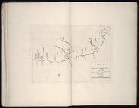
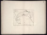
Beinecke Rare Book and Manuscript Library > Plan of Lucia Harbour on the north side of Jamaica
Call Number:
1973 Folio 67
Collection Title:
The West-India pilot: containing piloting directions for Port Royal and Kingston harbours in
Image Count:
1
Subject (Geographic):
Atlantic Ocean --Maps --Early works to 1800, Jamaica --Maps --Early works to 1800, and West Indies --Maps --Early works to 1800
Subject (Topic):
Harbors --Atlantic Coast (North America
Collection Created:
London : Printed for the author and sold by S. Hooper ..., MDCCLXXI [1771]
Found in:
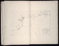
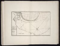
Beinecke Rare Book and Manuscript Library > Plan of Mantica Bay on the north side of Jamaica
Call Number:
1973 Folio 67
Collection Title:
The West-India pilot: containing piloting directions for Port Royal and Kingston harbours in
Image Count:
1
Subject (Geographic):
Atlantic Ocean --Maps --Early works to 1800, Jamaica --Maps --Early works to 1800, and West Indies --Maps --Early works to 1800
Subject (Topic):
Harbors --Atlantic Coast (North America
Collection Created:
London : Printed for the author and sold by S. Hooper ..., MDCCLXXI [1771]
Found in:
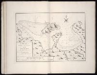
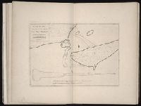
Beinecke Rare Book and Manuscript Library > Plan of Port Antonio on the north-east side of Jamaica
Call Number:
1973 Folio 67
Collection Title:
The West-India pilot: containing piloting directions for Port Royal and Kingston harbours in
Image Count:
1
Subject (Geographic):
Atlantic Ocean --Maps --Early works to 1800, Jamaica --Maps --Early works to 1800, and West Indies --Maps --Early works to 1800
Subject (Topic):
Harbors --Atlantic Coast (North America
Collection Created:
London : Printed for the author and sold by S. Hooper ..., MDCCLXXI [1771]
Found in:
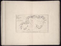
Beinecke Rare Book and Manuscript Library > Plan of Port Royal harbour Rattan
Creator:
Call Number:
1973 Folio 67
Collection Title:
The West-India pilot: containing piloting directions for Port Royal and Kingston harbours in
Image Count:
1
Subject (Geographic):
Atlantic Ocean --Maps --Early works to 1800, Mexico, Gulf of --Maps --Early works to 1800, and Veracruz-Llave (Mexico : State) --Maps
Subject (Topic):
Harbors --Atlantic Coast (North America
Collection Created:
London : Printed for the author and sold by S. Hooper ..., MDCCLXXI [1771]
Found in:
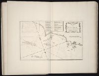
Beinecke Rare Book and Manuscript Library > Plan of Vera Cruz
Call Number:
1973 Folio 67
Collection Title:
The West-India pilot: containing piloting directions for Port Royal and Kingston harbours in
Image Count:
1
Subject (Geographic):
Atlantic Ocean --Maps --Early works to 1800, Central America --Maps --Early works to 1800, and Honduras --Maps
Subject (Topic):
Harbors --Atlantic Coast (North America
Collection Created:
London : Printed for the author and sold by S. Hooper ..., MDCCLXXI [1771]
Found in:
Beinecke Rare Book and Manuscript Library > Plan of port of St. Fernando de Omoa near Honduras
Creator:
Call Number:
1973 Folio 67
Collection Title:
The West-India pilot: containing piloting directions for Port Royal and Kingston harbours in
Image Count:
1
Subject (Geographic):
Atlantic Ocean --Maps --Early works to 1800, Cuba --Maps --Early works to 1800, Matanzas Bay (Cuba) --Maps --Early works to 1800, and West Indies --Maps --Early works to 1800
Subject (Topic):
Harbors --Atlantic Coast (North America
Collection Created:
London : Printed for the author and sold by S. Hooper ..., MDCCLXXI [1771]
Found in:
Beinecke Rare Book and Manuscript Library > Plan of the Bay of Matanzas
Call Number:
1973 Folio 67
Collection Title:
The West-India pilot: containing piloting directions for Port Royal and Kingston harbours in
Image Count:
1
Subject (Geographic):
Atlantic Ocean --Maps --Early works to 1800, Fear, Cape (N.C.) --Maps, and North Carolina --Maps --Early works to 1800
Subject (Topic):
Harbors --Atlantic Coast (North America
Collection Created:
London : Printed for the author and sold by S. Hooper ..., MDCCLXXI [1771]
Found in:
Beinecke Rare Book and Manuscript Library > Plan of the entrance into Cape Fear harbour, North Carolina
Creator:
Call Number:
1973 Folio 67
Collection Title:
The West-India pilot: containing piloting directions for Port Royal and Kingston harbours in
Image Count:
1
Subject (Geographic):
Atlantic Ocean --Maps --Early works to 1800, Central America --Maps --Early works to 1800, and Honduras --Maps
Subject (Topic):
Harbors --Atlantic Coast (North America
Collection Created:
London : Printed for the author and sold by S. Hooper ..., MDCCLXXI [1771]
Found in:
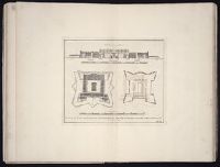
Beinecke Rare Book and Manuscript Library > Plan of the fortification now finishing in the port of St. Fernando de Omoa
Branch:v1.64.3 ,Deployed:2024-09-25T10:53:04-04:00