Search
You Searched For
Search Results
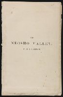
- Creator:
- Hartley, W. M. B
- Published / Created:
- [1870?]
- Call Number:
- Zc39 870ha
- Image Count:
- 7
- Subject (Geographic):
- United States--Maps
- Subject (Topic):
- Railroads--United States--Maps
- Found in:
- Beinecke Rare Book and Manuscript Library > The Neosho Valley ...
- Call Number:
- 1974 +231
- Collection Title:
- A new and elegant general atlas, comprising all the new discoveries, to the present time
- Image Count:
- 1
- Subject (Geographic):
- United States--Maps--1804
- Found in:
- Beinecke Rare Book and Manuscript Library > [Map of the United States of America]
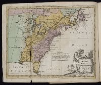
- Creator:
- Faden, William, 1749-1836, creator
- Published / Created:
- 1785 February 11
- Call Number:
- 1982 Folio 10
- Image Count:
- 1
- Subject (Geographic):
- United States --Boundaries --Maps
- Found in:
- Beinecke Rare Book and Manuscript Library > The United States of North America, with the British & Spanish territories according to the treaty of 1784
- Call Number:
- Zc20 697heg
- Collection Title:
- A new discovery of a vast country in America : extending above four thousand miles, between New
- Image Count:
- 1
- Subject (Geographic):
- United States --Maps --Early works to
- Found in:
- Beinecke Rare Book and Manuscript Library > A map of a large country newly discovered in the northern America situated between New Mexico and the frozen sea, together with the course of the Great River Meschasipi. Dedicated to His Ma.ty William III King of Great Britain. By Father Lewis Hennepin, m
- Call Number:
- Zc20 697heg
- Collection Title:
- A new discovery of a vast country in America : extending above four thousand miles, between New
- Image Count:
- 1
- Subject (Geographic):
- United States --Maps --Early works to
- Found in:
- Beinecke Rare Book and Manuscript Library > A map of a new world between New Mexico and the frozen sea newly discovered by Father Lewis Hennepin, missionary recollect and native of Aht in Hainault. Dedicated to his majesty of Great Britain William III
- Creator:
- Sotzmann, D. F
- Call Number:
- Zm Sp79
- Collection Title:
- Allgemeines historisches Taschenbuch, oder, Abriss der merkwurdigsten neuen Welt-Begebenheiten
- Image Count:
- 1
- Subject (Geographic):
- United States --Maps --Early works to
- Found in:
- Beinecke Rare Book and Manuscript Library > Die Vereinigten Staaten von Nord America. nach der von Wm Faden 1783
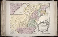
- Creator:
- Anville, Jean Baptiste Bourguignon d', 1697-1782
Pownall, Thomas, 1722-1805
Sayer, Robert, 1725-1794, creator
- Published / Created:
- 1786
- Call Number:
- 1982 Folio 10
- Image Count:
- 2
- Subject (Geographic):
- United States --Maps --Early works to
- Found in:
- Beinecke Rare Book and Manuscript Library > A new map of the whole continent of America : divided into North and South and West Indies wherein are exactly described the United States of North America as well as the several European possessions according to the preliminaries of peace signed at Versa
- Creator:
- Haussard, C
Robert de Vaugondy, Gilles, 1688-1766, creator
- Published / Created:
- 1755
- Call Number:
- 2003 Folio 85
- Image Count:
- 1
- Subject (Geographic):
- United States -- Maps -- Early works to
- Found in:
- Beinecke Rare Book and Manuscript Library > Partie de l'Amerique septentrionale: qui comprend le cours de l'Ohio, la Nlle. Angleterre, la Nlle York, le New Jersey, la Pensylvanie, le Maryland, la Virginie, la Caroline
- Call Number:
- Egf 789
- Collection Title:
- The American geography; or, A view of the present situation of the United States of America
- Image Count:
- 1
- Subject (Geographic):
- United States --Maps --Early works to
- Subject (Topic):
- Maps --United States --1788
- Found in:
- Beinecke Rare Book and Manuscript Library > A Map of the northern and middle states; comprehending the western Territory and the British dominions in North America. Compiled from the best authorities
- Creator:
- Doolittle, Amos, 1754-1832
Purcell, Joseph
- Published / Created:
- 1788
- Call Number:
- Egf 789
- Collection Title:
- The American geography; or, A view of the present situation of the United States of America
- Image Count:
- 1
- Subject (Geographic):
- United States --Maps --Early works to
- Subject (Topic):
- Maps --United States --1788
- Found in:
- Beinecke Rare Book and Manuscript Library > A Map of the states of Virginia, North Carolina South Carolina and Georgia comprehending the Spanish provinces of east and west Florida exhibiting the boundaries as fixed by the late Treaty of Peace between the United States and the Spanish dominions comp
- Published / Created:
- 1783
- Call Number:
- Cb21 35B
- Collection Title:
- History of the war with America, France, Spain, and Holland; commencing in 1775 and ending in 1783
- Image Count:
- 1
- Subject (Geographic):
- United States --Maps --Early works to
- Found in:
- Beinecke Rare Book and Manuscript Library > A Map of the United States of America, as settled by the peace of 1783
- Creator:
- Russell, John, fl. 1733-1795
- Published / Created:
- 1794 July 26
- Call Number:
- 1986 102
- Collection Title:
- An historical, geographical, commercial, and philosophical view of the American United States, and
- Image Count:
- 1
- Subject (Geographic):
- United States --Maps --Early works to
- Found in:
- Beinecke Rare Book and Manuscript Library > A General map of North America drawn from the best sources
- Call Number:
- Ck44 23
- Collection Title:
- Kort beskrifning om provincien Nya Swerige uti America : som nu foertjden af the Engelske kallas
- Image Count:
- 1
- Subject (Geographic):
- United States --Maps --Early works to
- Found in:
- Beinecke Rare Book and Manuscript Library > Virginiae N. Angliae N. Hollandiae nec non Nova Sueviae delineatio
- Creator:
- Russell, John, fl. 1733-1795
- Published / Created:
- 1795 February 7
- Call Number:
- 1986 102
- Collection Title:
- An historical, geographical, commercial, and philosophical view of the American United States, and
- Image Count:
- 1
- Subject (Geographic):
- United States --Maps --Early works to
- Found in:
- Beinecke Rare Book and Manuscript Library > Map of the northern, or, New England states of America. Comprehending Vermont, New Hampshire, District of Main, Massachusetts, Rhode-Island, and Connecticut
- Published / Created:
- [1759-1771] and 1763 May
- Call Number:
- Z17 289q
- Image Count:
- 1
- Resource Type:
- Books, Journals & Pamphlets
- Subject (Geographic):
- United States--Maps--Early works to
- Found in:
- Beinecke Rare Book and Manuscript Library > Royal magazine; or, Gentleman's monthly companion.