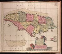
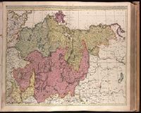
"Cum privilo. ordinm. Generalm. Belgii Foederati.", Backed with paper. Ms. no. "96" in upper right-hand corner. Sheet measures 53.6 x 62.9 cm. No. 86 of 87 maps bound together., Includes three bar scales., and Relief shown pictorially.
Publisher:
[Nicolaes Visscher,
Subject (Geographic):
Jamaica--Maps--Early works to 1800.
Subject (Name):
Albany Institute Stamp. and Anse, Luggert van, fl. 1690-1716, engraver.
Backed with paper. Ms. no. "53" in upper-right corner. Sheet measures 53.7 x 62.8 cm. No. 48 of 87 maps bound together., Bar scale given in "milliaria Gallica"., Prime meridian: Ferro., Relief shown pictorially., and Watermark.
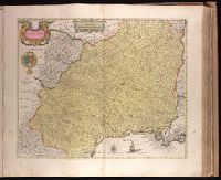
Appears in Justus Danckerts's first two Atlas editions; see Koeman, C. Atlantes Neerlandici, vol. III, Dan 1, Dan 2., Backed with paper. Ms. no. "59" in upper right-hand corner. Sheet measures 53.8 x 62.8 cm. No. 54 of 87 maps bound together., Bar scales given in "milliaria Germanica communia" and "milliaria Gallica communia"., Prime meridian: Ferro., and Relief shown pictorially.
Publisher:
Theodore Danckerts,
Subject (Geographic):
Alsace (France)--Maps--Early works to 1800., Baden-Württemberg (Germany)--Maps--Early works to 1800., Lorraine (France)--Maps--Early works to 1800., and Saarland (Germany)--Maps--Early works to 1800.
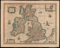
Bar scales given in "milliaria Anglica communia," "milliaria Anglica parva," and "milliaria Germanica communia.", From Joan Blaeu's Latin edition of Theatrum orbis terrarum (1648)., In Latin on verso, with caption title "Britannia," signature A, and paginated 1-2., Relief shown pictorially., Watermark., and With inset map "Orcades insulae."
Subject (Geographic):
Great Britain--Maps--Early works to 1800.
Subject (Name):
Blaeu, Joan, 1596-1673 and Blaeu, Joan, 1596-1673. Theatrum orbis terrarum.
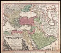
Includes three bar scales., Prime meridian: Ferro., Relief shown pictorially., and Watermark. Manuscript number in upper right corner: 94. From the Karpinski Collection.
Publisher:
[Mattheus Seutter],
Subject (Geographic):
Middle East--Maps--Early works to 1800.
Subject (Name):
Drentwet, Abraham, -1785, engraver. and Karpinski, Louis Charles,--1878-1956--Ownership.
Marchionatus Brandenburgici pars, quae marchia media vulgo Mittelmarck audit
Description:
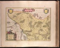
Bar scale given in "milliaria Germanica"., BEIN 1973 Folio 18: Backed with paper. Ms. no. in upper right corner: 19. Sheet measures 53.7 x 63.4 cm. No. 19 of 87 maps bound together., Prime meridian: Ferro., Relief shown pictorially., Watermark., and With blank shield in upper right.
Publisher:
Excud. Joannes Blaeu,
Subject (Geographic):
Brandenburg (Germany : Landkreis)--Maps--Early works to 1800.
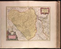
Backed with paper. Ms. no. in upper right corner: 21. Sheet measures 53.7 x 62.5 cm. No. 21 of 87 maps bound together., Bar scale given in "milliaria Germanica"., Dedication cartouche with blank text panel and blank shield., and Prime meridian: Ferro.
Publisher:
Joan Blaeu,
Subject (Geographic):
Saxony-Anhalt (Germany)--Maps--Early works to 1800.
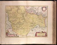
Backed with paper. Ms. no. in upper right corner: 18. Sheet measures 53.6 x 62.9 cm. No. 18 of 87 maps bound together., Bar scale given in "milliaria Germanica"., Prime meridian: Ferro., and With two blank shields.
Publisher:
Joan Blaeu,
Subject (Geographic):
Brandenburg (Germany : Landkreis)--Maps--Early works to 1800.
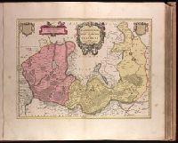
Bar scale given in "milliaria Germanica"., BEIN 1973 Folio 18: Backed with paper. Ms. no. in upper right corner: 20. Sheet measures 53.7 x 62.8 cm. No. 20 of 87 maps bound together., Prime meridian: Ferro., Relief shown pictorially., Watermark., and With two blank shields.
Publisher:
Joan Blaeu,
Subject (Geographic):
Brandenburg (Germany : Landkreis)--Maps--Early works to 1800. and Województwo Zachodniopomorskie (Poland)--Maps--Early works to 1800.
Appears in Valk and Schenk's Atlantis sylloge compendiosa, ca. 1702., Bar scales given in "milliaria Germanica communia" and "milliaria Gallica communia"., Imperfect: slight stains on verso and recto, with no loss of text. Backed with paper. Ms. no. in upper right corner: 23. Sheet measures 53.7 x 62.8 cm. No. 23 of 87 maps bound together., Prime meridian: Ferro., and Relief shown pictorially.
Publisher:
Gerard Valck,
Subject (Geographic):
Pomerania (Poland and Germany)--Maps--Early works to 1800.
Subject (Name):
Schenk, Peter, 1660-1718 or 1719. Atlantis sylloge compendiosa., Valck, G. (Gerard), 1651 or 1652-1726. Atlantis sylloge compendiosa., and Valck, Leonard, 1675-1746.