Search
You Searched For
Search Results
- Creator:
- Jefferys, Thomas, -1771, printmaker.
- Published / Created:
- 1755
- Call Number:
- 783 1755F
- Container / Volume:
- BRBL_00507
- Image Count:
- 1
- Resource Type:
- Maps, Atlases & Globes
- Found in:
- Beinecke Rare Book and Manuscript Library > A map of the most inhabited part of Virginia containing the whole province of Maryland with part of Pensilvania, New Jersey and North Carolina / drawn by Joshua Fry & Peter Jefferson in 1751.
- Creator:
- Bennett, R. (Richard), creator.
- Published / Created:
- [1765?]
- Call Number:
- 2017 Folio 49
- Image Count:
- 1
- Resource Type:
- Maps, Atlases & Globes
- Found in:
- Beinecke Rare Book and Manuscript Library > A new & accurate map of Germany including the seat of war in the Kingdom of Prussia, Bohemia, Lusatia, Silesia, Saxony, Westphalia &c. : also an exact table of the distances in German & English miles from town to town / by R. Bennett, engraver.
- Creator:
- Bowen, Emanuel, 1693 or 1694-1767, cartographer.
- Published / Created:
- [1747]
- Call Number:
- 655 1747
- Container / Volume:
- BRBL_00345
- Image Count:
- 1
- Resource Type:
- Maps, Atlases & Globes
- Found in:
- Beinecke Rare Book and Manuscript Library > A new & accurate map of Negroland and the adjacent countries : also Upper Guinea, shewing the principal European settlements, & distinguishing w[hi]ch belong to England, Denmark, Holland &c., the sea coast & some of the rivers being drawn from surveys & t
- Creator:
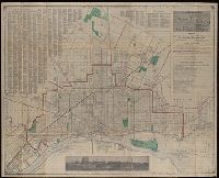
- Silas Farmer & Co.
- Published / Created:
- 1911-12 [i.e. 1911?], and c1911.
- Call Number:
- 811 D48 1911
- Container / Volume:
- BRBL_00553
- Image Count:
- 1
- Resource Type:
- Maps, Atlases & Globes
- Found in:
- Beinecke Rare Book and Manuscript Library > A new map of Detroit and suburbs : includes River Rouge, Oakwood, Highland Park, Hamtramck, St. Clair Heights, and Grosse Pointe.
- Creator:
- Pownall, Thomas, 1722-1805
- Published / Created:
- 12th May 1794.
- Call Number:
- 71 1794P
- Container / Volume:
- BRBL_00726
- Image Count:
- 2
- Resource Type:
- Maps, Atlases & Globes
- Found in:
- Beinecke Rare Book and Manuscript Library > A new map of North America with the West India Islands : divided according to the preliminary articles of peace, signed at Versailles, 20 Jan. 1783, wherein are particularly distinguished the United States, and the several provinces, governments &ca which
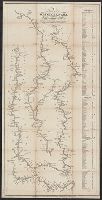
- Creator:
- Munson, Samuel B., 1806-1880.
- Published / Created:
- 1845
- Call Number:
- 80 1845A
- Image Count:
- 1
- Resource Type:
- Maps, Atlases & Globes
- Found in:
- Beinecke Rare Book and Manuscript Library > A new map of the western rivers, or, Travellers guide : exhibiting the Mississippi, Missouri, Ohio, and Illinois rivers with all the principal towns, islands & distances / by Saml. B. Munson.
- Creator:
- Munson, Samuel B., 1806-1880, cartographer.
- Published / Created:
- 1844
- Call Number:
- 807 1844
- Image Count:
- 1
- Resource Type:
- Maps, Atlases & Globes
- Found in:
- Beinecke Rare Book and Manuscript Library > A new map of the western rivers, or, Travellers guide : exhibiting the Mississippi, Missouri, Ohio, and Illinois rivers with all the principal towns, islands & distances / by Saml. B. Munson.
- Creator:
- Speed, John, 1552?-1629
- Call Number:
- Lanman 50 1676
- Image Count:
- 2
- Resource Type:
- Maps, Atlases & Globes
- Found in:
- Beinecke Rare Book and Manuscript Library > A newe mape of Tartary / augmented by John Speed and are to be sold by Tho. Bassett in Fleet Street & Richard Chiswell in St. Pauls Churchyard ; Dirck Grÿp, sculp.