Search
You Searched For
Search Results
- Creator:
- Hughes, Andrew, 18th century
- Published / Created:
- [1780?]
- Call Number:
- 786 1780A
- Image Count:
- 1
- Resource Type:
- Maps, Atlases & Globes
- Found in:
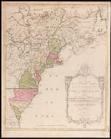
- Beinecke Rare Book and Manuscript Library > A draught of South Carolina and Georgia from Sewee to St. Estaca / by Andrew Hughes.
- Creator:
- Lodge, John, -1796
- Published / Created:
- [1778?]
- Call Number:
- BrSides 2017 62
- Image Count:
- 1
- Resource Type:
- Maps, Atlases & Globes
- Found in:
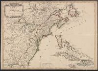
- Beinecke Rare Book and Manuscript Library > A general map of North America ; from the latest observations / engrav'd by Jno. Lodge from the late Mr. Jefferys, geographer to the King.
- Creator:
- Anville, Jean Baptiste Bourguignon d', 1697-1782.
- Published / Created:
- [between 1743-1747?]
- Call Number:
- BrSides Folio 2017 16
- Image Count:
- 1
- Resource Type:
- Maps, Atlases & Globes
- Found in:
- Beinecke Rare Book and Manuscript Library > A general map of the River Sanaga, from the falls of Govina to the Ocean / taken by a French Engineer in 1718, & drawn by Sr. d'Anville, from his particular draughts ; G. Child, sculpt.
- Creator:
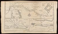
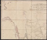
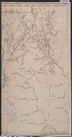
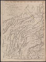
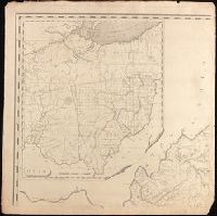
- Arrowsmith, Aaron, 1750-1823, cartographer.
- Call Number:
- 71 1811
- Image Count:
- 4
- Resource Type:
- Maps, Atlases & Globes
- Found in:
- Beinecke Rare Book and Manuscript Library > A map exhibiting all the new discoveries in the interior parts of North America [cartographic material] / inscribed by permission to the honorable governor and company of the adventurers of England trading into Hudsons Bay, in testimony of their liberal communications to their most obedient and very humble servant A. Arrowsmith, hydrographer to H.R.H. the Prince of Wales, January 1st 1795 ; Puke, sc.
- Creator:
- Scull, William, active 1765, cartographer.
- Published / Created:
- 10 June 1775.
- Call Number:
- 774 1775
- Container / Volume:
- BRBL_00497
- Image Count:
- 2
- Resource Type:
- Maps, Atlases & Globes
- Found in:
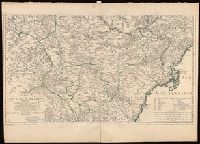
- Beinecke Rare Book and Manuscript Library > A map of Pennsylvania exhibiting not only the improved parts of that Province, but also its extensive frontiers: Laid down from actual surveys, and chiefly from the late map of W. Scull published in 1770; and humbly inscribed to the Honorable Thomas Penn
- Creator:
- Scull, William, active 1765, cartographer.
- Published / Created:
- 10 June 1775.
- Call Number:
- 774 1775
- Container / Volume:
- BRBL_00730
- Image Count:
- 3
- Resource Type:
- Maps, Atlases & Globes
- Found in:
- Beinecke Rare Book and Manuscript Library > A map of Pennsylvania exhibiting not only the improved parts of that Province, but also its extensive frontiers: Laid down from actual surveys, and chiefly from the late map of W. Scull published in 1770; and humbly inscribed to the Honorable Thomas Penn
- Creator:
- Madison, James, 1751-1836, creator.
- Published / Created:
- March 4, 1807.
- Call Number:
- BrSides Double Folio 2019 110
- Image Count:
- 1
- Resource Type:
- Maps, Atlases & Globes
- Found in:
- Beinecke Rare Book and Manuscript Library > A map of Virginia [cartographic material] : Formed from actual surveys, and the latest as well as most accurate observations / by James Madison, D.D., president of Wm. & Mary College. ; Drawn by: Wm. Davis. ; Engraved by: Fred. Bossler, Ricmd.
- Creator:
- Phillips, R. (Richard), Sir, 1767-1840
- Published / Created:
- [1806]
- Call Number:
- BrSides Folio 2017 61
- Image Count:
- 1
- Resource Type:
- Maps, Atlases & Globes
- Found in:
- Beinecke Rare Book and Manuscript Library > A map of the country from Rariton River in East Jersey, to Elk Head in Maryland [cartographic material] : shewing the several operations of the American & British armies, in 1776 & 1777 / Neele sc., Strand.
- Creator:
- Rocque, John, -1762.
- Published / Created:
- [between 1762 and 1773]
- Call Number:
- 327 1785
- Image Count:
- 2
- Resource Type:
- Maps, Atlases & Globes
- Found in:
- Beinecke Rare Book and Manuscript Library > A map of the kingdom of Ireland : divided into provinces, counties and baronies, shewing the archbishopricks, bishopricks, cities, boroughs, market towns, villages, barracks, mountains, lakes, bogs, rivers, bridges, ferries, passes : also, the great, the branch and the by post roads, together with the inland navigation, &c. / by John Rocque ...
- Creator:
- Jefferys, Thomas, -1771, printmaker.
- Published / Created:
- 1755
- Call Number:
- 783 1755F
- Container / Volume:
- BRBL_00507
- Image Count:
- 1
- Resource Type:
- Maps, Atlases & Globes
- Found in:
- Beinecke Rare Book and Manuscript Library > A map of the most inhabited part of Virginia containing the whole province of Maryland with part of Pensilvania, New Jersey and North Carolina / drawn by Joshua Fry & Peter Jefferson in 1751.
- Creator:
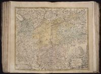
- Bennett, R. (Richard), creator.
- Published / Created:
- [1765?]
- Call Number:
- 2017 Folio 49
- Image Count:
- 1
- Resource Type:
- Maps, Atlases & Globes
- Found in:
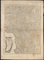
- Beinecke Rare Book and Manuscript Library > A new & accurate map of Germany including the seat of war in the Kingdom of Prussia, Bohemia, Lusatia, Silesia, Saxony, Westphalia &c. : also an exact table of the distances in German & English miles from town to town / by R. Bennett, engraver.
- Creator:
- Bowen, Emanuel, 1693 or 1694-1767, cartographer.
- Published / Created:
- [1747]
- Call Number:
- 655 1747
- Container / Volume:
- BRBL_00345
- Image Count:
- 1
- Resource Type:
- Maps, Atlases & Globes
- Found in:
- Beinecke Rare Book and Manuscript Library > A new & accurate map of Negroland and the adjacent countries : also Upper Guinea, shewing the principal European settlements, & distinguishing w[hi]ch belong to England, Denmark, Holland &c., the sea coast & some of the rivers being drawn from surveys & t
- Creator:
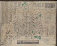
- Silas Farmer & Co.
- Published / Created:
- 1911-12 [i.e. 1911?], and c1911.
- Call Number:
- 811 D48 1911
- Container / Volume:
- BRBL_00553
- Image Count:
- 1
- Resource Type:
- Maps, Atlases & Globes
- Found in:
- Beinecke Rare Book and Manuscript Library > A new map of Detroit and suburbs : includes River Rouge, Oakwood, Highland Park, Hamtramck, St. Clair Heights, and Grosse Pointe.
- Creator:
- Pownall, Thomas, 1722-1805
- Published / Created:
- 12th May 1794.
- Call Number:
- 71 1794P
- Container / Volume:
- BRBL_00726
- Image Count:
- 2
- Resource Type:
- Maps, Atlases & Globes
- Found in:
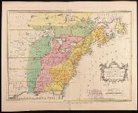
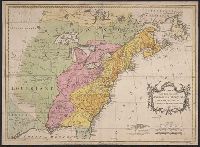
- Beinecke Rare Book and Manuscript Library > A new map of North America with the West India Islands : divided according to the preliminary articles of peace, signed at Versailles, 20 Jan. 1783, wherein are particularly distinguished the United States, and the several provinces, governments &ca which
- Creator:
- Pownall, Thomas, 1722-1805
- Published / Created:
- 12th May 1794.
- Call Number:
- 71 1794P
- Container / Volume:
- BRBL_00726
- Image Count:
- 2
- Resource Type:
- Maps, Atlases & Globes
- Found in:
- Beinecke Rare Book and Manuscript Library > A new map of North America with the West India Islands : divided according to the preliminary articles of peace, signed at Versailles, 20 Jan. 1783, wherein are particularly distinguished the United States, and the several provinces, governments &ca which
- Creator:
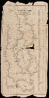
- Munson, Samuel B., 1806-1880.
- Published / Created:
- 1845
- Call Number:
- 80 1845A
- Image Count:
- 1
- Resource Type:
- Maps, Atlases & Globes
- Found in:
- Beinecke Rare Book and Manuscript Library > A new map of the western rivers, or, Travellers guide : exhibiting the Mississippi, Missouri, Ohio, and Illinois rivers with all the principal towns, islands & distances / by Saml. B. Munson.
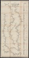
- Creator:
- Munson, Samuel B., 1806-1880, cartographer.
- Published / Created:
- 1844
- Call Number:
- 807 1844
- Image Count:
- 1
- Resource Type:
- Maps, Atlases & Globes
- Found in:
- Beinecke Rare Book and Manuscript Library > A new map of the western rivers, or, Travellers guide : exhibiting the Mississippi, Missouri, Ohio, and Illinois rivers with all the principal towns, islands & distances / by Saml. B. Munson.
- Creator:
- Speed, John, 1552?-1629
- Call Number:
- Lanman 50 1676
- Image Count:
- 2
- Resource Type:
- Maps, Atlases & Globes
- Found in:
- Beinecke Rare Book and Manuscript Library > A newe mape of Tartary / augmented by John Speed and are to be sold by Tho. Bassett in Fleet Street & Richard Chiswell in St. Pauls Churchyard ; Dirck Grÿp, sculp.
- Creator:
- Dorman, Moses, author.
- Published / Created:
- 1830
- Call Number:
- 764 An23 1830
- Image Count:
- 1
- Resource Type:
- Maps, Atlases & Globes
- Found in:
- Beinecke Rare Book and Manuscript Library > A plan of Andover taken for the town / by Moses Dorman, Jr.
- Creator:
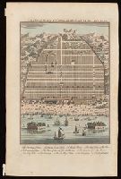
- Harris, John, 1667?-1719.
- Published / Created:
- [1744]
- Call Number:
- BrSides Folio 2017 33
- Image Count:
- 1
- Resource Type:
- Maps, Atlases & Globes
- Found in:
- Beinecke Rare Book and Manuscript Library > A plan of the city of Canton on the river Ta ho [cartographic material].
- Creator:
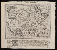
- Hondius, Jodocus, 1563-1612, cartographer.
- Published / Created:
- [1625]
- Call Number:
- BrSides Box 2019 15
- Image Count:
- 2
- Resource Type:
- Maps, Atlases & Globes
- Found in:
- Beinecke Rare Book and Manuscript Library > Abissinorum Regnu[m].
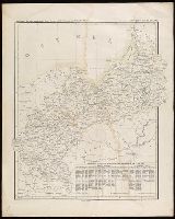
- Published / Created:
- [1842?]
- Call Number:
- 361 1845B
- Image Count:
- 1
- Resource Type:
- Maps, Atlases & Globes
- Found in:
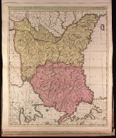
- Beinecke Rare Book and Manuscript Library > Abtheilung [sic] II, die nicht zum deutschen bunde gehörigen östlichen provinzen des Preussischen Staats.
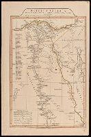
- Creator:
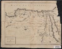
- Anville, Jean Baptiste Bourguignon d', 1697-1782
- Published / Created:
- 1st April 1812.
- Call Number:
- 61 1812B
- Image Count:
- 2
- Resource Type:
- Maps, Atlases & Globes
- Found in:
- Beinecke Rare Book and Manuscript Library > Aegyptus Antiqua Mandato Serenissimi Delphini publici juris facta / Auctor d'Anville Regiae Humaniorum Litterarum Academiae et scientiarum Petropolitanae socius, et Aurelianorum Celsiss. Duci a Secretis. MDCCLXV.
- Published / Created:
- [1750?]
- Call Number:
- 615 32
- Container / Volume:
- BRBL_00332
- Image Count:
- 2
- Resource Type:
- Maps, Atlases & Globes
- Found in:
- Beinecke Rare Book and Manuscript Library > Aegyptus et Cyrenaica.
- Creator:
- Jefferys, Thomas, -1771.
- Published / Created:
- [1748]
- Call Number:
- BrSides Folio 2017 11
- Image Count:
- 1
- Resource Type:
- Maps, Atlases & Globes
- Found in:
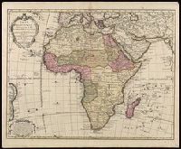
- Beinecke Rare Book and Manuscript Library > Africa [cartographic material] / drawn from the best maps by T. Jefferys, Geographer to his Royal Highness the Prince of Wales.
- Creator:
- Seutter, Matthaeus, 1678-1756, cartographer.
- Published / Created:
- after 1741]
- Call Number:
- 60 1735
- Container / Volume:
- BRBL_00323
- Image Count:
- 1
- Resource Type:
- Maps, Atlases & Globes
- Found in:
- Beinecke Rare Book and Manuscript Library > Africa iuxta navigationes et observationaes recentissimas aucta, correcta et in sua regna et status divisa / in lucem edita a Matth. Seuttero, s. Caes. maj. geographo aug.
- Creator:
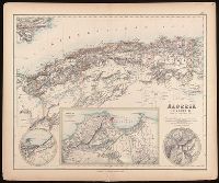
- Johnson, J. Hugh (John Hugh)
- Published / Created:
- [1872?]
- Call Number:
- BrSides Folio 2019 97
- Image Count:
- 1
- Resource Type:
- Maps, Atlases & Globes
- Found in:
- Beinecke Rare Book and Manuscript Library > Algeria [cartographic material] = l'Algérie / drawn by J. Hugh Johnson ; engraved at Stanford's Geographical Establishment.
- Creator:
- Homann Erben (Firm), cartographer, publisher.
- Published / Created:
- 1756
- Call Number:
- 755 1756Ea
- Image Count:
- 1
- Resource Type:
- Maps, Atlases & Globes
- Found in:
- Beinecke Rare Book and Manuscript Library > America Septentrionalis a Domino d'Anville in Galliis edita nunc in Anglia : coloniis in interiorem Virginiam deductis nec non Fluvii Ohio cursu aucta notisque geographicis et historicis illustrata / sumptibus Homannianorum Heredum.
- Creator:
- Homann Erben (Firm)
- Published / Created:
- 1777
- Call Number:
- 755 1777B
- Container / Volume:
- BRBL_00431
- Image Count:
- 1
- Resource Type:
- Maps, Atlases & Globes
- Found in:
- Beinecke Rare Book and Manuscript Library > America Septentrionalis a Domino d'Anville in Galliis edita nunc in Anglia : coloniis in interiorem Virginiam deductis nec non Fluvii Ohio cursu aucta notisque geographicis et historicis illustrata et ad bellum praesentis temporis accomodata / sumptibus Homannianorum Heredum.
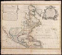
- Creator:
- L'Isle, Guillaume de, 1675-1726, cartographer.
- Published / Created:
- [1718]
- Call Number:
- BrSides Double Folio 2019 105
- Image Count:
- 1
- Resource Type:
- Maps, Atlases & Globes
- Found in:
- Beinecke Rare Book and Manuscript Library > America septentrionalis : concinnata juxta observationes D[omi]n[o] n[ostro] Academiae Regalis Scientiarum et nonnullorum aliorum, et juxta annotationes recentissimas / par G. De L'Isle, geographum.
- Creator:
- Speed, John, 1552?-1629.
- Published / Created:
- [1676?]
- Call Number:
- 70 1676
- Container / Volume:
- BRBL_00354
- Image Count:
- 2
- Resource Type:
- Maps, Atlases & Globes
- Found in:
- Beinecke Rare Book and Manuscript Library > America with those known parts in that unknowne worlde both people and manner of buildings / Discribed and inlarged by I.S. Ano 1626 ; Abraham Goos ... sculpsit.
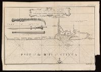
- Published / Created:
- [between 1743-1747?]
- Call Number:
- BrSides Folio 2017 20
- Image Count:
- 1
- Resource Type:
- Maps, Atlases & Globes
- Found in:
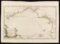
- Beinecke Rare Book and Manuscript Library > An accurate map of Kalbar River (commonly called Kalabar or Rio Real) and adjacent coast drawn on ye spot by several pilots, 1699 / G. Child, sculpt.
- Creator:
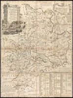
- Bowen, Emanuel, 1693 or 1694-1767, creator.
- Published / Created:
- [1749]
- Call Number:
- 2016 1346
- Image Count:
- 1
- Resource Type:
- Maps, Atlases & Globes
- Found in:
- Beinecke Rare Book and Manuscript Library > An accurate map of the county of Huntingdon divided into its hundreds : drawn from surveys and illustrated with various additional improvements ; also historical extracts relating to its trade, manufactures, natural history &c. not extant in any other map
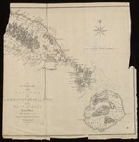
- Published / Created:
- [1782]
- Call Number:
- BrSides Folio 2017 24
- Image Count:
- 1
- Resource Type:
- Maps, Atlases & Globes
- Found in:
- Beinecke Rare Book and Manuscript Library > An accurate map of the islands of St. Christophers and Nevis in the West Indies / by an officer ; with the position of the English and French fleets, February 7th, 1782 ; J. Cary, sc.
- Published / Created:
- [1826]
- Call Number:
- BrSides Folio 2017 31
- Image Count:
- 1
- Resource Type:
- Maps, Atlases & Globes
- Found in:
- Beinecke Rare Book and Manuscript Library > Anahuac o Imperio Megicano : con los Reinos de Acolhuacan y de Michuacan &c., como existan en el año de 1521, para servir de illustracion a la historia antigua de Megico / gravado por Neeles 352 Strand Londres.
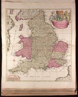
- Creator:
- Schenk, Peter, 1660-1718 or 1719.
- Published / Created:
- ca. 1700?]
- Call Number:
- 1973 Folio 18
- Image Count:
- 1
- Resource Type:
- Maps, Atlases & Globes
- Found in:
- Beinecke Rare Book and Manuscript Library > Anglia in septem Anglo-Saxonum regna omnesque hodiernas regiones ordine distincta [cartographic material] / ededit Petrus Schenk.
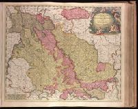
- Creator:
- Valck, G. (Gerard), 1651 or 1652-1726.
- Published / Created:
- ca. 1702?]
- Call Number:
- 1973 Folio 18
- Image Count:
- 1
- Resource Type:
- Maps, Atlases & Globes
- Found in:
- Beinecke Rare Book and Manuscript Library > Archiepiscopatus Coloniensis, ducatibus Iuliacensi et Montensi intermedius [cartographic material] : queis in septentrionem adjacent Geldria Hispanica, ac comitatus Mursanus / prostant penes Gerardum Valk.
- Creator:
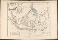
- Robert de Vaugondy, Gilles, 1688-1766.
- Published / Created:
- [1757-1786?]
- Call Number:
- 27 1750
- Container / Volume:
- BRBL_00023A
- Image Count:
- 1
- Resource Type:
- Maps, Atlases & Globes
- Found in:
- Beinecke Rare Book and Manuscript Library > Archipel des Indes Orientales : qui comprend les Isles de la Sonde, Moluques et Philippines / tirʹees des Cartes du Neptune Oriental par le Sr. Robert ; Guill. Delahaye sculp.
- Creator:
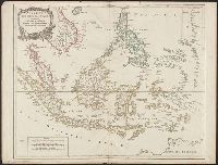
- Robert de Vaugondy, Gilles, 1688-1766.
- Published / Created:
- 1750
- Call Number:
- BrSides Double Folio 2017 6
- Image Count:
- 1
- Resource Type:
- Maps, Atlases & Globes
- Found in:
- Beinecke Rare Book and Manuscript Library > Archipel des Indes Orientales qui comprend les isles de la Sonde, Moluques et Philippines [cartographic material] : tirées des cartes du Neptune oriental / par le Sr. Robert, Géographe ordinaire du Roy ; Guill. Delahaye sculp.
- Creator:
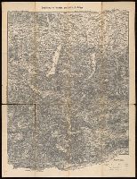
- Artaria & Co., author.
- Published / Created:
- [between 1910 an 1919?]
- Call Number:
- 424 1910
- Container / Volume:
- BRBL_00245
- Image Count:
- 2
- Resource Type:
- Maps, Atlases & Globes
- Found in:
- Beinecke Rare Book and Manuscript Library > Artaria's neueste Touristen-karten im Massstabe von 1:129,600.
- Creator:
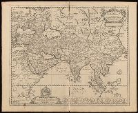
- Blankaart, Nikolaas, 1624-1703, cartographer.
- Published / Created:
- [1652?]
- Call Number:
- BrSides Folio 2017 6
- Image Count:
- 1
- Resource Type:
- Maps, Atlases & Globes
- Found in:
- Beinecke Rare Book and Manuscript Library > Asia antiqua cum finitimis Africae et Europae regionibus / Nicolaus Blancardus Belga, Leidensis, ad lucem aevi veteris delineabat.
- Creator:
- Keulen, Gerard van.
- Published / Created:
- [1717]
- Call Number:
- 1973 Folio 18
- Image Count:
- 1
- Resource Type:
- Maps, Atlases & Globes
- Found in:
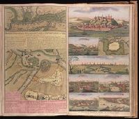
- Beinecke Rare Book and Manuscript Library > Attaque der Turkse galeyen en saiken, op de 2 keyserlyke oorlog scheepen op den 9 July voor gevallen op den Donau [cartographic material].
- Creator:
- Valck, G. (Gerard), 1651 or 1652-1726.
- Published / Created:
- [ca. 1702?]
- Call Number:
- 1973 Folio 18
- Image Count:
- 1
- Resource Type:
- Maps, Atlases & Globes
- Found in:
- Beinecke Rare Book and Manuscript Library > Aurelianensis Praefectura Generalis, in qua partiliter discriminati superiores Ducatus Cenomanensis ... [cartographic material] / Ger. et Leo. Valk.
- Published / Created:
- 1910?]
- Call Number:
- 11hcf 1919C-14
- Image Count:
- 1
- Resource Type:
- Maps, Atlases & Globes
- Found in:
- Beinecke Rare Book and Manuscript Library > Austria-Hungary.
- Creator:
- Automobile Club of America, cartographer.
- Published / Created:
- [1908]
- Call Number:
- 762gmb 1908
- Container / Volume:
- BRBL_00451
- Image Count:
- 1
- Resource Type:
- Maps, Atlases & Globes
- Found in:
- Beinecke Rare Book and Manuscript Library > Automobile map of New Hampshire / Automobile Club of America.
- Creator:
- Valck, G. (Gerard), 1651 or 1652-1726.
- Published / Created:
- ca. 1702?]
- Call Number:
- 1973 Folio 18
- Image Count:
- 1
- Resource Type:
- Maps, Atlases & Globes
- Found in:
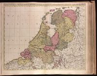
- Beinecke Rare Book and Manuscript Library > Belgica Foederata complectens septem Provincias, Ducatum Geldriae, Comitatus Hollandiae et Zelandiae, Dioeceses Trajectum, Transisulaniam, Groningam, et Frisiam, et circumjacentes Provincias [cartographic material] / venalis habent Gerardus et Leonardus Valk.
- Creator:
- New York (N.Y.). Board of Public Improvements.
- Published / Created:
- 1900
- Call Number:
- 771 N49 1900J
- Image Count:
- 4
- Resource Type:
- Maps, Atlases & Globes
- Found in:
- Beinecke Rare Book and Manuscript Library > Borough of Brooklyn, showing investigation and adjustment of monuments carried on by the Topographical Bureau.
- Creator:
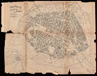
- Bradshaw, George, 1801-1853
- Published / Created:
- [approximately 1850?]
- Call Number:
- 38 P21 1850A
- Image Count:
- 1
- Resource Type:
- Maps, Atlases & Globes
- Found in:
- Beinecke Rare Book and Manuscript Library > Bradshaw's plan of Paris, and map of the environs.
- Published / Created:
- [between 1652 and 1684]
- Call Number:
- BrSides Double Folio 2019 99
- Image Count:
- 1
- Resource Type:
- Maps, Atlases & Globes
- Found in:
- Beinecke Rare Book and Manuscript Library > Britannia prout divisa fuit temporibus Anglo-Saxonvm praesertim durante illorum heptarchia.
- Creator:
- Valck, G. (Gerard), 1651 or 1652-1726.
- Published / Created:
- ca. 1702]
- Call Number:
- 1973 Folio 18
- Image Count:
- 1
- Resource Type:
- Maps, Atlases & Globes
- Found in:
- Beinecke Rare Book and Manuscript Library > Bulgaria et Romania [cartographic material] : divisa in singulares sangiacatus Silistriam, Nicopolin, Bodinum, Sardiam, Bysantium, Kirkeliam et Gallipolin, una cum finitimis regionibus Valachia, Servia etc. / per Ger. et Leon. Valk.
- Creator:
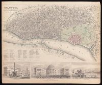
- Society for the Diffusion of Useful Knowledge (Great Britain)
- Published / Created:
- Novr. 1842.
- Call Number:
- BrSides Folio 2019 94
- Image Count:
- 1
- Resource Type:
- Maps, Atlases & Globes
- Found in:
- Beinecke Rare Book and Manuscript Library > Calcutta / published under the superintendence of the Society for the Diffusion of Knowledge.
- Creator:
- Le Rouge, Georges-Louis
- Published / Created:
- 1755
- Call Number:
- 755 1755J
- Container / Volume:
- BRBL_00427
- Image Count:
- 1
- Resource Type:
- Maps, Atlases & Globes
- Found in:
- Beinecke Rare Book and Manuscript Library > Canada et Louisiane / par le Sr. Le Rouge, ingenieur geographe du roy.
- Creator:
- Le Rouge, Georges-Louis
- Published / Created:
- 1755
- Call Number:
- 755 1755C
- Container / Volume:
- BRBL_00427
- Image Count:
- 1
- Resource Type:
- Maps, Atlases & Globes
- Found in:
- Beinecke Rare Book and Manuscript Library > Canada et Louisiane / par le Sr. Le Rouge, ingenieur geographe du roy.
- Creator:
- Anville, Jean Baptiste Bourguignon d', 1697-1782, cartographer.
- Published / Created:
- 1781
- Call Number:
- BrSides Folio 2017 19
- Image Count:
- 1
- Resource Type:
- Maps, Atlases & Globes
- Found in:
- Beinecke Rare Book and Manuscript Library > Carta della bassa Guinea tra il capo tres puntas, e l'equatore / di Mr. d'Anville.
- Creator:
- L'Isle, Guillaume de, 1675-1726.
- Published / Created:
- 1730
- Call Number:
- 60 1730
- Image Count:
- 1
- Resource Type:
- Maps, Atlases & Globes
- Found in:
- Beinecke Rare Book and Manuscript Library > Carte d'Afrique / dressée pour l'usage du Roy par Guillaume Delisle, premier geographe de sa Majesté, de l'aacademie [sic] royale des sciences.
- Creator:
- Lapie, M. (Pierre), 1779-1850
- Published / Created:
- 1808
- Call Number:
- BrSides Folio 2017 80
- Image Count:
- 1
- Resource Type:
- Maps, Atlases & Globes
- Found in:
- Beinecke Rare Book and Manuscript Library > Carte de la Finlande / dressée par P. Lapie, Capp. Ing. Géogr. ; gravé par Tardieu ainé ; écrit par Giraldon.
- Creator:
- Trémaux, P. (Pierre)
- Published / Created:
- [1850]
- Call Number:
- BrSides Folio 2019 98
- Image Count:
- 1
- Resource Type:
- Maps, Atlases & Globes
- Found in:
- Beinecke Rare Book and Manuscript Library > Carte de la localité ou sont situées les principales mines d'or du Soudan oriental / dressée par Trémaux, architecte lauréat de l'Institut.
- Creator:
- Santini, Francesco, cartographer, publisher.
- Call Number:
- 23 1752C
- Image Count:
- 1
- Resource Type:
- Maps, Atlases & Globes
- Found in:
- Beinecke Rare Book and Manuscript Library > Carte des nouvelles découvertes au nord de la Mer du Sud : tant à l'est de la Siberie et du Kamtchatka, qu'à l'ouest de la Nouvelle France.
- Creator:
- Palairet, Jean, 1697-1774, cartographer.
- Published / Created:
- 1755
- Call Number:
- BrSides Double Folio 2019 111
- Image Count:
- 1
- Resource Type:
- Maps, Atlases & Globes
- Found in:
- Beinecke Rare Book and Manuscript Library > Carte des possessions angloises & françoises du continent de l'Amérique septentrionale / Thos. Kitchin, sculpt.
- Creator:
- Palairet, Jean, 1697-1774, cartographer.
- Call Number:
- 755 1755G
- Image Count:
- 1
- Resource Type:
- Maps, Atlases & Globes
- Found in:
- Beinecke Rare Book and Manuscript Library > Carte des possessions angloises & françoises du continent de l'Amérique septentrionale / Thos. Kitchin, sculpt.
- Creator:
- Imbert, J. Leopold
- Published / Created:
- 1777
- Call Number:
- 755 1777K
- Container / Volume:
- BRBL_00431
- Image Count:
- 1
- Resource Type:
- Maps, Atlases & Globes
- Found in:
- Beinecke Rare Book and Manuscript Library > Carte des possessions angloises dans l'Amérique septentrionale : pour servir d'intelligence à la guerre presente / traduite de l'Anglois par J. Leopold Imbert.
- Creator:
- Verseyl, Elizabeth, d. 1726.
- Published / Created:
- 1710?]
- Call Number:
- 1973 Folio 18
- Image Count:
- 1
- Resource Type:
- Maps, Atlases & Globes
- Found in:
- Beinecke Rare Book and Manuscript Library > Carte du Paraguay, du Chili, Détroit de Magellan, & Terre de Feu, dans l'Amérique Méridionale / par la veuve de Nicolas Visscher.
- Creator:
- Anville, Jean Baptiste Bourguignon d', 1697-1782, cartographer.
- Published / Created:
- 1719
- Call Number:
- 3945 1719
- Container / Volume:
- BRBL_00193
- Image Count:
- 2
- Resource Type:
- Maps, Atlases & Globes
- Found in:
- Beinecke Rare Book and Manuscript Library > Carte du royaume d'Aragon : dressée sur plursieurs cartes manuscrites et imprimees; sur les memoires composés dans le pays par M. l'Abbé de Vairac; sur les cartes topographiques des Pirenées levées sur les lieux par M. Roussel Ingenieur du Roy; confo
- Creator:
- Lotter, Matthäus Albrecht, 1741-1810.
- Published / Created:
- 1776?]
- Call Number:
- 755 1776E
- Image Count:
- 1
- Resource Type:
- Maps, Atlases & Globes
- Found in:
- Beinecke Rare Book and Manuscript Library > Carte nouvelle de l'Amérique angloise contenant tout ce que les Anglois possedent sur le continent de l'Amérique septentrionale savoir le Canada : la Nouvelle Ecosse ou Acadie, les treize provinces unies qui font : les quatres colonies de la Nouvelle Angleterre ... / gravée exactement d'après les determinations geographiques dernierement faites par Matthieu Albert Lotter.
- Creator:
- Jaillot, Bernard Antoine, -1749, cartographer.
- Published / Created:
- 1738
- Call Number:
- 3897 1738
- Container / Volume:
- BRBL_00183
- Image Count:
- 1
- Resource Type:
- Maps, Atlases & Globes
- Found in:
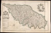
- Beinecke Rare Book and Manuscript Library > Carte particuliere de l'Isle de Corse : divisée par ses dix provinces ou juridictions et ses quatre fiefs / levée ... par le Sr. Bernard Antoine Jaillot Geographe Ordre. du Roy ; Delahaye sculpsit.
- Creator:
- Krevelt, A. van
- Published / Created:
- 1779
- Call Number:
- BrSides Folio 2017 81
- Image Count:
- 1
- Resource Type:
- Maps, Atlases & Globes
- Found in:
- Beinecke Rare Book and Manuscript Library > Carte qui indique la route des vaisseaux de roi le Race-Horse et la Carcasse : pendant l'expedition vers le Pole Boreal en 1773, pour servir à l'Histoire Générale des Voyages / A. v. Krevelt sculps.
- Creator:
- Lapie, M. (Pierre), 1779-1850
- Published / Created:
- 1814
- Call Number:
- 49cea 1814
- Image Count:
- 2
- Resource Type:
- Maps, Atlases & Globes
- Found in:
- Beinecke Rare Book and Manuscript Library > Carte réduite de la Mer Méditerranée et de la Mer Noire / par P. Lapie ; gravée par P.A.F Tardieu ; écrit par J.J. Pachouse.
- Creator:
- Delarochette, L. (Louis), 1731-1802, cartographer.
- Call Number:
- 23 1794A
- Image Count:
- 1
- Resource Type:
- Maps, Atlases & Globes
- Found in:
- Beinecke Rare Book and Manuscript Library > Chart of the N.W. coast of America and the N.E. coast of Asia, explored in the years 1778 and 1779 / prepared by Lieut. Heny. Roberts, under the immediate inspection of Capt. Cook ; engraved by W. Palmer, No. 128, Chancery Lane.
- Published / Created:
- [1814?]
- Call Number:
- BrSides 2018 138
- Image Count:
- 1
- Resource Type:
- Maps, Atlases & Globes
- Found in:
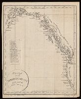
- Beinecke Rare Book and Manuscript Library > Charte von der nordwestküste America's nach Vancouver.
- Creator:
- Wilbrecht, Alexander
- Published / Created:
- [1793?] and [1795?]
- Call Number:
- Lada-Mocarski 352 1793
- Image Count:
- 1
- Resource Type:
- Maps, Atlases & Globes
- Found in:
- Beinecke Rare Book and Manuscript Library > Chertezhʺ novoprīobri︠e︡tennymʺ otʺ Polʹshi Rossīei︠u︡ zemli︠a︡mʺ vʺ 1793 godu / soch: A. Vilbrekhtʺ.
- Creator:
- Jode, Cornelis de, 1568-1600.
- Published / Created:
- [1593?]
- Call Number:
- BrSides Folio 2017 35
- Image Count:
- 1
- Resource Type:
- Maps, Atlases & Globes
- Found in:
- Beinecke Rare Book and Manuscript Library > China regnvm.
- Creator:
- Cruchley, G. F.
- Published / Created:
- February 1st, 1842.
- Call Number:
- BrSides Folio 2019 90
- Image Count:
- 1
- Resource Type:
- Maps, Atlases & Globes
- Found in:
- Beinecke Rare Book and Manuscript Library > China.
- Creator:
- Danckerts, Justus, 1635-1701.
- Published / Created:
- after 1696]
- Call Number:
- 1973 Folio 18
- Image Count:
- 1
- Resource Type:
- Maps, Atlases & Globes
- Found in:
- Beinecke Rare Book and Manuscript Library > Circuli Austriaci in quo sunt archiducatus Austriae ducatus Stiriae Carintiae Carniolae Comitatus Tirolis et episcopatus Tridentini novissima deschriptio [cartographic material] / per Iustinum Danckerts.
- Creator:
- Valck, G. (Gerard), 1651 or 1652-1726.
- Published / Created:
- ca. 1702?]
- Call Number:
- 1973 Folio 18
- Image Count:
- 1
- Resource Type:
- Maps, Atlases & Globes
- Found in:
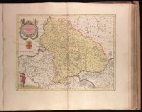
- Beinecke Rare Book and Manuscript Library > Circulus Franconicus [cartographic material] : divisa in Ducatus Coburgi, Franconiae, et Episcopatus Wurtzburgi, Bambergae, et Stadii., Marchionatus Culmbachii, et Onspachii, Comitatus Hennenbergae, Rheineci, Werthemii, Erpachia, Limburgi, Hollae, Suartenburgi, et Castellae / per Ger. et Leon Valk.
- Creator:
- Valck, G. (Gerard), 1651 or 1652-1726.
- Published / Created:
- ca. 1702?]
- Call Number:
- 1973 Folio 18
- Image Count:
- 1
- Resource Type:
- Maps, Atlases & Globes
- Found in:
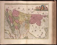
- Beinecke Rare Book and Manuscript Library > Circulus Saxoniae Inferioris, divisa in ducatus Brunsuici, Zellae, Holsatiae, Meklenburgi et Bremae, archiepiscopatum Magdeburgi, et episcopatus Hildesii et Halberstadii [cartographic material] / per Gerardi et Leonardi Valk, cum privilegio.
- Creator:
- Valck, G. (Gerard), 1651 or 1652-1726.
- Published / Created:
- ca. 1702?]
- Call Number:
- 1973 Folio 18
- Image Count:
- 1
- Resource Type:
- Maps, Atlases & Globes
- Found in:
- Beinecke Rare Book and Manuscript Library > Circulus Saxoniae superioris, divisa in ducatus Saxoniae, Altenburgi, Vinariae, Gothae, et Isenaci, principatum Anhaltinum, comitatus Suartenburgi, Barbiae, et Bichlingii, episcoptatius Ceitzii et Halae, cum reliquis ditionibus [cartographic material] / per Gerard et Leonard Valk.
- Creator:
- Valck, G. (Gerard), 1651 or 1652-1726.
- Published / Created:
- [ca. 1702?]
- Call Number:
- 1973 Folio 18
- Image Count:
- 1
- Resource Type:
- Maps, Atlases & Globes
- Found in:
- Beinecke Rare Book and Manuscript Library > Circulus Suevicus complectens omnes status subdivisos ex quibus constat [cartographic material].
- Creator:
- Mitchell, S. Augustus (Samuel Augustus), 1792-1868
- Published / Created:
- 1847
- Call Number:
- BrSides 2017 63
- Image Count:
- 1
- Resource Type:
- Maps, Atlases & Globes
- Found in:
- Beinecke Rare Book and Manuscript Library > City of Washington [cartographic material].
- Creator:
- Levasseur, V. (Victor)
- Published / Created:
- [1846]
- Call Number:
- BrSides Folio 2017 14
- Image Count:
- 1
- Resource Type:
- Maps, Atlases & Globes
- Found in:
- Beinecke Rare Book and Manuscript Library > Colonies françaises (en Afrique) [cartographic material] / géographie et statistique par V. Levasseur ; illustré par Raimond Bonheur ; grave par Laguillermie.
- Creator:
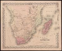
- Colton, J. H. (Joseph Hutchins), 1800-1893, creator.
- Published / Created:
- [1855]
- Call Number:
- BrSides 2019 90
- Image Count:
- 2
- Resource Type:
- Maps, Atlases & Globes
- Found in:
- Beinecke Rare Book and Manuscript Library > Colton's Africa : southern sheet.
- Creator:
- Blaeu, Willem Janszoon, 1571-1638.
- Published / Created:
- [after 1644]
- Call Number:
- 1973 Folio 18
- Image Count:
- 1
- Resource Type:
- Maps, Atlases & Globes
- Found in:
- Beinecke Rare Book and Manuscript Library > Comitatus Bellovacum vernaculè Beauvais [cartographic material].
- Creator:
- Caroli, Francesco di.
- Published / Created:
- ca. 1700?]
- Call Number:
- 1973 Folio 18
- Image Count:
- 1
- Resource Type:
- Maps, Atlases & Globes
- Found in:
- Beinecke Rare Book and Manuscript Library > Comitatus Hollandiae tabula [cartographic material] / pluribus locis recens emendata a Francisco Caroli.
- Creator:
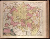
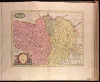
- Homann, Johann Baptist, 1663-1724
- Published / Created:
- [after 1724]
- Call Number:
- 428 1720
- Container / Volume:
- BRBL_00247
- Image Count:
- 1
- Resource Type:
- Maps, Atlases & Globes
- Found in:
- Beinecke Rare Book and Manuscript Library > Comitatus principalis Tirolis : in quo Episc. Tridentin[us] et Brixensis, Comitatus Brigantinus, Feldkirchiae Sonnebergae et Pludentii accuratè exhibentur / editore Ioh. Baptista Homanno, Sacrae Caes. Majestatis Geographo.
- Creator:
- Homann, Johann Baptist, 1663-1724
- Published / Created:
- [after 1724]
- Call Number:
- 1983 Folio 23
- Collection Title:
- [Atlas factice of 50 maps, primarily by Johann Baptist Homann and/or issued by the Homann Erben
- Image Count:
- 1
- Found in:
- Beinecke Rare Book and Manuscript Library > Comitatus principalis Tirolis : in quo Episc. Tridentin[us] et Brixensis, Comitatus Brigantinus, Feldkirchiae Sonnebergae et Pludentii accuratè exhibentur / editore Ioh. Baptista Homanno, Sacrae Caes. Majestatis Geographo.
- Creator:
- Cram, George Franklin, 1841-1928
- Published / Created:
- [between 1920 and 1929?]
- Call Number:
- BrSides Folio 2017 3
- Image Count:
- 1
- Resource Type:
- Maps, Atlases & Globes
- Found in:
- Beinecke Rare Book and Manuscript Library > Connecticut.
- Creator:
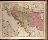
- Valck, G. (Gerard), 1651 or 1652-1726.
- Published / Created:
- [1710?]
- Call Number:
- 1973 Folio 18
- Image Count:
- 1
- Resource Type:
- Maps, Atlases & Globes
- Found in:
- Beinecke Rare Book and Manuscript Library > Dalmatia, Sclavonia, Croatia, Bosnia, Servia, et Istria [cartographic material] : distributa in singulares ditiones et diœceses, una cum Republica Ragusana, et circumjacentibus regionibus, Hungaria, Venetiis, statu ecclesiastico, Napoli et Macedonia / Venundantur per Gerardum et Leonardum Valk, cum Priv.
- Creator:
- Schenk, Peter, 1660-1718 or 1719.
- Published / Created:
- 1706
- Call Number:
- 1973 Folio 18
- Image Count:
- 1
- Resource Type:
- Maps, Atlases & Globes
- Found in:
- Beinecke Rare Book and Manuscript Library > Dania regnum [cartographic material] : ducatus Holsatia et Slesvicum insulae Danicae et provinciae Iutia Scania etc. / auctore Petrus Schenk.
- Creator:
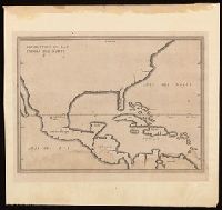
- Herrera y Tordesillas, Antonio de, -1625.
- Published / Created:
- 1622]
- Call Number:
- BrSides Folio 2017 36
- Image Count:
- 1
- Resource Type:
- Maps, Atlases & Globes
- Found in:
- Beinecke Rare Book and Manuscript Library > Descripcion de las Yndias del Norte, 2 [cartographic material].
- Creator:
- Jansson, Jan, 1588-1664, cartographer, publisher.
- Published / Created:
- [between 1652 and 1684]
- Call Number:
- BrSides Double Folio 2019 100
- Image Count:
- 1
- Resource Type:
- Maps, Atlases & Globes
- Found in:
- Beinecke Rare Book and Manuscript Library > Dimidia Tribus Manasse ultra Iordanem, tribus Neptalim et partes orientales tribuum Zabuion et Isachar.
- Creator:
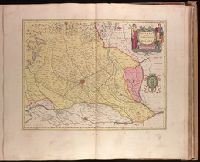
- Blaeu, Joan, 1596-1673.
- Published / Created:
- 1647?]
- Call Number:
- 1973 Folio 18
- Image Count:
- 1
- Resource Type:
- Maps, Atlases & Globes
- Found in:
- Beinecke Rare Book and Manuscript Library > Ducato di Parma et di Piacenza [cartographic material].
- Creator:
- Blaeu, Joan, 1596-1673.
- Published / Created:
- 1647?]
- Call Number:
- 1973 Folio 18
- Image Count:
- 1
- Resource Type:
- Maps, Atlases & Globes
- Found in:
- Beinecke Rare Book and Manuscript Library > Ducato ouero Territorio di Milano [cartographic material].
- Creator:
- Doppelmayr, Johann Gabriel, 1677-1750.
- Published / Created:
- [1706?]
- Call Number:
- 1973 Folio 18
- Image Count:
- 1
- Resource Type:
- Maps, Atlases & Globes
- Found in:
- Beinecke Rare Book and Manuscript Library > Eclipseos solis totalis cum mora d[ie] 12 Maii 1706, horis antem: in Europa celebratae, geographica repraesentatio [cartographic material] : in qua centralis umbrae tractus ac reliquae magnitudines suis locis competentes, ex illustrium virorum observationibus deductae, per arcus parallelos, ceu digitorum singulorum indices / ope. Dni. J. Gabr. Doppelmayr, Math. P. P. et Simon Moolen, Mathematici, curiose ostenduntur.
- Creator:
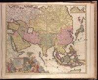
- Allard, Carel, 1648-ca. 1709.
- Published / Created:
- 1702]
- Call Number:
- 1973 Folio 18
- Image Count:
- 1
- Resource Type:
- Maps, Atlases & Globes
- Found in:
- Beinecke Rare Book and Manuscript Library > Exactissima Asiae delineatio, in praecipuas regiones, ceterasq [cartographic material] : partes divisa, et denuo in lucem / edita per Carolum Allard, cum privilegio potentissimorum D.D. Ordinum Hollandiae & Westfriae ; extracta ex authenticis tabulis D. Nicolai Witsen, cos. Amst., et praecipuorum auctorum, cum consensu viri amplissimi ; Ph. Tiedeman, delin. ; G. v. Gouwen, sculp.
- Creator:
- Bailleul, Nicolas, cartographer.
- Published / Created:
- 1746
- Call Number:
- 384 1746
- Container / Volume:
- BRBL_00179
- Image Count:
- 1
- Resource Type:
- Maps, Atlases & Globes
- Found in:
- Beinecke Rare Book and Manuscript Library > Évêché de Dijon / dressé sur les lieux par le Sr. Bailleul le jeune ... ; Bailleul le jeune excudit et sculp ...
- Creator:
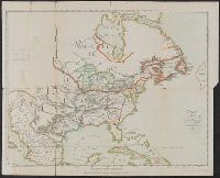
- Franquelin, Jean Baptiste Louis.
- Published / Created:
- between 1896 and 1901]
- Call Number:
- 795.8881857
- Image Count:
- 1
- Resource Type:
- Maps, Atlases & Globes
- Found in:
- Beinecke Rare Book and Manuscript Library > Franquelin's map of Louisiana.
- Creator:
- Blaeu, Willem Janszoon, 1571-1638.
- Published / Created:
- [163-?]
- Call Number:
- 1973 Folio 18
- Image Count:
- 1
- Resource Type:
- Maps, Atlases & Globes
- Found in:
- Beinecke Rare Book and Manuscript Library > Gastinois et Hurepois [cartographic material].
- Creator:
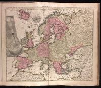
- Keere, Pieter van den, 1571-approximately 1646, cartographer.
- Published / Created:
- [between 1652 and 1684]
- Call Number:
- BrSides Double Folio 2019 103
- Image Count:
- 1
- Resource Type:
- Maps, Atlases & Globes
- Found in:
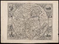
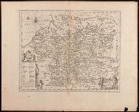
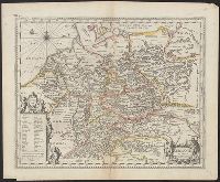
- Beinecke Rare Book and Manuscript Library > Germaniae veteris nova descriptio / Petrus Kaerius celavit.
- Creator:
- Keere, Pieter van den, 1571-approximately 1646
- Published / Created:
- [between 1652 and 1684]
- Call Number:
- 36 1630
- Container / Volume:
- BRBL_00117
- Image Count:
- 1
- Resource Type:
- Maps, Atlases & Globes
- Found in:
- Beinecke Rare Book and Manuscript Library > Germaniae veteris nova descriptio / Petrus Kaerius celavit.