Search
You Searched For
Search Results
- Creator:
- L'Isle, Guillaume de, 1675-1726, cartographer.
- Published / Created:
- [1718]
- Call Number:
- BrSides Double Folio 2019 105
- Image Count:
- 1
- Resource Type:
- Maps, Atlases & Globes
- Subject (Geographic):
- North America--Maps.
- Found in:
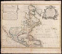
- Beinecke Rare Book and Manuscript Library > America septentrionalis : concinnata juxta observationes D[omi]n[o] n[ostro] Academiae Regalis Scientiarum et nonnullorum aliorum, et juxta annotationes recentissimas / par G. De L'Isle, geographum.
- Creator:
- National Railway Publication Company
- Call Number:
- BrSides Zc19 N82h 870na
- Image Count:
- 1
- Resource Type:
- Maps, Atlases & Globes
- Subject (Geographic):
- North America--Maps.
- Found in:
- Beinecke Rare Book and Manuscript Library > Map of the Northern Pacific Railway and tributary country.
- Creator:
- Arrowsmith, Aaron, 1750-1823, cartographer.
- Call Number:
- 71 1811
- Image Count:
- 4
- Resource Type:
- Maps, Atlases & Globes
- Subject (Geographic):
- North America--Maps.
- Found in:
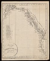
- Beinecke Rare Book and Manuscript Library > A map exhibiting all the new discoveries in the interior parts of North America [cartographic material] / inscribed by permission to the honorable governor and company of the adventurers of England trading into Hudsons Bay, in testimony of their liberal communications to their most obedient and very humble servant A. Arrowsmith, hydrographer to H.R.H. the Prince of Wales, January 1st 1795 ; Puke, sc.
- Published / Created:
- [1814?]
- Call Number:
- BrSides 2018 138
- Image Count:
- 1
- Resource Type:
- Maps, Atlases & Globes
- Subject (Geographic):
- Northwest Coast of North America--Maps.
- Found in:
- Beinecke Rare Book and Manuscript Library > Charte von der nordwestküste America's nach Vancouver.
- Creator:
- Lodge, John, -1796
- Published / Created:
- [1778?]
- Call Number:
- BrSides 2017 62
- Image Count:
- 1
- Resource Type:
- Maps, Atlases & Globes
- Subject (Geographic):
- North America--Maps--Early works to
- Found in:
- Beinecke Rare Book and Manuscript Library > A general map of North America ; from the latest observations / engrav'd by Jno. Lodge from the late Mr. Jefferys, geographer to the King.
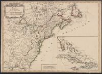
- Creator:
- Pownall, Thomas, 1722-1805
- Published / Created:
- 12th May 1794.
- Call Number:
- 71 1794P
- Container / Volume:
- BRBL_00726
- Image Count:
- 2
- Resource Type:
- Maps, Atlases & Globes
- Subject (Geographic):
- North America--Maps--Early works to
- Found in:
- Beinecke Rare Book and Manuscript Library > A new map of North America with the West India Islands : divided according to the preliminary articles of peace, signed at Versailles, 20 Jan. 1783, wherein are particularly distinguished the United States, and the several provinces, governments &ca which
- Creator:
- Imbert, J. Leopold
- Published / Created:
- 1777
- Call Number:
- 755 1777K
- Container / Volume:
- BRBL_00431
- Image Count:
- 1
- Resource Type:
- Maps, Atlases & Globes
- Subject (Geographic):
- North America--Maps--Early works to
- Found in:
- Beinecke Rare Book and Manuscript Library > Carte des possessions angloises dans l'Amérique septentrionale : pour servir d'intelligence à la guerre presente / traduite de l'Anglois par J. Leopold Imbert.
- Creator:
- Atwood, John M., approximately 1818- cartographer.
- Published / Created:
- 1849
- Call Number:
- 71 1849
- Image Count:
- 1
- Resource Type:
- Maps, Atlases & Globes
- Subject (Geographic):
- North America--Maps.
- Found in:
- Beinecke Rare Book and Manuscript Library > Map of the United States, the British provinces, Mexico &c. / drawn & engraved by J.M. Atwood.
- Creator:
- Homann, Johann Baptist, 1663-1724.
- Published / Created:
- between 1716 and 1737?]
- Call Number:
- 71 1705
- Container / Volume:
- BRBL_00687
- Image Count:
- 1
- Resource Type:
- Maps, Atlases & Globes
- Subject (Geographic):
- North America--Maps--Early works to
- Found in:
- Beinecke Rare Book and Manuscript Library > Regni Mexicani seu Novae Hispaniae, Ludovicianae, N. Angliae, Carolinae, Virginiae et Pensylvaniae necnon insularum archipelagi Mexicani in America Septentrionali / accurata tabula exhibita â Ioh. Baptista Homanno.
- Call Number:
- BrSides Double Folio 2017 38
- Image Count:
- 1
- Resource Type:
- Maps, Atlases & Globes
- Subject (Geographic):
- North America--Maps--Early works to
- Found in:
- Beinecke Rare Book and Manuscript Library > The theatre of war in North America, with the roads, and tables, of the superficial contents, distances, & ca. / by an American.
- Creator:
- Franquelin, Jean Baptiste Louis.
- Published / Created:
- between 1896 and 1901]
- Call Number:
- 795.8881857
- Image Count:
- 1
- Resource Type:
- Maps, Atlases & Globes
- Subject (Geographic):
- North America--Maps--Early works to
- Found in:
- Beinecke Rare Book and Manuscript Library > Franquelin's map of Louisiana.
- Creator:
- Homann Erben (Firm), cartographer, publisher.
- Published / Created:
- 1756
- Call Number:
- 755 1756Ea
- Image Count:
- 1
- Resource Type:
- Maps, Atlases & Globes
- Subject (Geographic):
- North America--Maps--Early works to
- Found in:
- Beinecke Rare Book and Manuscript Library > America Septentrionalis a Domino d'Anville in Galliis edita nunc in Anglia : coloniis in interiorem Virginiam deductis nec non Fluvii Ohio cursu aucta notisque geographicis et historicis illustrata / sumptibus Homannianorum Heredum.
- Creator:
- Homann Erben (Firm)
- Published / Created:
- 1777
- Call Number:
- 755 1777B
- Container / Volume:
- BRBL_00431
- Image Count:
- 1
- Resource Type:
- Maps, Atlases & Globes
- Subject (Geographic):
- North America--Maps--Early works to
- Found in:
- Beinecke Rare Book and Manuscript Library > America Septentrionalis a Domino d'Anville in Galliis edita nunc in Anglia : coloniis in interiorem Virginiam deductis nec non Fluvii Ohio cursu aucta notisque geographicis et historicis illustrata et ad bellum praesentis temporis accomodata / sumptibus Homannianorum Heredum.
- Creator:
- Lotter, Matthäus Albrecht, 1741-1810.
- Published / Created:
- 1776?]
- Call Number:
- 755 1776E
- Image Count:
- 1
- Resource Type:
- Maps, Atlases & Globes
- Subject (Geographic):
- North America--Maps--Early works to
- Found in:
- Beinecke Rare Book and Manuscript Library > Carte nouvelle de l'Amérique angloise contenant tout ce que les Anglois possedent sur le continent de l'Amérique septentrionale savoir le Canada : la Nouvelle Ecosse ou Acadie, les treize provinces unies qui font : les quatres colonies de la Nouvelle Angleterre ... / gravée exactement d'après les determinations geographiques dernierement faites par Matthieu Albert Lotter.
- Creator:
- Robert de Vaugondy, Gilles, 1688-1766, cartographer.
- Call Number:
- 73 1785
- Image Count:
- 1
- Resource Type:
- Maps, Atlases & Globes
- Subject (Geographic):
- Great Lakes Region (North America
- Found in:
- Beinecke Rare Book and Manuscript Library > Partie de l'Amérique septent? qui comprend la Nouvelle France ou le Canada / par le Sr. Robert de Vaugondy, géog? ordinaire du Roy ; Graux.
- Creator:
- Robert de Vaugondy, Gilles, 1688-1766.
- Published / Created:
- 1755]
- Call Number:
- 73 1755Kb
- Image Count:
- 1
- Resource Type:
- Maps, Atlases & Globes
- Subject (Geographic):
- Great Lakes Region (North America
- Found in:
- Beinecke Rare Book and Manuscript Library > Partie de l'Amérique septent? qui comprend la Nouvelle France ou le Canada / par le Sr. Robert de Vaugondy, géog? ordinaire du Roy.
- Creator:
- Bellin, Jacques Nicolas, 1703-1772, cartographer.
- Published / Created:
- 1755
- Call Number:
- 731 1755B
- Image Count:
- 1
- Resource Type:
- Maps, Atlases & Globes
- Subject (Geographic):
- Great Lakes Region (North America
- Found in:
- Beinecke Rare Book and Manuscript Library > Partie occidentale de la Nouvelle France ou du Canada / par Mr. Bellin, ingenieur du Roy et de la Marine, pour seruir à l'intelligence des affaires et de l'etat present en Amerique, communiquée au public par les Heritiers de Homanen l'an 1755.
- Creator:
- Palairet, Jean, 1697-1774, cartographer.
- Published / Created:
- 1755
- Call Number:
- BrSides Double Folio 2019 111
- Image Count:
- 1
- Resource Type:
- Maps, Atlases & Globes
- Subject (Geographic):
- North America--Maps--Early works to
- Found in:
- Beinecke Rare Book and Manuscript Library > Carte des possessions angloises & françoises du continent de l'Amérique septentrionale / Thos. Kitchin, sculpt.
- Creator:
- Palairet, Jean, 1697-1774, cartographer.
- Call Number:
- 755 1755G
- Image Count:
- 1
- Resource Type:
- Maps, Atlases & Globes
- Subject (Geographic):
- North America--Maps--Early works to
- Found in:
- Beinecke Rare Book and Manuscript Library > Carte des possessions angloises & françoises du continent de l'Amérique septentrionale / Thos. Kitchin, sculpt.