1. A new generall chart for the West Indies Call Number: 1974 Folio 72 Collection Title: The English pilot: describing the West-India navigation, from Hudson's-Bay to the river Amazones Image Count: 1 Found in: Beinecke Rare Book and Manuscript Library > A new generall chart for the West Indies
2. A new generall chart for the West Indies Call Number: 1973 Folio 116 Collection Title: The English pilot: describing the West-India navigation, from Hudson's-Bay to the river Amazones Image Count: 1 Found in: Beinecke Rare Book and Manuscript Library > A new generall chart for the West Indies
3. A new generall chart for the West Indies Call Number: 1973 Folio 114 Collection Title: The English pilot: describing the West-India navigation, from Hudson's-Bay to the river Amazones Image Count: 2 Resource Type: Maps, Atlases & Globes Found in: Beinecke Rare Book and Manuscript Library > A new generall chart for the West Indies
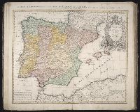
4. Regnorvm Hispaniae et Portvgalliae tabula generalis de l'Isliana / [cartographic material] / aucta Creator: Homann Erben (Firm)Homann, Johann Baptist, 1663-1724 Published / Created: 1728? Call Number: 1973 Folio 30 Collection Title: [Atlas factice of 32 maps and 1 distance table, produced by the Homann Erben firm] Image Count: 3 Found in: Beinecke Rare Book and Manuscript Library > Regnorvm Hispaniae et Portvgalliae tabula generalis de l'Isliana / [cartographic material] / aucta et ad usum scholarum novissime accom[m]odata a Ioh. Bapt. Homanno, S.C.M. Geogr.