Skip to search
Skip to main content
Skip to first result
Search
You Searched For
Genre
Portolan charts
Subject (Topic)
Nautical charts
Search Results
Creator:
Published / Created:
[1536?]
Call Number:
Covers 49 +1536
Image Count:
6
Resource Type:
cartographic image
Description:
Title devised by cataloger.
Publisher:
Conte di Ottomano Freducci
Subject (Geographic):
Mediterranean Region, North Atlantic Ocean, and Baltic Sea
Subject (Topic):
Nautical charts and Maps
Found in:
Beinecke Rare Book and Manuscript Library > Composite atlas of portolan charts produced by Conte di Ottomano Freducci
Creator:
Published / Created:
[approximately 1450-1475]
Call Number:
Art Storage 49cea 1425
Image Count:
2
Resource Type:
cartographic image
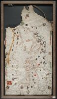
Description:
BEIN Art Storage 49cea 1425: Imperfect: lower left corner and bottom edge torn, with some loss of map; slight holes throughout. With leather thone tie on left edge.
Publisher:
Petrus Roselli?
Subject (Geographic):
Mediterranean Sea and Black Sea
Subject (Topic):
Maps and Nautical charts
Found in:
Beinecke Rare Book and Manuscript Library > Portolan chart of the Mediterranean Sea and the Black Sea
Published / Created:
[between 1800 and 1899?]
Call Number:
GEN MSS FILE 601 (Oversize)
Image Count:
2
Resource Type:
cartographic image
Description:
Title supplied by cataloger.
Subject (Geographic):
Europe and Mediterranean Sea
Subject (Topic):
Nautical charts
Found in:
Beinecke Rare Book and Manuscript Library > Portolan chart of western Europe and the Mediterranean Sea
Published / Created:
[approximately 1960]
Call Number:
Art Storage 1019
Image Count:
2
Resource Type:
cartographic image
Description:
Twentieth century forgery of a portlan chart with seaport names given for all coastlines; based on chart from the circle of Vesconte Maggiolo.
Subject (Geographic):
Mediterranean Sea, North Atlantic Ocean, Black Sea, Africa, West, Mediterranean Sea., North Atlantic Ocean., Black Sea., and Africa, West.
Subject (Topic):
Nautical charts
Found in:
Beinecke Rare Book and Manuscript Library > [Portolan chart of the Mediterranean Sea, the North Atlantic Ocean, the Black Sea, and the northwestern African coast].
Creator:
Published / Created:
[1601]
Call Number:
Manuscript 49cea 1601
Image Count:
2
Resource Type:
cartographic image
Description:
Title devised by cataloger.
Subject (Geographic):
Mediterranean Sea
Subject (Topic):
Nautical charts
Found in:
Beinecke Rare Book and Manuscript Library > [Portolan chart of the Mediterranean Sea].