Search
You Searched For
Search Results
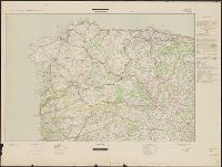
- Creator:
- Germany. Heer. Generalstab. Chef des Kriegskarten- und Vermessungswesens
- Published / Created:
- 1943-1944.
- Call Number:
- 39 1944A
- Container / Volume:
- BRBL_00188
- Image Count:
- 7
- Resource Type:
- Maps, Atlases & Globes
- Found in:
- Beinecke Rare Book and Manuscript Library > Spanien und Portugal 1:500 000 (Strassenkarte).
- Creator:
- Salway, Joseph.
- Published / Created:
- 1899-1903.
- Call Number:
- LTS 32 L84 1811/1903
- Image Count:
- 30
- Resource Type:
- Maps, Atlases & Globes
- Found in:
- Beinecke Rare Book and Manuscript Library > Plan of the road from Hyde Park Corner to Counter's Bridge / made for the Kensington Turnpike Trustees by their surveyor Joseph Salway in the year 1811.
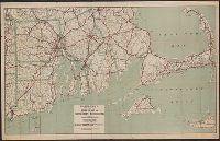
- Creator:
- C.S. Hammond & Company
- Published / Created:
- [1917].
- Call Number:
- 76gmb 1917
- Container / Volume:
- BRBL_00446
- Image Count:
- 1
- Resource Type:
- Maps, Atlases & Globes
- Found in:
- Beinecke Rare Book and Manuscript Library > Hammond's new road map of Rhode Island and southeastern Massachusetts.
- Published / Created:
- 1908
- Call Number:
- 763gmb 1908
- Container / Volume:
- BRBL_00452
- Image Count:
- 1
- Resource Type:
- Maps, Atlases & Globes
- Found in:
- Beinecke Rare Book and Manuscript Library > Automobile map of Vermont, South.
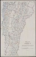
- Creator:
- Walker Lith. & Pub. Co
- Published / Created:
- 1912
- Call Number:
- 763 1912
- Container / Volume:
- BRBL_00452
- Image Count:
- 1
- Resource Type:
- Maps, Atlases & Globes
- Found in:
- Beinecke Rare Book and Manuscript Library > Road map of Vermont showing the selected highways, state roads, which are being improved and maintained under state supervision in accordance with Chapters 172 and 176 P.S. / Issued in connection with the Biennial Report of the State Highway Commissioner
- Published / Created:
- 1897
- Call Number:
- 812gmb M648 1897
- Container / Volume:
- BRBL_00556
- Image Count:
- 1
- Resource Type:
- Maps, Atlases & Globes
- Found in:
- Beinecke Rare Book and Manuscript Library > Wright's map of Milwaukee.
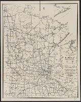
- Creator:
- Minnesota. Dept. of Highways
- Published / Created:
- [1946]
- Call Number:
- 814gmb 1946
- Container / Volume:
- BRBL_00559
- Image Count:
- 1
- Resource Type:
- Maps, Atlases & Globes
- Found in:
- Beinecke Rare Book and Manuscript Library > 1946 condition map of Minnesota trunk highways : showing national and state markings.
- Creator:
- American Automobile Association
- Published / Created:
- [1928?]
- Call Number:
- 815gmb 1928
- Container / Volume:
- BRBL_00561
- Image Count:
- 1
- Resource Type:
- Maps, Atlases & Globes
- Found in:
- Beinecke Rare Book and Manuscript Library > Official AAA road map, Iowa.
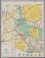
- Creator:
- Arizona. State Highway Commission
- Published / Created:
- 1946]
- Call Number:
- 842gmb 1946
- Container / Volume:
- BRBL_00600
- Image Count:
- 1
- Resource Type:
- Maps, Atlases & Globes
- Found in:
- Beinecke Rare Book and Manuscript Library > Road map of Arizona, 1946 / Arizona State Highway Commission.
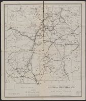
- Creator:
- New Mexico State Highway Commission
- Published / Created:
- 1918
- Call Number:
- 841gmb 1918
- Container / Volume:
- BRBL_00597
- Image Count:
- 1
- Resource Type:
- Maps, Atlases & Globes
- Found in:
- Beinecke Rare Book and Manuscript Library > Map showing condition of state roads, state of New Mexico / issued by State Highway Commission.