Search
You Searched For
Search Results
- Published / Created:
- 1873?]
- Call Number:
- 844cbf 1873A
- Container / Volume:
- BRBL_00613
- Image Count:
- 1
- Resource Type:
- Maps, Atlases & Globes
- Found in:
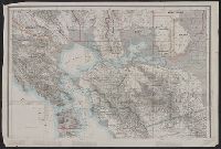
- Beinecke Rare Book and Manuscript Library > [Topographical map of central California].
- Creator:
- Great Britain. Ordnance Survey
- Published / Created:
- Novr. 9th, 1843 [i.e. ca. 1853-1874?]
- Call Number:
- 32 1873
- Container / Volume:
- BRBL_00744
- Image Count:
- 8
- Resource Type:
- Maps, Atlases & Globes
- Found in:
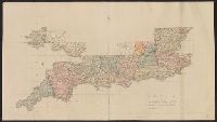
- Beinecke Rare Book and Manuscript Library > [Old series Ordnance Survey maps of England and Wales] / engraved at the Ordnance Map Office, Southampton ...
- Creator:
- Great Britain. Ordnance Survey
- Published / Created:
- Novr. 9th, 1843 [i.e. ca. 1853-1874?]
- Call Number:
- 32 1873
- Container / Volume:
- BRBL_00743
- Image Count:
- 35
- Resource Type:
- Maps, Atlases & Globes
- Found in:
- Beinecke Rare Book and Manuscript Library > [Old series Ordnance Survey maps of England and Wales] / engraved at the Ordnance Map Office, Southampton ...
- Published / Created:
- 1863
- Call Number:
- 783 C899 1863
- Container / Volume:
- BRBL_00510
- Image Count:
- 1
- Resource Type:
- Maps, Atlases & Globes
- Found in:
- Beinecke Rare Book and Manuscript Library > [Military and topographic map of region about Culpepper Courthouse, Va.].
- Creator:
- United States. Army Map Service
- Published / Created:
- 1944
- Call Number:
- 50 1945M
- Container / Volume:
- BRBL_00273
- Image Count:
- 1
- Resource Type:
- Maps, Atlases & Globes
- Found in:
- Beinecke Rare Book and Manuscript Library > [AAF cloth chart]. Eastern Asia [cartographic material].
- Creator:
- Geological Survey (U.S.)
- Published / Created:
- [1898]
- Call Number:
- 836gfc T498 1898
- Container / Volume:
- BRBL_00593
- Image Count:
- 2
- Resource Type:
- Maps, Atlases & Globes
- Found in:
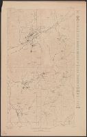
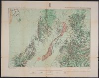
- Beinecke Rare Book and Manuscript Library > Utah : Tintic mining map.
- Creator:
- Geographical Surveys West of the 100th Meridian (U.S.)
- Published / Created:
- [1878]
- Call Number:
- 841 1878B
- Container / Volume:
- BRBL_00596
- Image Count:
- 1
- Resource Type:
- Maps, Atlases & Globes
- Found in:
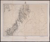
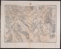
- Beinecke Rare Book and Manuscript Library > U.S. geographical surveys west of the 100th meridian part of southern New Mexico, atlas sheet no. 84 (B) [cartographic material] / under the command of 1st. Lieut. Geo. M. Wheeler, Corps of Engineer, U.S. Army.
- Creator:
- Geographical Surveys West of the 100th Meridian (U.S.)
- Published / Created:
- 1879
- Call Number:
- 841 1879A
- Container / Volume:
- BRBL_00596
- Image Count:
- 1
- Resource Type:
- Maps, Atlases & Globes
- Found in:
- Beinecke Rare Book and Manuscript Library > U.S. geographical surveys west of the 100th meridian land classification map of part of southern New Mexico, atlas sheet no. 84 (B) [cartographic material] / under the command of 1st. Lieut. Geo. M. Wheeler, Corps of Engineer, U.S. Army.
- Creator:
- Wheeler, George M. (George Montague), 1842-1905
- Published / Created:
- 1876
- Call Number:
- 842 1876B
- Container / Volume:
- BRBL_00598
- Image Count:
- 1
- Resource Type:
- Maps, Atlases & Globes
- Found in:
- Beinecke Rare Book and Manuscript Library > U.S. geographical surveys west of the 100th meridian [cartographic material] : parts of eastern Arizona and western New Mexico, atlas sheet no. 76 / under the command of 1st. Lieut. Geo. M. Wheeler.
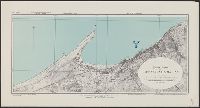
- Creator:
- Great Britain. Inter-service Topographical Dept
- Published / Created:
- 1943
- Call Number:
- 40 V652 1943
- Image Count:
- 1
- Resource Type:
- Maps, Atlases & Globes
- Found in:
- Beinecke Rare Book and Manuscript Library > Town plan of Vibo Valentia Marina [cartographic material] / compiled and drawn by Inter-Service Topographical Department ; produced under the Superintendence of Vice-Admiral John Edgell, hydrographer.