Search
You Searched For
Search Results
- Creator:
- Germany. Heer. Oberkommando
- Published / Created:
- 1943
- Call Number:
- 68 1943B
- Container / Volume:
- BRBL_00349
- Image Count:
- 2
- Resource Type:
- Maps, Atlases & Globes
- Found in:
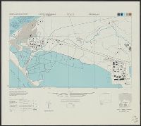
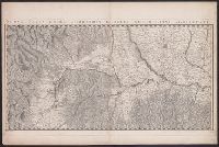
- Beinecke Rare Book and Manuscript Library > Afrika 1:200 000 (Algerien) : sheet I 32 NW1 Batna.
- Creator:
- Helm, Charles J
- Published / Created:
- 1906
- Call Number:
- 848 1906
- Container / Volume:
- BRBL_00630
- Image Count:
- 1
- Resource Type:
- Maps, Atlases & Globes
- Found in:
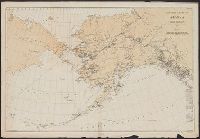
- Beinecke Rare Book and Manuscript Library > Alaska / compiled from the official records of the General Land Office, U.S. Coast and Geodetic Survey, Geological Survey, Canadian and other sources, under the direction of Frank Bond ; compiled by M. Hendges ; revised and drawn by Charles J. Helm.
- Creator:
- Geological Survey (U.S.)
- Published / Created:
- 1898
- Call Number:
- 848 C793 1898
- Container / Volume:
- BRBL_00632
- Image Count:
- 1
- Resource Type:
- Maps, Atlases & Globes
- Found in:
- Beinecke Rare Book and Manuscript Library > Alaska military expedition : in charge of Captain W.R. Abercrombie, U.S.A. Copper River and adjacent territory / topography by P.G. Lowe, F.C. Schrader, and Emil Mahlo.
- Creator:
- Geological Survey (U.S.)
- Published / Created:
- 1909
- Call Number:
- 848 C26 1909
- Container / Volume:
- BRBL_00632
- Image Count:
- 1
- Resource Type:
- Maps, Atlases & Globes
- Found in:
- Beinecke Rare Book and Manuscript Library > Alaska, Casadepaga quadrangle / U.S. Geological Survey.
- Creator:
- Geological Survey (U.S.)
- Published / Created:
- [1908]
- Call Number:
- 848 F15 1908
- Container / Volume:
- BRBL_00632
- Image Count:
- 1
- Resource Type:
- Maps, Atlases & Globes
- Found in:
- Beinecke Rare Book and Manuscript Library > Alaska, Fairbanks special map / U.S. Geological Survey.
- Creator:
- Geological Survey (U.S.)
- Published / Created:
- [1915]
- Call Number:
- 848 V23 1915
- Container / Volume:
- BRBL_00634
- Image Count:
- 1
- Resource Type:
- Maps, Atlases & Globes
- Found in:
- Beinecke Rare Book and Manuscript Library > Alaska, Prince William Sound region, Port Valdez District [cartographic material] / U.S. Geological Survey, Alfred H. Brooks, Geologist in charge of division ; topography by J.W. Bagley and C.E. Giffin.
- Creator:
- Woerl, Joseph Edmund
- Published / Created:
- 1840
- Call Number:
- 30 1840
- Container / Volume:
- BRBL_00031
- Image Count:
- 4
- Resource Type:
- Maps, Atlases & Globes
- Found in:
- Beinecke Rare Book and Manuscript Library > Atlas von Südwest-Deutschland und dem Alpenlande : in 48 Blättern und 6 statistischen Tabellen / entworfen u. bearbeitet von J.E. Woerl.
- Creator:
- Woerl, Joseph Edmund
- Published / Created:
- 1840
- Call Number:
- 30 1840
- Container / Volume:
- BRBL_00031
- Image Count:
- 1
- Resource Type:
- Maps, Atlases & Globes
- Found in:
- Beinecke Rare Book and Manuscript Library > Atlas von Südwest-Deutschland und dem Alpenlande : in 48 Blättern und 6 statistischen Tabellen / entworfen u. bearbeitet von J.E. Woerl.
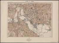
- Published / Created:
- 1905
- Call Number:
- 38hc Se27 1871A
- Container / Volume:
- BRBL_00173
- Image Count:
- 1
- Resource Type:
- Maps, Atlases & Globes
- Found in:
- Beinecke Rare Book and Manuscript Library > Battle of Sedan: position of the Germans in the afternoon shortly before the end of the struggle.
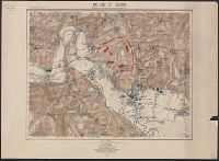
- Published / Created:
- 1905
- Call Number:
- 38hc Se27 1871
- Container / Volume:
- BRBL_00173
- Image Count:
- 1
- Resource Type:
- Maps, Atlases & Globes
- Found in:
- Beinecke Rare Book and Manuscript Library > Battle of Sedan: position of the contending forces towards noon.
- Creator:
- Germany. Heer. Generalstab
- Published / Created:
- 1940
- Call Number:
- 11hd 1942D-54
- Container / Volume:
- BRBL_00010ZE
- Image Count:
- 1
- Resource Type:
- Maps, Atlases & Globes
- Found in:
- Beinecke Rare Book and Manuscript Library > Befestigungskarte Frankreich 1:25000 : St. Amand, Nr. 1-2, XXVI-5/1-2.
- Creator:
- Mexico. Comisión Geográfica de Guerra y Fomento
- Published / Created:
- 1890-
- Call Number:
- 88 1903
- Container / Volume:
- BRBL_00646
- Image Count:
- 4
- Resource Type:
- Maps, Atlases & Globes
- Found in:
- Beinecke Rare Book and Manuscript Library > Carta de la República Mexicana a la 100,000a. 1. ser / Secretarʹia de Estado y del Despacho de Fomento, Comisión Geográfica de Guerra y Fomento.
- Published / Created:
- anno 1807.
- Call Number:
- 40 M59 1807
- Container / Volume:
- BRBL_00210
- Image Count:
- 1
- Resource Type:
- Maps, Atlases & Globes
- Found in:
- Beinecke Rare Book and Manuscript Library > Carta topografica dei contorni di Milano.
- Published / Created:
- 1849]
- Call Number:
- 40 M72 1849
- Container / Volume:
- BRBL_00211
- Image Count:
- 12
- Resource Type:
- Maps, Atlases & Globes
- Found in:
- Beinecke Rare Book and Manuscript Library > Carta topografica del Ducato di Modena.
- Creator:
- Manazzale, Andrea, cartographer
- Published / Created:
- 1805
- Call Number:
- 400am R66 1805
- Container / Volume:
- BRBL_00233
- Image Count:
- 1
- Resource Type:
- Maps, Atlases & Globes
- Found in:
- Beinecke Rare Book and Manuscript Library > Carta topografica dell'antichità di Roma [cartographic material] / Andrea Manazzale inv. ; D. Pronti inc.
- Call Number:
- 401 1820
- Container / Volume:
- BRBL_00233
- Image Count:
- 1
- Resource Type:
- Maps, Atlases & Globes
- Found in:
- Beinecke Rare Book and Manuscript Library > Carte chorographique d'une partie du Piémont et de la Savoie : comprenant le réseau trigonométrique fait pour joindre la grande triangulation de France avec celle de l'Italie.
- Creator:
- Schweizerischer Juraverein
- Published / Created:
- [1940]-
- Call Number:
- 37 J974 1940
- Image Count:
- 2
- Resource Type:
- Maps, Atlases & Globes
- Found in:
- Beinecke Rare Book and Manuscript Library > Carte du Jura = Spezialkarte des Jura / editée par le Schweizerischen Juraverein.
- Published / Created:
- [1900]
- Call Number:
- 37 1900
- Image Count:
- 2
- Resource Type:
- Maps, Atlases & Globes
- Found in:
- Beinecke Rare Book and Manuscript Library > Carte générale de la Suisse.
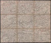
- Creator:
- Allied Forces
Great Britain. War Office. General Staff. Geographical Section
- Published / Created:
- 1943-
- Call Number:
- 11hd 1942D-44
- Image Count:
- 14
- Resource Type:
- Maps, Atlases & Globes
- Found in:
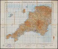
- Beinecke Rare Book and Manuscript Library > Central Europe 1:100,000.
- Creator:
- Great Britain. War Office. General Staff. Geographical Section
- Published / Created:
- 1943
- Call Number:
- 56cbf 1942
- Container / Volume:
- BRBL_00297
- Image Count:
- 1
- Resource Type:
- Maps, Atlases & Globes
- Found in:
- Beinecke Rare Book and Manuscript Library > China and Japan [cartographic material] / compiled from G.S.G.S. 4065 and 2957.
- Creator:
- United States. Office of Strategic Services. Research and Analysis Branch
- Published / Created:
- 1944
- Call Number:
- 56cbf 1944
- Container / Volume:
- BRBL_00297
- Image Count:
- 1
- Resource Type:
- Maps, Atlases & Globes
- Found in:
- Beinecke Rare Book and Manuscript Library > China, terrain and transportation [cartographic material] / compiled and drawn in the Branch of Research and Analysis, OSS.
- Creator:
- Geological Survey (U.S.)
- Published / Created:
- 1910
- Call Number:
- BrSides Double Folio 2019 84
- Image Count:
- 1
- Resource Type:
- Maps, Atlases & Globes
- Found in:
- Beinecke Rare Book and Manuscript Library > Colorado (Lake County), Leadville special map [cartographic material] / triangulation and topography by A.D. Wilson, chief topographer.
- Creator:
- Geological Survey (U.S.)
- Published / Created:
- 1906
- Call Number:
- BrSides Folio 2019 61
- Image Count:
- 1
- Resource Type:
- Maps, Atlases & Globes
- Found in:
- Beinecke Rare Book and Manuscript Library > Colorado, Central City special map [cartographic material] / U.S. Geological Survey ; E.M. Douglas, geographer ; Frank Tweedy, in charge of section ; topography by Pearson Chapman and D.F. Moor ; triangulation by Frank Tweedy.
- Creator:
- Herder, Bartholomä, 1774-1839, lithographer
Woerl, Joseph Edmund
Woerl, Joseph Edmund. Atlas von Central-Europa
- Call Number:
- 30 1840B
- Container / Volume:
- BRBL_00031
- Image Count:
- 1
- Resource Type:
- Maps, Atlases & Globes
- Found in:
- Beinecke Rare Book and Manuscript Library > Constanz.
- Creator:
- Great Britain. War Office. General Staff. Geographical Section
- Published / Created:
- 1945
- Call Number:
- 56 P36 1945
- Container / Volume:
- BRBL_00297
- Image Count:
- 1
- Resource Type:
- Maps, Atlases & Globes
- Found in:
- Beinecke Rare Book and Manuscript Library > Eastern China 1:50,000. Sheet 16/2,200, Peking / Geographical Section, General Staff [cartographic material].
- Creator:
- Egypt. Maṣlaḥat al-Misāḥah, cartographer, issuing body
- Published / Created:
- 1909-
- Call Number:
- 61 1909
- Container / Volume:
- BRBL_00764
- Image Count:
- 6
- Resource Type:
- Maps, Atlases & Globes
- Found in:
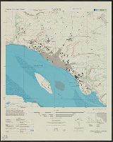
- Beinecke Rare Book and Manuscript Library > Egypt 1:1,000,000 / Survey of Egypt.
- Creator:
- Topografische Inrichting (Jakarta, Indonesia)
- Published / Created:
- 1912
- Call Number:
- 27251 1912
- Container / Volume:
- BRBL_00023B
- Image Count:
- 1
- Resource Type:
- Maps, Atlases & Globes
- Found in:
- Beinecke Rare Book and Manuscript Library > Eiland Leti / Topographische Inrichting ; Opgenomen door den opnemer A. Lichtenberg.
- Creator:
- United States. Army Map Service
- Published / Created:
- 1945
- Call Number:
- 575 T57 1945
- Container / Volume:
- BRBL_00313
- Image Count:
- 1
- Resource Type:
- Maps, Atlases & Globes
- Found in:
- Beinecke Rare Book and Manuscript Library > Formosa city plans 1: 6,000 : Toen / prepared under the direction of the Chief of Engineers by the Army Map Service (AM), U.S. Army.
- Creator:
- United States. Army Map Service
- Published / Created:
- 1944
- Call Number:
- 575 T574 1944
- Container / Volume:
- BRBL_00313
- Image Count:
- 1
- Resource Type:
- Maps, Atlases & Globes
- Found in:
- Beinecke Rare Book and Manuscript Library > Formosa city plans 1: 6,000 : Toko / prepared under the direction of the Chief of Engineers by the Army Map Service (AM), U.S. Army.
- Creator:
- United States. Army Map Service
- Published / Created:
- 1945
- Call Number:
- 575 T15 1945
- Container / Volume:
- BRBL_00313
- Image Count:
- 1
- Resource Type:
- Maps, Atlases & Globes
- Found in:
- Beinecke Rare Book and Manuscript Library > Formosa city plans 1: 8,000 : Tansui / prepared under the direction of the Chief of Engineers by the Army Map Service (AM), U.S. Army.
- Creator:
- Germany. Heer. Abteilung für Kriegskarten- und Vermessungswesen
- Published / Created:
- 1942-1944.
- Call Number:
- 38cbf 1943
- Container / Volume:
- BRBL_00168
- Image Count:
- 1
- Resource Type:
- Maps, Atlases & Globes
- Found in:
- Beinecke Rare Book and Manuscript Library > Frankreich 1:200,000 Zusammendruck [cartographic material].
- Published / Created:
- 1903
- Call Number:
- 848 1903
- Container / Volume:
- BRBL_00630
- Image Count:
- 1
- Resource Type:
- Maps, Atlases & Globes
- Found in:
- Beinecke Rare Book and Manuscript Library > General chart of Alaska : to accompany reindeer report by Sheldon Jackson general agent of education in Alaska.
- Creator:
- Wieser, Franz, Ritter von, 1848-1923
- Published / Created:
- [1870-1874]
- Call Number:
- BrSides 2019 102
- Image Count:
- 18
- Resource Type:
- Maps, Atlases & Globes
- Found in:
- Beinecke Rare Book and Manuscript Library > Generalstabs-Karte von Tirol / Dr. Franz Wieser.
- Creator:
- Geological Survey (U.S.)
- Published / Created:
- 1912
- Call Number:
- 848 G95 1912
- Container / Volume:
- BRBL_00632
- Image Count:
- 1
- Resource Type:
- Maps, Atlases & Globes
- Found in:
- Beinecke Rare Book and Manuscript Library > Geologic reconnaissance map of headwater region of Gulkana and Susitna Rivers, Alaska / U.S. Geological Survey. Alfred H. Brooks, geologist in charge of division, topography and triangulation by D.C. Witherspoon, C.E. Giffin and J.W. Bagley.
- Creator:
- Woerl, Joseph Edmund
- Call Number:
- 41 1830
- Container / Volume:
- BRBL_00241
- Image Count:
- 1
- Resource Type:
- Maps, Atlases & Globes
- Found in:
- Beinecke Rare Book and Manuscript Library > Grätz.
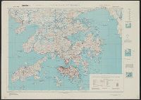
- Creator:
- Great Britain. War Office. General Staff. Geographical Section
- Published / Created:
- 1945
- Call Number:
- 5681 1945
- Container / Volume:
- BRBL_00300
- Image Count:
- 2
- Resource Type:
- Maps, Atlases & Globes
- Found in:
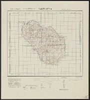
- Beinecke Rare Book and Manuscript Library > Hong Kong and New territory.
- Published / Created:
- 1909
- Call Number:
- 428 In7 1909
- Container / Volume:
- BRBL_00248
- Image Count:
- 1
- Resource Type:
- Maps, Atlases & Globes
- Found in:
- Beinecke Rare Book and Manuscript Library > Innsbruck und Umgebung.
- Creator:
- International Boundary Commission
- Published / Created:
- 1952]
- Call Number:
- 848fab 1951
- Container / Volume:
- BRBL_00635
- Image Count:
- 15
- Resource Type:
- Maps, Atlases & Globes
- Found in:
- Beinecke Rare Book and Manuscript Library > Joint maps of the international boundary between United States and Canada from Cape Muzon to Mount St. Elias.
- Creator:
- Geological Survey (U.S.)
- Published / Created:
- [1918]
- Call Number:
- 848 J953 1918
- Container / Volume:
- BRBL_00633
- Image Count:
- 1
- Resource Type:
- Maps, Atlases & Globes
- Found in:
- Beinecke Rare Book and Manuscript Library > Juneau and vicinity, Alaska / Alfred H. Brooks, geologist in charge of division ; topography by D.C. Witherspoon.
- Creator:
- Wiedenmann, P
- Published / Created:
- [1890?]
- Call Number:
- 41 G51 1880
- Container / Volume:
- BRBL_00242
- Image Count:
- 1
- Resource Type:
- Maps, Atlases & Globes
- Found in:
- Beinecke Rare Book and Manuscript Library > Karte der Glockner Gruppe [cartographic material] / mit benützung sämtl. einschlägiger quellen bearbeitet von P. Wiedenmann.
- Published / Created:
- [1874]
- Call Number:
- 37 1874A
- Image Count:
- 1
- Resource Type:
- Maps, Atlases & Globes
- Found in:
- Beinecke Rare Book and Manuscript Library > Karte der Schweiz von R. Leuzinger = Carte de la Suisse par R. Leuzinger.
- Creator:
- Schumacher, Gottlieb
- Published / Created:
- [1908?-]
- Call Number:
- 51 1908
- Container / Volume:
- BRBL_00279
- Image Count:
- 3
- Resource Type:
- Maps, Atlases & Globes
- Found in:
- Beinecke Rare Book and Manuscript Library > Karte des Ostjordanlandes [cartographic material] / aufgen. von Dr. G. Schumacher ; herausgeg. vom Deutschen Verein zur Erforschung Palästinas.
- Creator:
- Woerl, Joseph Edmund
- Published / Created:
- [1840]
- Call Number:
- 40 1840C
- Image Count:
- 5
- Resource Type:
- Maps, Atlases & Globes
- Found in:
- Beinecke Rare Book and Manuscript Library > Karte von Ober-Italien in 6 Blättern : mit roth eingedruckten Strassen, Ortspositionen und Grenzen / entworfen und bearbeitet im Maasstabe van 1.500,000 von Professor Dr. J.E. Woerl.
- Creator:
- Woerl, Joseph Edmund
- Published / Created:
- [1840]
- Call Number:
- 40 1840C
- Container / Volume:
- BRBL_00200
- Image Count:
- 4
- Resource Type:
- Maps, Atlases & Globes
- Found in:
- Beinecke Rare Book and Manuscript Library > Karte von Ober-Italien in 6 Blättern : mit roth eingedruckten Strassen, Ortspositionen und Grenzen / entworfen und bearbeitet im Maasstabe van 1.500,000 von Professor Dr. J.E. Woerl.
- Creator:
- Woerl, Joseph Edmund
- Published / Created:
- [1840]
- Call Number:
- 40 1840C
- Container / Volume:
- BRBL_00200
- Image Count:
- 1
- Resource Type:
- Maps, Atlases & Globes
- Found in:
- Beinecke Rare Book and Manuscript Library > Karte von Ober-Italien in 6 Blättern : mit roth eingedruckten Strassen, Ortspositionen und Grenzen / entworfen und bearbeitet im Maasstabe van 1.500,000 von Professor Dr. J.E. Woerl.
- Creator:
- Geographical Surveys West of the 100th Meridian (U.S.)
- Published / Created:
- 1879
- Call Number:
- 834 1879B
- Container / Volume:
- BRBL_00587
- Image Count:
- 1
- Resource Type:
- Maps, Atlases & Globes
- Found in:
- Beinecke Rare Book and Manuscript Library > Land classification map of part of south western Colorado [cartographic material] : atlas sheet No. 61 (D).
- Creator:
- Geological Survey (U.S.)
- Published / Created:
- 1913
- Call Number:
- BrSides Double Folio 2019 127
- Image Count:
- 1
- Resource Type:
- Maps, Atlases & Globes
- Found in:
- Beinecke Rare Book and Manuscript Library > Leadville mining district [cartographic material] / U.S. Geological Survey ; R.B. Marshall, chief geographer ; Sledge Tatum, geographer in charge ; topography by E.P. Davis and S.E. Taylor ; control by R.B. Robertson, C.H. Semper, and S.E. Taylor.
- Creator:
- Great Britain. Army. Royal Engineers. Fd. Survey Coy., 512
- Published / Created:
- 1943
- Call Number:
- 493 1943
- Container / Volume:
- BRBL_00270
- Image Count:
- 2
- Resource Type:
- Maps, Atlases & Globes
- Found in:
- Beinecke Rare Book and Manuscript Library > Malta and Gozo [cartographic material] / drawn at Ordnance Survey Office, Southampton, 1934 ; revised and reprinted by 512 Fd. Survey Coy., R.E. Feb., 1943.
- Creator:
- Geological Survey (U.S.)
- Published / Created:
- 1909
- Call Number:
- 848 1909
- Container / Volume:
- BRBL_00630
- Image Count:
- 1
- Resource Type:
- Maps, Atlases & Globes
- Found in:
- Beinecke Rare Book and Manuscript Library > Map of Alaska / compiled chiefly from maps of the U.S. Geological Survey ... Alfred H. Brooks, geologist in charge, Division of Alaskan Mineral Resources.
- Creator:
- Geological Survey (U.S.)
- Published / Created:
- 1913
- Call Number:
- 848 1913A
- Container / Volume:
- BRBL_00631
- Image Count:
- 2
- Resource Type:
- Maps, Atlases & Globes
- Found in:
- Beinecke Rare Book and Manuscript Library > Map of Alaska : compiled chiefly from maps of the U.S. Geological Survey / engraved and printed by the U.S. Geological Survey ; Alfred H. Brooks, Geologist in charge, Division of Alaskan Mineral Resources.
- Creator:
- National Geographic Society (U.S.). Cartographic Division
- Published / Created:
- 1914
- Call Number:
- 848 1914D
- Container / Volume:
- BRBL_00631
- Image Count:
- 1
- Resource Type:
- Maps, Atlases & Globes
- Found in:
- Beinecke Rare Book and Manuscript Library > Map of Alaska : showing latest explorations by U.S. Geological Survey and U.S. Coast and Geodetic Survey.
- Published / Created:
- 1909?]
- Call Number:
- 825 L487 1909
- Container / Volume:
- BRBL_00574
- Image Count:
- 1
- Resource Type:
- Maps, Atlases & Globes
- Found in:
- Beinecke Rare Book and Manuscript Library > Map of Fort Leavenworth, Kansas and vicinity.
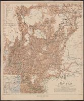
- Creator:
- Davies, Henry Rodolph, 1865-
- Published / Created:
- 1908
- Call Number:
- 5631 1908
- Container / Volume:
- BRBL_00299
- Image Count:
- 1
- Resource Type:
- Maps, Atlases & Globes
- Found in:
- Beinecke Rare Book and Manuscript Library > Map of Yün-nan / compiled by Major H.R. Davies.
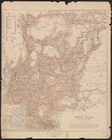
- Published / Created:
- 1873
- Call Number:
- 9713 1873
- Container / Volume:
- BRBL_00678
- Image Count:
- 1
- Resource Type:
- Maps, Atlases & Globes
- Found in:
- Beinecke Rare Book and Manuscript Library > Mapa del Peru, Departamento de Anchachs : con la nueva provincia Dos de Mayo del Departo. de Huanuco / por A. Raimondi.
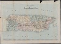
- Published / Created:
- 1886
- Call Number:
- 856 1886
- Container / Volume:
- BRBL_00643
- Image Count:
- 1
- Resource Type:
- Maps, Atlases & Globes
- Found in:
- Beinecke Rare Book and Manuscript Library > Mapa topográfico de la isla de Puerto Rico.
- Creator:
- France. Corps d'état-major
- Published / Created:
- 1912
- Call Number:
- 38281cbf M46 1912
- Container / Volume:
- BRBL_00177
- Image Count:
- 1
- Resource Type:
- Maps, Atlases & Globes
- Found in:
- Beinecke Rare Book and Manuscript Library > Meaux.
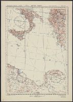
- Creator:
- Great Britain. War Office. General Staff. Geographical Section
- Published / Created:
- 1943
- Call Number:
- 49 1943
- Container / Volume:
- BRBL_00268
- Image Count:
- 3
- Resource Type:
- Maps, Atlases & Globes
- Found in:
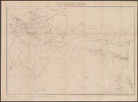
- Beinecke Rare Book and Manuscript Library > Méditerranée orientale, 1:2,000,000.
- Call Number:
- 783 C899 1863B
- Container / Volume:
- BRBL_00510
- Image Count:
- 1
- Resource Type:
- Maps, Atlases & Globes
- Found in:
- Beinecke Rare Book and Manuscript Library > Military and topographic map of region about Culpepper Courthouse, Va.
- Creator:
- Nell, Louis
- Published / Created:
- 1903
- Call Number:
- 834 1903
- Container / Volume:
- BRBL_00588
- Image Count:
- 1
- Resource Type:
- Maps, Atlases & Globes
- Found in:
- Beinecke Rare Book and Manuscript Library > Nell's topographical map of the state of Colorado.
- Published / Created:
- 1834
- Call Number:
- 40 1832
- Container / Volume:
- BRBL_00199
- Image Count:
- 1
- Resource Type:
- Maps, Atlases & Globes
- Found in:
- Beinecke Rare Book and Manuscript Library > North Italy &c. and the passes of the Alps & Apennines / by J. Arrowsmith.
- Creator:
- Rizzi-Zannoni, Giovanni Antonio, 1736-1814, cartographer
- Published / Created:
- 1795
- Call Number:
- 402 1795
- Container / Volume:
- BRBL_00233
- Image Count:
- 4
- Resource Type:
- Maps, Atlases & Globes
- Found in:
- Beinecke Rare Book and Manuscript Library > Nuova carta della Lombardia e delle sue regioni aggiacenti / formata d'ordine di S.M. Siciliana dal Reg. Geogr. G.A. Rizzi-Zannoni ; Gius. Guerra Nap. Reg. inc.
- Creator:
- Great Britain. Ordnance Survey
- Published / Created:
- 1920-21.
- Call Number:
- 32 1920B
- Container / Volume:
- BRBL_00745
- Image Count:
- 11
- Resource Type:
- Maps, Atlases & Globes
- Found in:
- Beinecke Rare Book and Manuscript Library > Ordnance Survey of Great Britain 1/4 inch to one mile.
- Creator:
- Great Britain. Ordnance Survey
- Published / Created:
- 1920-21.
- Call Number:
- 32 1920B
- Container / Volume:
- BRBL_00745
- Image Count:
- 7
- Resource Type:
- Maps, Atlases & Globes
- Found in:
- Beinecke Rare Book and Manuscript Library > Ordnance Survey of Great Britain 1/4 inch to one mile.
- Creator:
- Great Britain. Ordnance Survey
- Published / Created:
- 1940-
- Call Number:
- 32 1940
- Container / Volume:
- BRBL_00745
- Image Count:
- 1
- Resource Type:
- Maps, Atlases & Globes
- Found in:
- Beinecke Rare Book and Manuscript Library > Ordnance Survey of Great Britain [cartographic material] : England & Wales.
- Creator:
- Great Britain. War Office. General Staff. Geographical Section
- Published / Created:
- 1943
- Call Number:
- 40 P19 1942
- Container / Volume:
- BRBL_00213
- Image Count:
- 1
- Resource Type:
- Maps, Atlases & Globes
- Found in:
- Beinecke Rare Book and Manuscript Library > Pantelleria [cartographic material] / drawn by GSGS, War Office 1940.
- Creator:
- Geological and Geographical Survey of the Territories (U.S.)
- Published / Created:
- [1878?]
- Call Number:
- 833 1878A
- Container / Volume:
- BRBL_00584
- Image Count:
- 1
- Resource Type:
- Maps, Atlases & Globes
- Found in:
- Beinecke Rare Book and Manuscript Library > Part of central Wyoming / U.S. Geological and Geographical Survey of the Territories ; F.V. Hayden, U.S. geologist in charge ; George B. Chittenden topographical assistant.
- Creator:
- Geographical Surveys West of the 100th Meridian (U.S.)
- Published / Created:
- 1876
- Call Number:
- 842 1876A
- Container / Volume:
- BRBL_00598
- Image Count:
- 1
- Resource Type:
- Maps, Atlases & Globes
- Found in:
- Beinecke Rare Book and Manuscript Library > Parts of Central and Western Arizona [cartographic material] : atlas sheet no. 75.
- Creator:
- Geographical Surveys West of the 100th Meridian (U.S.)
- Published / Created:
- [1876]
- Call Number:
- 842 1876C
- Container / Volume:
- BRBL_00598
- Image Count:
- 1
- Resource Type:
- Maps, Atlases & Globes
- Found in:
- Beinecke Rare Book and Manuscript Library > Parts of eastern and southeastern Arizona, western and southwestern New Mexico, Parts of eastern and southeastern Arizona, western and southwestern New Mexico / U.S. Geographical Surveys West of the 100th Meridian.
- Creator:
- Geological and Geographical Survey of the Territories (U.S.)
- Published / Created:
- [1878]
- Call Number:
- 833 1878
- Container / Volume:
- BRBL_00584
- Image Count:
- 1
- Resource Type:
- Maps, Atlases & Globes
- Found in:
- Beinecke Rare Book and Manuscript Library > Parts of western Wyoming and southeastern Idaho / U.S. Geological and Geographical Survey of the Territories ; F.V. Hayden, U.S. geologist in charge ; G.R. Bechler and Fred A. Clark, topographical assistants.
- Creator:
- Geological and Geographical Survey of the Territories (U.S.)
- Published / Created:
- [1878]
- Call Number:
- 833ca 1878
- Container / Volume:
- BRBL_00585
- Image Count:
- 1
- Resource Type:
- Maps, Atlases & Globes
- Found in:
- Beinecke Rare Book and Manuscript Library > Parts of western Wyoming and southeastern Idaho / U.S. Geological and Geographical Survey of the Territories ; F.V. Hayden, U.S. geologist in charge ; O. St. John, geological assistant ; G.R. Bechler and Fred A. Clark, topographical assistants.
- Creator:
- Geological and Geographical Survey of the Territories (U.S.)
- Published / Created:
- [1878]
- Call Number:
- 833ca 1878A
- Container / Volume:
- BRBL_00585
- Image Count:
- 1
- Resource Type:
- Maps, Atlases & Globes
- Found in:
- Beinecke Rare Book and Manuscript Library > Parts of western Wyoming, southeastern Idaho and northeastern Utah / U.S. Geological and Geographical Survey of the Territories ; F.V. Hayden, U.S. geologist in charge ; A.C. Peale, geological assistant ; Henry Gannett, topographical assistant.
- Creator:
- Geological and Geographical Survey of the Territories (U.S.)
- Published / Created:
- [1877]
- Call Number:
- 833ca 1878AB
- Container / Volume:
- BRBL_00585
- Image Count:
- 1
- Resource Type:
- Maps, Atlases & Globes
- Found in:
- Beinecke Rare Book and Manuscript Library > Parts of western Wyoming, southeastern Idaho and northeastern Utah [cartographic material] / F.V. Hayden, U.S. geologist in charge ; Harry Gannett, M.E., topographical assistant ; Julius Bien, lith., New York.
- Call Number:
- 406 1855
- Container / Volume:
- BRBL_00236
- Image Count:
- 1
- Resource Type:
- Maps, Atlases & Globes
- Found in:
- Beinecke Rare Book and Manuscript Library > Pianta Della Campagna Romana Nello Stato Antico e Moderno / To the Right Hon'ble Lord George John Warren Vernon ... this plate is respectfully dedicated by His Lordship's most obed't serv't Luigi Piale ; Domenico Feltrini scrisse ; Augusto Fornari incise,
- Creator:
- Sickler, Friedrich, 1773-1836, cartographer
- Published / Created:
- 1816
- Call Number:
- 400 R66 1816
- Container / Volume:
- BRBL_00233
- Image Count:
- 1
- Resource Type:
- Maps, Atlases & Globes
- Found in:
- Beinecke Rare Book and Manuscript Library > Plan topographique de la campagne de Rome [cartographic material] / dessiné et expliqué par F. Ch. L. Sickler D. à l'usage des voyageurs ; P. Ruga inc.
- Creator:
- Geological Survey (U.S.)
- Published / Created:
- 1913
- Call Number:
- 848 K842 1913
- Container / Volume:
- BRBL_00633
- Image Count:
- 1
- Resource Type:
- Maps, Atlases & Globes
- Found in:
- Beinecke Rare Book and Manuscript Library > Reconnaissance map of Koyukuk-Chandalar region, Alaska / U.S. Geological Survey ; Alfred H. Brooks, Geologist in charge of division, topography and triangulation by T.G. Gerdine ... [et al.].
- Creator:
- Geological Survey (U.S.)
- Published / Created:
- 1921
- Call Number:
- 848 R82 1921
- Container / Volume:
- BRBL_00634
- Image Count:
- 1
- Resource Type:
- Maps, Atlases & Globes
- Found in:
- Beinecke Rare Book and Manuscript Library > Reconnaissance map of Ruby district, Alaska / U.S. Geoogical Survey; Alfred H. Brooks, geologist in charge of division.
- Creator:
- Geological Survey (U.S.)
- Published / Created:
- 1916
- Call Number:
- 848 Y91 1916
- Container / Volume:
- BRBL_00634
- Image Count:
- 1
- Resource Type:
- Maps, Atlases & Globes
- Found in:
- Beinecke Rare Book and Manuscript Library > Reconnaissance map of Yukon-Koyukuk region, Alaska / U.S. Geological Survey; Alfred H. Brooks, geologist in charge of division, topography by H.M. Eakin [et al].
- Creator:
- Geological Survey (U.S.)
- Published / Created:
- 1907
- Call Number:
- 848 Se87 1907
- Container / Volume:
- BRBL_00634
- Image Count:
- 1
- Resource Type:
- Maps, Atlases & Globes
- Found in:
- Beinecke Rare Book and Manuscript Library > Reconnaissance map of northeastern portion of Seward Peninsula Alaska / U.S. Geological Survey ; Alfred H. Brooks, geologist in charge ; D.C. Witherspoon, topographer ; C.E. Hill, field assistant.
- Creator:
- Geological Survey (U.S.)
- Published / Created:
- 1921
- Call Number:
- 848 K96 1921
- Container / Volume:
- BRBL_00633
- Image Count:
- 1
- Resource Type:
- Maps, Atlases & Globes
- Found in:
- Beinecke Rare Book and Manuscript Library > Reconnaissance map of the Lower Kuskokwim region, Alaska / U.S. Geological Survey ; Alfred H. Brooks, Geologist in charge of division, topography by A.G. Maddren, R.H. Sargent and W.S. Post.
- Creator:
- Geological Survey (U.S.)
- Published / Created:
- 1907
- Call Number:
- 848 Se87 1907A
- Container / Volume:
- BRBL_00634
- Image Count:
- 1
- Resource Type:
- Maps, Atlases & Globes
- Found in:
- Beinecke Rare Book and Manuscript Library > Reconnaissance map, southern part of Seward Peninsula, Alaska / topography by E.C. Barnard, D.L. Reaburn, J.G. Hefty ... [et al.].
- Creator:
- Woerl, Joseph Edmund
- Call Number:
- 40 1830
- Container / Volume:
- BRBL_00199
- Image Count:
- 1
- Resource Type:
- Maps, Atlases & Globes
- Found in:
- Beinecke Rare Book and Manuscript Library > Rom.
- Published / Created:
- 1834
- Call Number:
- 400 R66 1834
- Container / Volume:
- BRBL_00233
- Image Count:
- 1
- Resource Type:
- Maps, Atlases & Globes
- Found in:
- Beinecke Rare Book and Manuscript Library > Rome & its environs [cartographic material] : from a trigonometrical survey / by Sir William Gell ; engraved by J. Gardner.
- Creator:
- U.S. Coast and Geodetic Survey
- Published / Created:
- 1898
- Call Number:
- 848 J953 1897
- Container / Volume:
- BRBL_00633
- Image Count:
- 1
- Resource Type:
- Maps, Atlases & Globes
- Found in:
- Beinecke Rare Book and Manuscript Library > Route map, Juneau to Porcupine River, Alaska.
- Published / Created:
- 1909
- Call Number:
- 97 M11 1909
- Container / Volume:
- BRBL_00678
- Image Count:
- 1
- Resource Type:
- Maps, Atlases & Globes
- Found in:
- Beinecke Rare Book and Manuscript Library > Ruinas de Macchupichu : Linea No. 1 K 130 - K 140 / E.B. Sanderson, Ingenerio en Jefe de los Estudios.
- Creator:
- Woerl, Joseph Edmund
- Call Number:
- 42 1830
- Container / Volume:
- BRBL_00244
- Image Count:
- 1
- Resource Type:
- Maps, Atlases & Globes
- Found in:
- Beinecke Rare Book and Manuscript Library > Salzburg.
- Creator:
- Schedler, J. (Joseph)
- Published / Created:
- c1877.
- Call Number:
- 44 1877A
- Container / Volume:
- BRBL_00255
- Image Count:
- 1
- Resource Type:
- Maps, Atlases & Globes
- Found in:
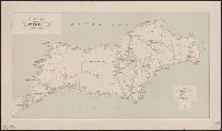
- Beinecke Rare Book and Manuscript Library > Schedler's topographical map of the Dobrudsha (eastern Bulgaria), central Roumania and Bessarabia [cartographic material] / drawn by J. Schedler.
- Creator:
- Topografische Inrichting (Jakarta, Indonesia)
- Published / Created:
- 1915
- Call Number:
- 2717 1915
- Container / Volume:
- BRBL_00023B
- Image Count:
- 1
- Resource Type:
- Maps, Atlases & Globes
- Found in:
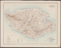
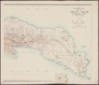
- Beinecke Rare Book and Manuscript Library > Schetskaart van het eiland Boeroe.
- Creator:
- Topografische Inrichting (Jakarta, Indonesia)
- Published / Created:
- 1914
- Call Number:
- 2716 1914
- Container / Volume:
- BRBL_00023B
- Image Count:
- 2
- Resource Type:
- Maps, Atlases & Globes
- Found in:
- Beinecke Rare Book and Manuscript Library > Schetskaart van het eiland Ceram en omliggende eilanden / Topografische dienst.
- Creator:
- Topografische Inrichting (Jakarta, Indonesia)
- Published / Created:
- 1911
- Call Number:
- 2725 1911
- Container / Volume:
- BRBL_00023B
- Image Count:
- 1
- Resource Type:
- Maps, Atlases & Globes
- Found in:
- Beinecke Rare Book and Manuscript Library > Schetskaart van het eiland Wetar / Topografische Inrichting.
- Creator:
- Great Britain. Army. Royal Engineers. Survey Production Centre
- Published / Created:
- 1945
- Call Number:
- 582 B22 1945
- Container / Volume:
- BRBL_00314
- Image Count:
- 1
- Resource Type:
- Maps, Atlases & Globes
- Found in:
- Beinecke Rare Book and Manuscript Library > Siam 1 inch to 1 mile Bangkok West.
- Creator:
- Great Britain. Army. Royal Engineers. Survey Production Centre
- Published / Created:
- 1945
- Call Number:
- 582 B22 1945B
- Container / Volume:
- BRBL_00314
- Image Count:
- 1
- Resource Type:
- Maps, Atlases & Globes
- Found in:
- Beinecke Rare Book and Manuscript Library > Siam 1 inch to 1 mile Nakhaun Chaisi.
- Creator:
- Great Britain. Army. Royal Engineers. Survey Production Centre
- Published / Created:
- 1945
- Call Number:
- 582 B22 1945C
- Container / Volume:
- BRBL_00314
- Image Count:
- 1
- Resource Type:
- Maps, Atlases & Globes
- Found in:
- Beinecke Rare Book and Manuscript Library > Siam 1 inch to 1 mile Samut Prakan.
- Creator:
- France. Corps d'état-major
- Published / Created:
- 1912
- Call Number:
- 3829cbf So37 1912
- Container / Volume:
- BRBL_00177
- Image Count:
- 1
- Resource Type:
- Maps, Atlases & Globes
- Found in:
- Beinecke Rare Book and Manuscript Library > Soissons.
- Creator:
- United States. Office of Strategic Services. Research and Analysis Branch
- Published / Created:
- [1944]
- Call Number:
- 53cbf 1944A
- Container / Volume:
- BRBL_00286
- Image Count:
- 1
- Resource Type:
- Maps, Atlases & Globes
- Found in:
- Beinecke Rare Book and Manuscript Library > Southeastern Europe [cartographic material] / lithographed in Reproduction Branch, OSS.
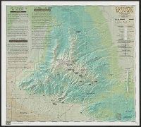
- Creator:
- Allan Cartography (Firm)
- Published / Created:
- c1999.
- Call Number:
- 842 1999
- Container / Volume:
- BRBL_00599
- Image Count:
- 2
- Resource Type:
- Maps, Atlases & Globes
- Found in:
- Beinecke Rare Book and Manuscript Library > Southern Arizona's Santa Catalina Mountains / map development/design Allan Cartography, Medford, OR ; map overlay Moon St. Cartography Inc, Durango, CO.
- Creator:
- Deutscher und Österreichischer Alpenverein
- Published / Created:
- 1882
- Call Number:
- 428 Z65 1882
- Container / Volume:
- BRBL_00249
- Image Count:
- 1
- Resource Type:
- Maps, Atlases & Globes
- Found in:
- Beinecke Rare Book and Manuscript Library > Special-karte der centralen Zillerthaler Gebirgsgruppe Östliches blatt [cartographic material] / Herausgegeben vom Deutschen u. Oesterreichischen Alpenverein.
- Creator:
- Deutscher und Österreichischer Alpenverein
- Published / Created:
- 1882
- Call Number:
- 428 Z65 1882A
- Container / Volume:
- BRBL_00249
- Image Count:
- 1
- Resource Type:
- Maps, Atlases & Globes
- Found in:
- Beinecke Rare Book and Manuscript Library > Special-karte der centralen Zillerthaler Gebirgsgruppe Westliches blatt / Herausgegeben vom Deutschen u. Oesterreichischen Alpenverein.