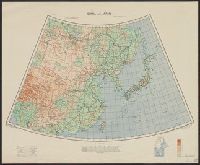
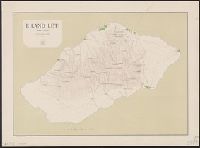
Great Britain. War Office. General Staff. Geographical Section
Published / Created:
1943
Call Number:
56cbf 1942
Container / Volume:
BRBL_00297
Image Count:
1
Resource Type:
Maps, Atlases & Globes
Alternative Title:
Great Britain. War Office. General Staff. Geographical Section. G.S.G.S. ; 4304. and Its [G.S.G.S.] ; 4304
Description:
"Drawn and reproduced by 512 (A. Fd. svy.) coy., R.E., Dec. 1941. Compiled from G.S.G.S. 4065 and 2957.", "Published by W.O. 1942.", Elevations shown by altitude tints., Marginal map: Index to adjoining sheet [Malaya] and boundaries., and Relief shown by contours
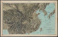
Herder, Bartholomä, 1774-1839, lithographer Woerl, Joseph Edmund Woerl, Joseph Edmund. Atlas von Central-Europa
Call Number:
30 1840B
Container / Volume:
BRBL_00031
Image Count:
1
Resource Type:
Maps, Atlases & Globes
Description:
From Woerl's Atlas von Central-Europa, 1830., Imperfect: trimmed along neat line, with loss of marginal data. Dissected and mounted on cloth., Relief shown by hachures., and Title from label on verso.
Subject (Geographic):
Baden-Württemberg (Germany)--Maps, Graubünden (Switzerland)--Maps, Tyrol (Austria)--Maps, and Vorarlberg (Austria)--Maps
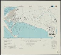
Great Britain. War Office. General Staff. Geographical Section
Published / Created:
1945
Call Number:
56 P36 1945
Container / Volume:
BRBL_00297
Image Count:
1
Resource Type:
Maps, Atlases & Globes
Alternative Title:
G.S.G.S. ; 3789
Description:
"9-45.", "Geographical Section, General Staff, No. 3789. Published at the War Office 1927. First GSGS Edition (AMS 1), 1926; Third GSGS Edition (AMS 2), 1944; AMS Revisions (AMS 3), 1944.", "Peking N3949-E11610/11x21"--Lower right margin., Includes legend., and R
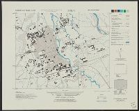
Egypt. Maṣlaḥat al-Misāḥah, cartographer, issuing body
Published / Created:
1909-
Call Number:
61 1909
Container / Volume:
BRBL_00764
Image Count:
6
Resource Type:
Maps, Atlases & Globes
Description:
Cultivated land shown in color., DLC, Relief shown by form lines and spot heights., Sheet 1. Alexandria -- Sheet 2. Cairo -- Sheet 3. Western Oases -- Sheet 4. Eatern Desert -- Sheet 5., Some LC copies mounted on cloth backing., and Various issues of some sheets.
"1-45.", "A.M.S. L991.", Includes glossary, index map to boundaries, and coverage diagram., and Relief shown variously by contours, hachures, form lines, and spot heights.
"11-44.", "A.M.S. L991.", Includes glossary, index map to boundaries, and coverage diagram., and Relief shown variously by contours, hachures, form lines, and spot heights.