Skip to search
Skip to main content
Skip to first result
Search
You Searched For
Repository
Beinecke Rare Book and Manuscript Library
Language
Dutch; Flemish
Subject (Geographic)
Netherlands --Maps --Early works to 1800
Search Results
Creator:
Published / Created:
ca. 1680
Call Number:
Folio 469
Collection Title:
[Atlas factice of 13 maps by Nicolaes Visscher I, Nicolaes Visscher II, Guillaume Sanson, and
Image Count:
1
Publisher:
Justus Danckerts
Subject (Geographic):
Europe --Maps --Early works to 1800 and Netherlands --Maps --Early works to 1800
Subject (Topic):
Atlases, Dutch --Early works to 1800
Collection Created:
1677-1692
Found in:
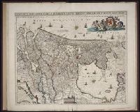
Beinecke Rare Book and Manuscript Library > Comitatus Hollandiae tabula / [cartographic material] / pluribus locis recens emendata a Iusto Danckerts
Creator:
Published / Created:
ann. 1605.
Call Number:
1976 Folio 46
Image Count:
125
Resource Type:
Books, Journals & Pamphlets
Alternative Title:
Mariners mirrour.
Description:
Charts and title pages in English, text in Dutch., Map oriented with North at bottom left., and Volvelle on p. [17].
Publisher:
Jodocus Hondius excudit,
Subject (Geographic):
Europe --Maps --Early works to 1800, Great Britain --Maps --Early works to 1800, Netherlands --Maps --Early works to 1800, and North Sea --Maps --Early works to 1800
Found in:
Beinecke Rare Book and Manuscript Library > The mariners mirrovr wherin may playnly be seen the courses, heights, distances, depths, sounding, flouds and ebs, risings of lands, rocks ... of the harbouroughs, havens and ports of the greatest part of Europe: ... together w.th the rules and instrumeíÄ
Creator:
Published / Created:
ann. 1605.
Call Number:
1976 Folio 46
Image Count:
1
Resource Type:
Maps, Atlases & Globes
Alternative Title:
Mariners mirrour.
Description:
Map oriented with North at bottom left.
Publisher:
Jodocus Hondius excudit,
Subject (Geographic):
Great Britain --Maps --Early works to 1800, Netherlands --Maps --Early works to 1800, and North Sea --Maps --Early works to 1800
Found in:
Beinecke Rare Book and Manuscript Library > The mariners mirrovr wherin may playnly be seen the courses, heights, distances, depths, sounding, flouds and ebs, risings of lands, rocks ... of the harbouroughs, havens and ports of the greatest part of Europe: ... together w.th the rules and instrumeíÄ
Branch:v1.68.2 ,Deployed:2025-06-12T06:59:25-04:00