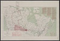
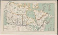
"To show area surveyed in the Provinces of Alberta, Saskatchewan and Manitoba and certain points north of the surveyed area where wheat has been grown"; "...Siberian province of Tobolsk superimposed on this map in its correct position as to latitude". and Includes table of distances, and "Points North of present wheat belt where wheat has been grown".
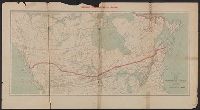
In lower margin: "Edition of April 1904.", In upper margin: "National transcontinental railway.", and Shows "approximate route of N.T. Ry." and connecting lines.
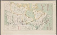
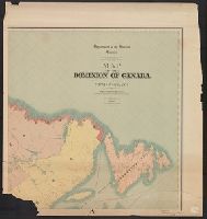
Includes distances from Montreal to other cities in Canada, costs of railways operations in 1907, mileage operated in 1907 and "Railway mileage by provinces, 1907." and Shows existing railroads.
Includes information on "points north of present wheat belt where wheat has been grown" and table of distances., Inset: Tobolsk., Relief shown by spot heights., and Shows areas where wheat has been grown.
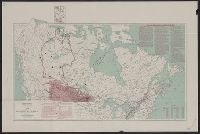
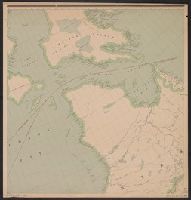
Imperfect: Incomplete; available sheets show the Yukon and parts of the Northwest Territories and Baffin Island. Ms. annotations in blue pencil to indicate area of "new map" and Manitoba boundary., Relief shown by spot heights., and Title devised by cataloger.