Skip to search
Skip to main content
Skip to first result
Search
You Searched For
Date
-
"North America--Maps"
Repository
Beinecke Rare Book and Manuscript Library
Language
English
New Search
Search Results
Creator:
Published / Created:
1854
Call Number:
71 1854B
Container / Volume:
BRBL_00371
Image Count:
2
Resource Type:
Maps, Atlases & Globes
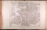
Description:
"Entered according to Act of Congress in the year 1848 by J.H. Colton in the Clerk's Office of the District Court for the Southern District of New York.", Includes ill. and decorative border., and Insets: Map of the Atlantic ocean, showing the American & Europe
Publisher:
Published by J.H. Colton and Co., No. 172 William St.,
Subject (Geographic):
North America --Maps
Subject (Name):
Atwood, John M., b. ca. 1818, Barnard, William S., b. ca. 1809, and Colton, J. H. (Joseph Hutchins), 1800-1893
Found in:
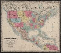
Beinecke Rare Book and Manuscript Library > Map of the United States of America, the British provinces, Mexico, the West Indies, and Central America, with part of New Granada and Venezuela / map drawn by Geo. W. Colton ; engraved by John M. Atwood ; border desig'd. & eng'd. by W.S. Barnard.
Creator:
Published / Created:
1851
Call Number:
75 1851B
Container / Volume:
BRBL_00400
Image Count:
1
Resource Type:
Maps, Atlases & Globes
Description:
Hand colored., Includes table of distances., and Relief shown by hachures.
Publisher:
J.M. Atwood,
Subject (Geographic):
North America --Maps
Subject (Name):
Atwood, John M., b. ca. 1818, engraver and McLellan, David, b. ca. 1825, printer
Found in:
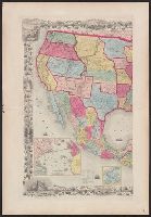
Beinecke Rare Book and Manuscript Library > Map of the United States, Canada, Mexico, Central America, and the West India Islands : with a portion of Venezuela & New Granada; showing the routes overland and by the Isthmus to California & Oregon, also the new boundaries of California, Utah, & New Me
Creator:
Published / Created:
1823 August 12
Call Number:
71 1823
Container / Volume:
BRBL_00369
Image Count:
1
Resource Type:
Maps, Atlases & Globes
Description:
Includes text., Prime meridians: London and Ferro., and Relief shown by hachures.
Publisher:
Robt. Wilkinson No. 125 Fenchurch Street,
Subject (Geographic):
North America --Maps
Subject (Name):
Bourne, Ebenezer
Found in:
Beinecke Rare Book and Manuscript Library > North America / E. Bourne sculp.
Creator:
Published / Created:
1814
Call Number:
71 1814
Container / Volume:
BRBL_00368
Image Count:
1
Resource Type:
Maps, Atlases & Globes
Description:
"Drawn and engraved for Thomsons new general atlas 1814.", Relief shown by hachures., and Upper right corner: no. 53.
Publisher:
J. Thomson],
Subject (Geographic):
North America --Maps
Subject (Name):
Hewitt, N. R and Thomson, John, geographer. New general atlas
Found in:
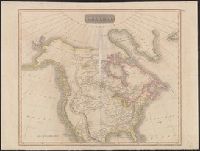
Beinecke Rare Book and Manuscript Library > North America / N.R. Hewitt, sc.
Creator:
Published / Created:
[18--?]
Call Number:
71 18XX
Container / Volume:
BRBL_00371
Image Count:
2
Resource Type:
Maps, Atlases & Globes
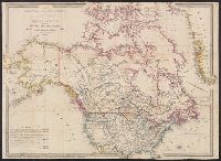
Description:
Includes inset of Jamaica., Relief shown by hachures., and Yale's copy with portion of a cover pasted on backing, showing advertisements for Betts maps.
Publisher:
John Betts, 7 Compton Street, Brunswick Square,
Subject (Geographic):
North America --Maps
Found in:
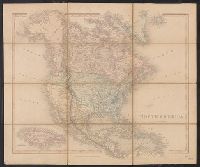
Beinecke Rare Book and Manuscript Library > North America.
Creator:
Published / Created:
c1842-[45]
Call Number:
1977 Folio 77
Image Count:
1
Description:
Issued in parts.
Publisher:
Harper,
Subject (Geographic):
North America --Maps
Subject (Name):
Baldwin, Roger S.--(Roger Sherman),--1793-1863--Autograph
Found in:
Beinecke Rare Book and Manuscript Library > North American atlas
Creator:
Published / Created:
1766?]
Call Number:
755 1763A
Container / Volume:
BRBL_00428
Image Count:
1
Resource Type:
Maps, Atlases & Globes
Description:
No publication imprint. "Separate publication, ca. 1766?" (McCorkle 166)., Relief shown pictorially., and Verso: Stamped "Yale Horace Brown 1900S".
Publisher:
T. Kitchin?,
Subject (Geographic):
North America --Maps --Early works to
Subject (Topic):
British--North America --Maps --Early
Found in:
Beinecke Rare Book and Manuscript Library > A new and accurate map of the British dominions in America, according to the Treaty of 1763, divided into the several provinces and jurisdictions : projected upon the best authorities and astronomical observations / by Thos. Kitchin, geographer.
Creator:
Published / Created:
1904
Call Number:
70gme 1904
Container / Volume:
BRBL_00359
Image Count:
1
Resource Type:
Maps, Atlases & Globes
Description:
In bottom margin: Andrew B. Graham, photo-litho, Washington, D.C., In English and Spanish., and Prime meridians: Greenwich and Paris.
Publisher:
Andrew B. Graham?],
Subject (Name):
Andrew B. Graham Co, International American Conference (2nd : 1901-1902 : Mexico), Pan-American Railway--Maps, and Permanent Pan-American Railway Committee
Subject (Topic):
Railroads--North America --Maps
Found in:
Beinecke Rare Book and Manuscript Library > Intercontinental railway map : prepared under the direction of the permanent Pan American Railway Committee authorized by the Second International Conference of American States / M. Hendges.
Branch:v1.61.6 ,Deployed:2024-06-12T09:55:36-04:00