Skip to search
Skip to main content
Skip to first result
Search
You Searched For
Resource Type
Maps, Atlases & Globes
Language
English
New Search
Search Results
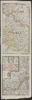
Published / Created:
[1794?]
Call Number:
36 1794A
Container / Volume:
BRBL_00119
Image Count:
1
Resource Type:
Maps, Atlases & Globes
Description:
2nd copy only one sheet.
Publisher:
Robert Sayer,
Subject (Geographic):
Germany--Maps--Early works to 1800
Found in:
Beinecke Rare Book and Manuscript Library > Map of the Empire of Germany, ... with the Kingdom of Prussia, etc. By L. Delarochette. T.Kitchin, Sculpt.
Creator:
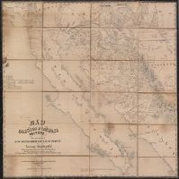
Published / Created:
1890
Call Number:
844ca P69 1890A
Container / Volume:
BRBL_00613
Image Count:
2
Resource Type:
Maps, Atlases & Globes
Alternative Title:
Annual report of the state mineralogist for the year ending ...
Description:
"Prepared for the tenth annual report of the State Mineralogist.", Includes 20 cross sections., Oriented with north toward the upper right., and Relief shown by spot heights.
Publisher:
California State Mining Bureau?],
Subject (Name):
Britton & Rey and Browne, Ross E
Subject (Topic):
Gold mines and mining--California--Placer County--Maps and Mining claims--California--Placer County--Maps
Found in:
Beinecke Rare Book and Manuscript Library > Map of the Forest Hill Divide, Placer County, California : based upon surveys and examinations by Ross E. Browne ; drawn by John D. Hoffmann, 307 Sansome St., S.F.
Creator:
Published / Created:
1858
Call Number:
8101 1858
Container / Volume:
BRBL_00552
Image Count:
1
Resource Type:
Maps, Atlases & Globes
Alternative Title:
Pacific wagon roads.
Description:
"To accompany report of William H. Nobles." and At head of title: Pacific wagon roads.
Publisher:
Dept. of the Interior,
Subject (Name):
Key, John Ross, 1832-1920, Nobles, William H, and United States. Dept. of the Interior
Subject (Topic):
Discoveries in geography and Roads--West (U.S.)--Maps
Found in:
Beinecke Rare Book and Manuscript Library > Map of the Fort Ridgely & South Pass road / by Samuel A. Medary ; drawn by John R. Key.
Creator:
Published / Created:
1917
Call Number:
11hc 1917F
Container / Volume:
BRBL_00010D
Image Count:
2
Resource Type:
Maps, Atlases & Globes
Alternative Title:
Western battle front no. 1, Nieuport to Reims and Western battle front, Reims, France to Basel, Switzerland
Description:
Includes 3 insets: Russo-German war front -- [Franco-German border] -- Pozieres and environs., Includes advertisement for First and old Detroit national bank., Includes ill. of military figures, places, soldiers, etc. with captions., and Shows boundaries, roads,
Publisher:
Geographical Publishing Co.,
Subject (Geographic):
Europe--Maps, France--Maps, Germany--Maps, Poland--Maps, and Russia--Maps
Subject (Topic):
World War, 1914-1918--Europe--Maps, World War, 1914-1918--France--Maps, World War, 1914-1918--Germany--Maps, World War, 1914-1918--Poland--Maps, and World War, 1914-1918--Russia--Maps
Found in:
Beinecke Rare Book and Manuscript Library > Map of the Franco-German war front : from Hirson, France to Basel, Switzerland, and the Russo-German war front from Riga, Russia, to Lemberg, Austria / Published for the Volume Library.
Creator:
Published / Created:
1858
Call Number:
88191 1858
Container / Volume:
BRBL_00653
Image Count:
1
Resource Type:
Maps, Atlases & Globes
Description:
"The Yaqui, Mayo, and Fuerte Valleys are by A. Fleury, millitary [sic] eng. of Sonora.", Library's copy annotated in pencil to show "ranchos.", and Relief shown by hachures.
Publisher:
Middleton, Strobridge & Co., lithographers,
Subject (Geographic):
Baja California (Mexico : Peninsula)--Maps, New Mexico--Maps, and Sonora (Mexico : State)--Maps
Subject (Name):
Fleury, A and Strobridge & Co. Lith
Subject (Topic):
Gadsden Purchase--Maps
Found in:
Beinecke Rare Book and Manuscript Library > Map of the Gadsden Purchase, Sonora, and portions of New Mexico, Chihuaua & California / by Herman Ehrenberg, C.E., from his private notes and those of Colonel Gray, Maj. Heintzelman, Lieut. Parks, and others.
Creator:
Published / Created:
[1875?]
Call Number:
36 1875
Container / Volume:
BRBL_00120
Image Count:
1
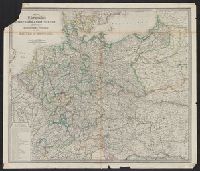
Resource Type:
Maps, Atlases & Globes
Publisher:
James Wyld,
Subject (Geographic):
Germany--Maps and Prussia (Germany)--Maps
Found in:
Beinecke Rare Book and Manuscript Library > Map of the Germanic confederated states : including the kingdoms of Prussia, and the empire of Germany / James Wyld.
Creator:
Published / Created:
1865
Call Number:
811 1865
Container / Volume:
BRBL_00552
Image Count:
1
Resource Type:
Maps, Atlases & Globes
Description:
Imperfect. Chipped with possible loss of text. and Inset map showing state of Michigan and surrounding area showing railroads.
Publisher:
Sage Sons & Co. lith.,
Subject (Geographic):
Grand Traverse Bay Region (Mich.)--Maps
Subject (Name):
Rothwell, H. G. (Harry G.) and Sage Sons & Co
Subject (Topic):
Geology--Michigan--Grand Traverse Bay Region--Maps
Found in:
Beinecke Rare Book and Manuscript Library > Map of the Grand Traverse region : to accompany a report on its geological & industrial resources / by Alexander Winchell ; drawn by H.G. Rothwell.
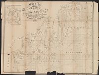
Creator:
Published / Created:
1854
Call Number:
758gme 1854
Container / Volume:
BRBL_00442
Image Count:
1
Resource Type:
Maps, Atlases & Globes
Description:
Covers area between New York City and St. Louis, Mo., in northern United States., Includes distance table., and Shows some drainage, state boundaries, and place names along the railroad lines.
Publisher:
Wm. Schuchman, lith.,
Subject (Name):
Great Central Railway (U.S.)
Subject (Topic):
Railroads--Northeastern States--Maps
Found in:
Beinecke Rare Book and Manuscript Library > Map of the Great Central Railway Line of the west and connecting lines.
Creator:
Published / Created:
1863?]
Call Number:
836 Sa37 1863
Container / Volume:
BRBL_00592
Image Count:
1
Resource Type:
Maps, Atlases & Globes
Alternative Title:
Great Salt Lake (Mormon) City and surrounding country. and Weekly Dispatch atlas.
Description:
From The Weekly Dispatch atlas. 1863, (p. 238). and Relief shown by hachures.
Publisher:
Weekly Dispatch Office,
Subject (Geographic):
Salt Lake City Region (Utah)--Maps
Subject (Name):
Day & Son
Found in:
Beinecke Rare Book and Manuscript Library > Map of the Great Salt Lake and adjacent country in the Territory of Utah ; The Great Salt Lake (Mormon) City and surrounding country : (on an enlarged scale) / drawn & engraved by Edwd. Weller, Duke Str., Bloomsbury.
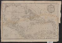
Published / Created:
1777
Call Number:
85 1777
Container / Volume:
BRBL_00637
Image Count:
1
Resource Type:
Maps, Atlases & Globes
Subject (Geographic):
Mexico, Gulf of--Maps--Early works to 1800
Found in:
Beinecke Rare Book and Manuscript Library > Map of the Gulf of Mexico, the Islands and Countries adjacent ... by Thos. Kitchin ...
Branch:v1.61.8 ,Deployed:2024-06-20T11:14:46-04:00