Search
You Searched For
Search Results
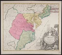
- Creator:
- Homann, Johann Baptist, 1663-1724
- Published / Created:
- ca. 1730]
- Call Number:
- 755 1714A
- Container / Volume:
- BRBL_00425
- Image Count:
- 1
- Resource Type:
- Maps, Atlases & Globes
- Found in:
- Beinecke Rare Book and Manuscript Library > Virginia, Marylandia et Carolina in America septentrionali Brittannorum industria excultæ / repraesentatae à Ioh. Bapt. Homann, S.C.M. Geog.
- Creator:
- Geological Survey (U.S.)
- Published / Created:
- 1907
- Call Number:
- 783 N765 1907
- Container / Volume:
- BRBL_00510
- Image Count:
- 2
- Resource Type:
- Maps, Atlases & Globes
- Found in:
- Beinecke Rare Book and Manuscript Library > Virginia, Norfolk special map / topography by U.S. Geological Survey ; control and shore topography by Coast and Geodetic Survey.
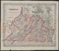
- Creator:
- Colton, J. H. (Joseph Hutchins), 1800-1893
- Published / Created:
- 1857
- Call Number:
- 783 1857
- Container / Volume:
- BRBL_00508
- Image Count:
- 1
- Resource Type:
- Maps, Atlases & Globes
- Found in:
- Beinecke Rare Book and Manuscript Library > Virginia.
- Published / Created:
- c1886.
- Call Number:
- 783 1888
- Container / Volume:
- BRBL_00509
- Image Count:
- 1
- Resource Type:
- Maps, Atlases & Globes
- Found in:
- Beinecke Rare Book and Manuscript Library > Virginia.
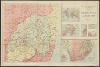
- Creator:
- W. & A.K. Johnston Limited
- Published / Created:
- [1899?]
- Call Number:
- 643 1899
- Container / Volume:
- BRBL_00340
- Image Count:
- 1
- Resource Type:
- Maps, Atlases & Globes
- Found in:
- Beinecke Rare Book and Manuscript Library > W. & A.K. Johnston's map to illustrate the Transvaal question.
- Creator:
- Bartholomew, John, 1831-1893
- Published / Created:
- [1870]
- Call Number:
- 3216 1870
- Container / Volume:
- BRBL_00056
- Image Count:
- 1
- Resource Type:
- Maps, Atlases & Globes
- Found in:
- Beinecke Rare Book and Manuscript Library > W.H. Smith & Son's map of the Isle of Wight from the ordnance survey.
- Published / Created:
- [1943?]
- Call Number:
- 11hd 1943B
- Container / Volume:
- BRBL_00010ZE
- Image Count:
- 2
- Resource Type:
- Maps, Atlases & Globes
- Found in:
- Beinecke Rare Book and Manuscript Library > WOR International Radio News Map.
- Creator:
- Chapin, R. M., Jr
Time, inc
- Published / Created:
- 1944
- Call Number:
- 11hd 1945C
- Container / Volume:
- BRBL_00010ZF
- Image Count:
- 1
- Resource Type:
- Maps, Atlases & Globes
- Found in:
- Beinecke Rare Book and Manuscript Library > Wacht am Rhein [cartographic material] / TIME map by R. M. Chapin, Jr.
- Creator:
- Guyot, A. (Arnold), 1807-1884
Sandoz, Ernest
Scribner, Charles, 1821-1871
- Published / Created:
- c1863.
- Call Number:
- 30 1863
- Container / Volume:
- BRBL_00032
- Image Count:
- 4
- Resource Type:
- Maps, Atlases & Globes
- Found in:
- Beinecke Rare Book and Manuscript Library > Wall-atlas. Constructed & drawn under the direction of A. Guyot. By Ernest Sandoz.
- Published / Created:
- 188-?]
- Call Number:
- 832 W155 1888
- Container / Volume:
- BRBL_00582
- Image Count:
- 1
- Resource Type:
- Maps, Atlases & Globes
- Found in:
- Beinecke Rare Book and Manuscript Library > Wallace.