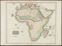
Bottom margin: Drawn and engraved for Thomson's New General Atlas., Printed in upper right margin: No. 47., Relief shown pictorially., and Shows boundaries, rivers, deserts, caravan routes, and principal settlements, with unexplored areas.
Subject (Geographic):
Africa--Maps
Subject (Name):
Neele & Son and Thomson, John, geographer. New general atlas
"J. & G. Menzies sculpt.", From Thomson's New general atlas, 1817., Hand col. Sheet measures 53 x 69 cm., Plate affixed in upper right margin: No. 47., Relief shown pictorially., and Shows boundaries, rivers, deserts, caravan routes, and principal settlements, wit
Publisher:
J. Thomson,
Subject (Geographic):
Africa--Maps
Subject (Name):
J. & G. Menzies and Thomson, John, geographer. New general atlas