Search
You Searched For
Search Results
- Creator:
- Fry, Joshua, approximately 1700-1754
- Published / Created:
- 1794
- Call Number:
- 783 1794
- Container / Volume:
- BRBL_00507
- Image Count:
- 1
- Resource Type:
- Maps, Atlases & Globes
- Found in:
- Beinecke Rare Book and Manuscript Library > A map of the most inhabited part of Virginia containing the whole province of Maryland with part of Pensilvania, New Jersey and North Carolina / drawn by Joshua Fry & Peter Jefferson in 1775.
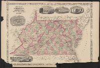
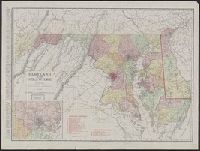
- Creator:
- Johnson, A. J. (Alvin Jewett), 1827-1884
- Published / Created:
- [between 1866 and 1879]
- Call Number:
- 783 1866A
- Container / Volume:
- BRBL_00509
- Image Count:
- 2
- Resource Type:
- Maps, Atlases & Globes
- Found in:
- Beinecke Rare Book and Manuscript Library > Johnson's Virginia, Delaware, Maryland and West Virginia.
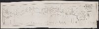
- Published / Created:
- [1840?]
- Call Number:
- 777gme 1840
- Container / Volume:
- BRBL_00504A
- Image Count:
- 1
- Resource Type:
- Maps, Atlases & Globes
- Found in:
- Beinecke Rare Book and Manuscript Library > Map & profile of the projected lateral rail road to the City of Washington in connection with the first nine miles of the Balto. & Ohio Rail Road showing the entire route from Balto. to Washington.
- Published / Created:
- 1910
- Call Number:
- 777gmb 1911
- Container / Volume:
- BRBL_00504A
- Image Count:
- 2
- Resource Type:
- Maps, Atlases & Globes
- Found in:
- Beinecke Rare Book and Manuscript Library > Map of Maryland showing state road system and state aid roads : completed or under construction December 31, 1911.
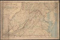
- Creator:
- Nicholson, W. L
- Published / Created:
- 1863
- Call Number:
- 783 1863B
- Container / Volume:
- BRBL_00509
- Image Count:
- 1
- Resource Type:
- Maps, Atlases & Globes
- Found in:
- Beinecke Rare Book and Manuscript Library > Map of the state of Virginia / compiled from the best authorities and printed at the Coast Survey Office, A.D. Bache, supdt. ; compiled by W.L. Nicholson ; lith. by Chas. G. Krebs.
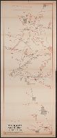
- Creator:
- Muzzey, George E
- Published / Created:
- [1864?]
- Call Number:
- 754hc 1864
- Container / Volume:
- BRBL_00421
- Image Count:
- 1
- Resource Type:
- Maps, Atlases & Globes
- Found in:
- Beinecke Rare Book and Manuscript Library > Marches of Webster regiment, 12th Mass. Vol. Infantry, July, 1861 to June, 1864 : the country copied from U.S. Engineers' map. Route traced from pocket-map of Geo. E. Muzzey, 1st Lieut. & Quartermaster.
- Published / Created:
- 1911
- Call Number:
- 777 1911
- Container / Volume:
- BRBL_00503
- Image Count:
- 1
- Resource Type:
- Maps, Atlases & Globes
- Found in:
- Beinecke Rare Book and Manuscript Library > Maryland and Delaware.
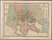
- Published / Created:
- 1836
- Call Number:
- 777 B21 1836
- Container / Volume:
- BRBL_00503
- Image Count:
- 1
- Resource Type:
- Maps, Atlases & Globes
- Found in:
- Beinecke Rare Book and Manuscript Library > Plan of the city of Baltimore, compiled from actual survey by Fielding Lucas Jr.
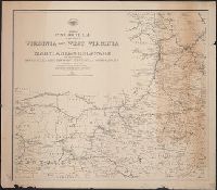
- Creator:
- United States. Post Office Dept
- Published / Created:
- 1874
- Call Number:
- 754GMD 1874
- Container / Volume:
- BRBL_00419
- Image Count:
- 2
- Resource Type:
- Maps, Atlases & Globes
- Found in:
- Beinecke Rare Book and Manuscript Library > Preliminary post route map of the states of Virginia and West Virginia together with Maryland and Delaware, with adjacent parts of Pennsylvania, Ohio, Kentucky, Tennessee and North Carolina / designed and constructed under the orders of Postmaster General
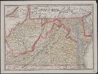
- Published / Created:
- [1890?].
- Call Number:
- 754 1890
- Container / Volume:
- BRBL_00417
- Image Count:
- 1
- Resource Type:
- Maps, Atlases & Globes
- Found in:
- Beinecke Rare Book and Manuscript Library > Railroad and county map of Virginia, W. Virginia, Maryland and Delaware.