Skip to search
Skip to main content
Skip to first result
Search
You Searched For
Language
English
Subject (Geographic)
United States--Maps
Search Results
Creator:
Published / Created:
[1878?].
Call Number:
75 1878
Container / Volume:
BRBL_00406
Image Count:
16
Resource Type:
Maps, Atlases & Globes
Alternative Title:
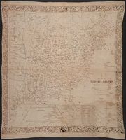
Centennial map of the United States and territories and Centennial map of the United States, 1879.
Description:
Imperfect: Sheet 5 wanting., In portfolio., and Relief shown by hachures.
Publisher:
J. Bien,
Subject (Geographic):
United States--Maps
Subject (Name):
Bien, Julius, 1826-1909, Roeser, C. (Charles), United States. General Land Office, and Woods, William L
Found in:
Beinecke Rare Book and Manuscript Library > 1876 Centennial map of the United States and territories : showing the extent of public surveys, indian and military reservations, land grant R.R. rail roads, canals, cities, towns & other details / compiled from the official surveys of the General Land O
Published / Created:
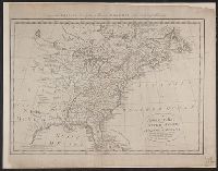
1810?]
Call Number:
75 1810A
Container / Volume:
BRBL_00396
Image Count:
1
Resource Type:
Maps, Atlases & Globes
Description:
"Engraved for [Thomas] Kankes's New, [royal, authentic and complete system of universal geography ..." 2 vol. London, [1787-1810?] Vol. 2.
Subject (Geographic):
United States--Maps
Found in:
Beinecke Rare Book and Manuscript Library > A correct map of the United States of North America. Including the British and Spanish territories carefully laid down agreeable to the treaty of 1784. By T. Bowen, Geogr.
Published / Created:
March 15, 1832
Call Number:
75 1850
Container / Volume:
BRBL_00689
Image Count:
2
Resource Type:
Maps, Atlases & Globes
Alternative Title:
Atlas of the United States of North America.
Description:
From An atlas of the United States of North America ... London : Published by Simpkin & Marshall and Thomas Wardle, Philadelphia, 1832. and Sheet measures 27.3 x 42 cm. Bound with plate "Geological sections of the United States." Cross Collection no. 187.
Publisher:
I.T. Hinton & Simpkin & Marshall,
Subject (Geographic):
United States--Maps
Subject (Name):
Fenner, Sears & Co, Hinton, Isaac Taylor, 1799-1847, and Simpkin and Marshall
Subject (Topic):
Geology--United States--Maps
Found in:
Beinecke Rare Book and Manuscript Library > A geological map of the United States [cartographic material].
Creator:
Published / Created:
[1813]
Call Number:
71 1813A
Container / Volume:
BRBL_00368
Image Count:
1
Resource Type:
Maps, Atlases & Globes
Description:
Relief shown pictorially. and Shows parts of Canada and the United States.
Publisher:
J. Tiebout, no. 258 Water St.,
Subject (Geographic):
Canada--Maps and United States--Maps
Subject (Name):
Tiebout, John, 1772?-1826
Found in:
Beinecke Rare Book and Manuscript Library > A map of the British possessions in North America, including part of the United States / by F.D. Allen, 1815 ; J. Lewis sculpt.
Published / Created:
[185-]
Call Number:
754gme 1850C
Container / Volume:
BRBL_00419
Image Count:
1
Resource Type:
Maps, Atlases & Globes
Description:
Shows railroads and coal lands between Lakes Erie and Ontario and Long Island.
Publisher:
Bisbee, lith.,
Subject (Geographic):
United States--Maps
Found in:
Beinecke Rare Book and Manuscript Library > A map of the North Western Rail Way : passing thr'o [sic] the Lackawanna Coal Lands in Pennsylvania / by James Seymour.
Creator:
Published / Created:
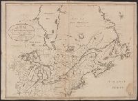
[1816]
Call Number:
75 1816
Container / Volume:
BRBL_00397
Image Count:
4
Resource Type:
Maps, Atlases & Globes
Abstract:
Subject: Map of the United States to the Mississippi River, and including parts of Upper and Lower Canada. Includes cartouche with a view of Niagara Falls and two Native Americans.
Description:
"Entered according to act of Congress October 1st, 1816 in the Dist. of Connecticut.", "Projected by Thomas Kensett.", "This view of the falls of Niagara is engraved from Tardieus map published at Paris. A. Doolittle sc.", and Dedicated to the president, senator
Publisher:
Shelton & Kensett,
Subject (Geographic):
Canada--Maps, Niagara Falls (N.Y. and Ont.)--Pictorial works, North America--Niagara Falls, and United States--Maps
Subject (Name):
Doolittle, Amos, 1754-1832, Kensett, Thomas, 1786-1829, and Shelton & Kensett
Subject (Topic):
Indians of North America and Indians of North America--Pictorial works
Found in:
Beinecke Rare Book and Manuscript Library > A map of the United States and British provinces of Upper and Lower Canada with other parts adjacent [cartographic material] / by Shelton & Kensett.
Published / Created:
1841
Call Number:
75 1841
Container / Volume:
BRBL_00399
Image Count:
1
Resource Type:
Maps, Atlases & Globes
Description:
A cloth map.
Publisher:
Published and Printed by Joseph W. Tuttle,
Subject (Geographic):
United States--Maps
Found in:
Beinecke Rare Book and Manuscript Library > A map of the United States from the latest surverys - with the height of mountains and length of principal rivers. Engraved by G.W. Beynton.
Creator:
Published / Created:
[1839?]
Call Number:
G1200 T34 1839 (LC)
Image Count:
4
Resource Type:
Maps, Atlases & Globes
Description:
Many maps dated 1839, other maps undated.
Publisher:
H.S. Tanner,
Subject (Geographic):
North America--Maps, South America--Maps, and United States--Maps
Found in:
Beinecke Rare Book and Manuscript Library > A new American atlas [cartographic material] : containing maps of the several states of the North American union ... / by Henry S. Tanner.
Published / Created:
1857
Call Number:
75gme 1857
Container / Volume:
BRBL_00412
Image Count:
2
Resource Type:
Maps, Atlases & Globes
Description:
Inset (separate sheet, attached to front of map): Rail Road Map of Massachusetts, Connecticut and Rhode Island, ca. 1:3,000,000.
Subject (Geographic):
United States--Maps
Found in:
Beinecke Rare Book and Manuscript Library > A new and complete Rail Road map of the United States / compiled from reliable sources by William Perris ; presented by the Home Insurance Company of New York ; Korff Brothers, Practical Lithographers, New York.
Creator:
Published / Created:
1870, c1856.
Call Number:
75 1870S
Container / Volume:
BRBL_00404
Image Count:
1
Resource Type:
Maps, Atlases & Globes
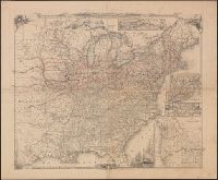
Description:
Insets: Railroad & canal routes from Albany to Buffalo -- Map showing the rail roads between the cities of New York, Boston & Albany and the Hudson R. from N. York to Albany -- Rail road route from New York to Philadelphia -- Rail road route from Philadel
Publisher:
J. Disturnell,
Subject (Geographic):
United States--Maps
Subject (Name):
Disturnell, John, 1801-1877 and Sherman & Smith
Found in:
Beinecke Rare Book and Manuscript Library > A new map for travelers through the United States of America showing the railroads, canals & stage roads with the distances / by J. Calvin Smith ; eng. on steel by Sherman & Smith, N.Y.
Branch:v1.68.2 ,Deployed:2025-06-12T06:59:37-04:00