Skip to search
Skip to main content
Skip to first result
Search
You Searched For
Language
English
Subject (Topic)
Manuscript maps
Search Results
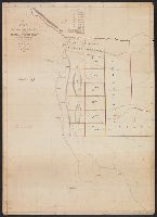
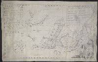
Creator:
Published / Created:
1828
Call Number:
796ad 1828
Container / Volume:
BRBL_00716
Image Count:
2
Resource Type:
Maps, Atlases & Globes
Description:
From the Streeter collection.
Subject (Geographic):
Coahuila and Texas (Mexico)--Maps, Manuscript and Texas--Maps
Subject (Name):
LeGrand, A. (Alexander) and Streeter, Thomas W.--(Thomas Winthrop),--1883-1965--Ownership
Subject (Topic):
Land grants--Texas--Maps, Manuscript and Manuscript maps
Found in:
Beinecke Rare Book and Manuscript Library > A map of northern part of Mexico, including Exter and Wilson's Grant / made from Legrand's notes and other documents by S. McL. Staples, A.M., surveyor general of Chihuahua.
Published / Created:
[18--?]
Call Number:
796 Au765 18XX
Container / Volume:
BRBL_00716
Image Count:
1
Resource Type:
Maps, Atlases & Globes
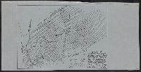
Alternative Title:
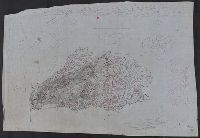
Austin County, Texas
Description:
Cadastral map.
Subject (Geographic):
Austin County (Tex.)--Maps, Manuscript
Subject (Topic):
Manuscript maps and Real property--Texas--Austin County--Maps, Manuscript
Found in:
Beinecke Rare Book and Manuscript Library > Map of Austin County, Texas.
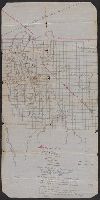
Published / Created:
[188-?]
Call Number:
796ad P926 1880
Container / Volume:
BRBL_00716
Image Count:
1
Resource Type:
Maps, Atlases & Globes
Description:
Cadastral map.
Subject (Geographic):
Presidio County (Tex.)--Maps, Manuscript
Subject (Name):
Gano Bros
Subject (Topic):
Manuscript maps and Real property--Texas--Presidio County--Maps, Manuscript
Found in:
Beinecke Rare Book and Manuscript Library > Map of lands near Van Horn's Well, 60 miles n.w. of Fort Davis, in Presidio County, owned by Gano Bros., Dallas, Tex.
Published / Created:
[1920?]
Call Number:
766 M86 1920
Container / Volume:
BRBL_00711
Image Count:
1
Resource Type:
Maps, Atlases & Globes
Description:
Black ink.
Subject (Geographic):
Sleeping Giant State Park (Conn.)--Maps, Manuscript
Subject (Name):
Connecticut.--State Park and Forest Commission--Maps and Sleeping Giant Park Association--Maps
Subject (Topic):
Manuscript maps
Found in:
Beinecke Rare Book and Manuscript Library > Map of western end of Mt. Carmel range showing lands acquired by the Sleeping Giant Park Assoc. and transferred to the State Park and Forest Comm.
Creator:
Published / Created:
1925
Call Number:
766 M86 1925
Container / Volume:
BRBL_00711
Image Count:
1
Resource Type:
Maps, Atlases & Globes
Description:
Black ink.
Subject (Geographic):
Carmel, Mount (Conn. : Mountain)--Maps, Manuscript and Carmel, Mount (Conn. : Mountain)--Maps, Topographic
Subject (Topic):
Manuscript maps
Found in:
Beinecke Rare Book and Manuscript Library > Map section of Mt. Carmel, from Mt. Carmel Road to Tuttle Avenue / E.B. Moore.
Published / Created:
January 30th, 1858.
Call Number:
796cea G13 1858
Container / Volume:
BRBL_00716
Image Count:
1
Resource Type:
Maps, Atlases & Globes
Alternative Title:
Sketch of Galveston Bay and harbor
Description:
Depths shown by soundings and isolines.
Subject (Geographic):
Galveston Bay (Tex.)--Maps, Manuscript
Subject (Topic):
Manuscript maps
Found in:
Beinecke Rare Book and Manuscript Library > Sketch of Galveston Bay & harbor, giving lines of fire of ... on Pelican Spit.
Creator:
Published / Created:
1924
Call Number:
766 M86 1924
Container / Volume:
BRBL_00711
Image Count:
1
Resource Type:
Maps, Atlases & Globes
Description:
"Contour interval 20 feet."
Subject (Geographic):
Sleeping Giant State Park (Conn.)--Maps, Manuscript and Sleeping Giant State Park (Conn.)--Maps, Topographic
Subject (Name):
Sleeping Giant Park Association
Subject (Topic):
Manuscript maps
Found in:
Beinecke Rare Book and Manuscript Library > Sleeping Giant State Park, on Mount Carmel, Hamden and Wallingford, Conn. / prepared for the State Park and Forest Commission and the Sleeping Giant Park Association.
Creator:
Published / Created:
[1773]
Call Number:
3254 1773
Container / Volume:
BRBL_00701
Image Count:
1
Resource Type:
Maps, Atlases & Globes
Description:
Cadastral map showing landowners.
Subject (Geographic):
Broadway (Worcestershire, England)--Maps, Manuscript--Early works to 1800
Subject (Name):
Savage, Geo., Esqr
Subject (Topic):
Landowners--England--Worcestershire--Broadway--Maps, Manuscript--Early works to 1800, Manuscript maps, and Real property--England--Worcestershire--Broadway--Maps, Manuscript--Early works to 1800
Found in:
Beinecke Rare Book and Manuscript Library > The Kites Nest, Broadway Court, and the Home Farms belonging to Geo. Savage Esqr., in the parish of Broadway, and county of Worcester, 1773 / J. Taylor delint.
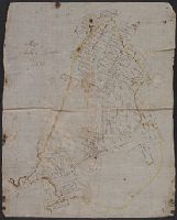
Published / Created:
[between 1829 and 1835]
Call Number:
796ad 1830
Container / Volume:
BRBL_00716
Image Count:
1
Resource Type:
Maps, Atlases & Globes
Description:
"[Juan] Dominguez [Y Valdez] was granted a colonization contract by the Texas government on July 6, 1829....the contract expired in 1835"--Taylor, V.H. Dominguez Y Valdez, Juan, in The handbook of Texas online. Texas Historical Association. 1997-2001....
Subject (Geographic):
Dominguez Grant (Tex.)--Maps, Manuscript and Texas--Maps, Manuscript
Subject (Name):
Streeter, Thomas W.--(Thomas Winthrop),--1883-1965--Ownership
Subject (Topic):
Land grants--Texas--Maps, Manuscript and Manuscript maps
Found in:
Beinecke Rare Book and Manuscript Library > [Dominguez Grant]
Published / Created:
[1930?]
Call Number:
766 M86 1930
Container / Volume:
BRBL_00711
Image Count:
1
Resource Type:
Maps, Atlases & Globes
Description:
Brown and black ink and pencil.
Subject (Geographic):
Sleeping Giant State Park (Conn.)--Maps, Manuscript and Sleeping Giant State Park (Conn.)--Maps, Topographic
Subject (Topic):
Manuscript maps
Found in:
Beinecke Rare Book and Manuscript Library > [Sleeping Giant State Park, Conn.].