Battle ground of freedom, Kenyon's War pocket map of the Western battle front of Europe, and Western Europe
Description:
Index of towns on verso., Insets: Map of the Eastern battle front; Map of the Italian battle front., and Shows battle lines from 1914 through October 21st, 1918, with "Explanation of lines, letters and numbers in red on this map" printed at bottom of sheet.
Publisher:
Kenyon Company,
Subject (Geographic):
Europe--Maps and France--Maps
Subject (Topic):
World War, 1914-1918--Europe--Maps and World War, 1914-1918--France--Maps
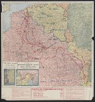
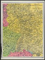
Western battle front no. 1, Nieuport to Reims and Western battle front, Reims, France to Basel, Switzerland
Description:
Includes 3 insets: Russo-German war front -- [Franco-German border] -- Pozieres and environs., Includes advertisement for First and old Detroit national bank., Includes ill. of military figures, places, soldiers, etc. with captions., and Shows boundaries, roads,
Publisher:
Geographical Publishing Co.,
Subject (Geographic):
Europe--Maps, France--Maps, Germany--Maps, Poland--Maps, and Russia--Maps
Subject (Topic):
World War, 1914-1918--Europe--Maps, World War, 1914-1918--France--Maps, World War, 1914-1918--Germany--Maps, World War, 1914-1918--Poland--Maps, and World War, 1914-1918--Russia--Maps
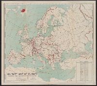
Includes table showing area and populations of the European powers., Indicates fortified towns, military headquarters, naval stations, railroads; concentric circl, Inset of location map of the world with Europe highlighted in red., and Prime meridian: Greenwich.
Publisher:
General Drafting Co.,
Subject (Geographic):
Europe--Maps
Subject (Topic):
World War, 1914-1918--Europe--Maps and World War, 1914-1918--Maps
Bontz, Geo. F United States. War Dept. General Staff. War College Division Williams, Arch. B
Published / Created:
1915
Call Number:
304fab 1915
Container / Volume:
BRBL_00034B
Image Count:
4
Resource Type:
Maps, Atlases & Globes
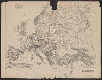
Description:
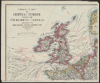
Relief shown by hachures., Shows Europe from Ireland and Portugal on the west, Moscow on the east, Trondheim, Norway on the north, and Crete on the south., and Shows steamship routes with estimated travel times, submarine cables, radio stations, naval bases, an