Search
You Searched For
Search Results
- Creator:
- Payne, John, fl. 1800
- Published / Created:
- 1792?]
- Call Number:
- 60 1792
- Container / Volume:
- BRBL_00324
- Image Count:
- 1
- Resource Type:
- Maps, Atlases & Globes
- Subject (Geographic):
- Africa--Maps--Early works to 1800
- Found in:
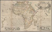
- Beinecke Rare Book and Manuscript Library > Africa, 1792 / Ferguson sculpsit.
- Call Number:
- 1976 1233
- Collection Title:
- Forty-two new maps of Asia, Africa, and America ... : all engrav’d, according to the latest
- Image Count:
- 1
- Subject (Geographic):
- Africa --Maps --Early works to 1800
- Found in:
- Beinecke Rare Book and Manuscript Library > Africa, according to ye newest and most exact observations
- Creator:
- Moll, Herman, -1732
- Published / Created:
- [1710]
- Call Number:
- 60 1708
- Container / Volume:
- BRBL_00322
- Image Count:
- 1
- Resource Type:
- Maps, Atlases & Globes
- Subject (Geographic):
- Africa--Maps--Early works to 1800
- Found in:
- Beinecke Rare Book and Manuscript Library > To the right honourable Charles, Earl of Peterborow and Monmouth, &c this map of Africa ... is most humbly dedicated / by your Lordship's humble servant H: Moll geographer.
- Call Number:
- 1976 1233
- Collection Title:
- Forty-two new maps of Asia, Africa, and America ... : all engrav’d, according to the latest
- Image Count:
- 1
- Subject (Geographic):
- Africa --Maps --Early works to 1800
- Found in:
- Beinecke Rare Book and Manuscript Library > A map of Zaara or the Desart, Negroland & Cape Virde Islands &c
- Call Number:
- 1976 1233
- Collection Title:
- Forty-two new maps of Asia, Africa, and America ... : all engrav’d, according to the latest
- Image Count:
- 1
- Subject (Geographic):
- Africa --Maps --Early works to 1800
- Found in:
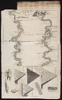
- Beinecke Rare Book and Manuscript Library > An exact map of the River Nile done by Mr. Lucas
- Creator:
- Delarochette, L. (Louis), 1731-1802, creator
Faden, William, 1749-1836
- Published / Created:
- 1782 March 20
- Call Number:
- 1982 Folio 10
- Image Count:
- 1
- Subject (Geographic):
- --Early works to 1800
- Found in:
- Beinecke Rare Book and Manuscript Library > The Dutch colony of the Cape of Good Hope
- Creator:
- Rogers, William, b. ca. 1545, engraver
- Published / Created:
- [1596?]
- Call Number:
- Taylor 216A
- Collection Title:
- John Huighen van Linschoten, his Discours of Voyages into ye Easte & West Indies
- Image Count:
- 1
- Subject (Geographic):
- Africa --Maps --Early works to 1800
- Found in:
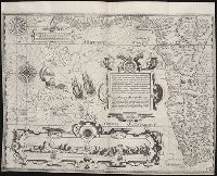
- Beinecke Rare Book and Manuscript Library > Typus orarum maritimarum Guinae, Manicongo & Angolae ultra promontorium Bonae Spei ...
- Creator:
- Anville, Jean Baptiste Bourguignon d', 1697-1782
Boulton, S., creator
Sayer, Robert, 1725-1794
- Published / Created:
- 1787 January 6
- Call Number:
- 1982 Folio 10
- Image Count:
- 2
- Subject (Geographic):
- Africa --Maps --Early works to 1800
- Found in:
- Beinecke Rare Book and Manuscript Library > Africa : with all its states, kingdoms, republics, regions, islands, & ca., improved and inlarged from D'Anville's map : to which have been added a particular chart of the Gold Coast wherein are distinguished all the European forts and factories
- Creator:
- Bowen, Emanuel, d. 1767
- Call Number:
- 623 1750
- Container / Volume:
- BRBL_00333
- Image Count:
- 1
- Resource Type:
- Maps, Atlases & Globes
- Subject (Geographic):
- Africa, Eastern--Maps--Early works to
- Found in:
- Beinecke Rare Book and Manuscript Library > A new and accurate map of Nubia & Abissinia, together with all the kingdoms tributary thereto, and bordering upon them / laid down from the latest & best authorities and regulated by astronl. observations ny Emanl. Bowen.
- Call Number:
- 1976 1233
- Collection Title:
- Forty-two new maps of Asia, Africa, and America ... : all engrav’d, according to the latest
- Image Count:
- 1
- Subject (Geographic):
- Africa --Maps --Early works to 1800
- Found in:
- Beinecke Rare Book and Manuscript Library > The west part of Barbary containing Fez, Marocco, Algier, and part of Biledulgerid the Canary Islands &c