Nouvelle carte particuliére de l'Amerique ou sont exactement marquées ... and Nouvelle carte particuliére de l'Amerique ou sont exactement marquées la Nouvelle Bretagne, le Canada ou Nouvelle France, la Nouvelle Ecosse, la Nouvelle Angleterre, la Nouvelle
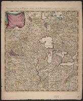
Description:
Appears in various eds. of Guillaume de L'Isle's Atlas nouveau., Each sheet has a unique caption title, all beginning with "Nouvelle carte partic, and Northwest sheet, state 1 (Babinski). Sheet measures 68.2 x 56.3 cm. Stamp on verso: Yale, Horace Brown, 1900S.
Publisher:
Printed for Iohn Cóvens and Cornelius Mortier,
Subject (Geographic):
NorthAmerica--Maps--Early works to
Subject (Name):
Condet, Johannes, 1711-1781, engraver, Cóvens et Mortier, and L'Isle, Guillaume de, 1675-1726. Atlas nouveau
According to Sellers and Van Ee, this map is the 2nd state., At lower margin "London, printed for R. Sayer & J. Bennett, map & sea chartseller, no. 53, Fleet Street, as the act directs, Augst. 17th 1776., Includes a list of British colonies and territories., and Relief shown pictorially.
Publisher:
[Printed and sold by R. Sayer and J. Bennett, map and print seller, no. 53, Fleet St. 1776]
Subject (Geographic):
NorthAmerica--Maps--Early works to
Subject (Name):
Carver, Jonathan, 1710-1780, Jefferys, Thomas, d. 1771. American atlas, and Robert Sayer and John Bennett (Firm)
First edition, first issue with Millar's name and Katharine Street in imprint misspelled Miller and Katherine, respectively. Two cities in Massachusetts are named Leicester, and none is named Worcester. and For a description of different editions and impressi
Publisher:
Publish'd by the author Febry 13th, 1755 according to the act of Parliament, and sold by And. Miller, opposite Katherine Street in the Strand,
Subject (Geographic):
NorthAmerica--Maps--Early works to
Subject (Name):
Kitchin, Thomas, 1718-1784 and Millar, Andrew, 1705-1768
"Longitude west from London.", First impression of 3d ed., Includes text and inset "A new map of Hudson's Bay and Labrador from the late surveys of those coasts.", and Relief shown pictorially.
Publisher:
Printed for Jefferys and Faden, geographers to the King,
Subject (Geographic):
NorthAmerica--Maps--Early works to
Subject (Name):
Jefferys and Faden, London and Kitchin, Thomas, d. 1784
Fourth ed., In bottom margin: Publish'd by the author Febry 13th 1755 according to act of Parliament., Includes text and inset "A new map of Hudson's Bay and Labrador from the late surveys of those coasts.", Relief shown pictorially., and Yale's copy stamped on b
Publisher:
Printed for Jefferys and Faden, geographers to the King,
Subject (Geographic):
NorthAmerica--Maps--Early works to
Subject (Name):
Jefferys and Faden, London and Kitchin, Thomas, d. 1784
"Sold by Wm. Herbert on London Bridge & Robt. Sayer over against Fetter Lane in Fleet Street.", Includes inset showing North America from Hudson's Bay to Panama., Library copy shows damage in top and bottom margins., and Relief shown pictorially.
Publisher:
Sold by Wm. Herbert ...,
Subject (Geographic):
NorthAmerica--Maps--Early works to
Subject (Name):
Sayer, Robert, 1725-1794 and Society of Anti-Gallicans
Includes historical notes, insets of "A particular map of Baffin and Hudson's Bay" and "The passage by land to California," and articles 4-7, 9, 12, 13, and 20 of the "definitive treaty.", Prime meridian: London and Ferro., Relief shown pictorially., and Stamped
Date in printer statement, in lower right margin: 15th July 1779., Includes notes and insets of "A particular map of Baffin and Hudson's Bay" and "The passage by land to California ....", Prime meridian: London and Ferro., and Relief shown pictorially.