Skip to search
Skip to main content
Skip to first result
Search
You Searched For
"Africa--Maps--Early works to 1800"
Language
English
New Search
Search Results
Published / Created:
[1751]
Call Number:
BrSides Box 2019 32
Image Count:
1
Resource Type:
Maps, Atlases & Globes
Subject (Geographic):
--Early works to 1800 .
Subject (Topic):
Coasts--South Africa --Maps --Early works
Found in:
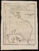
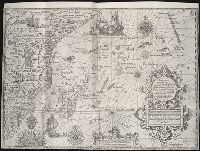
Beinecke Rare Book and Manuscript Library > Kort over Bayen St. Helena : udkaftet efter de Söfarendes Anmerkninger af N. Bellin.
Published / Created:
[1751]
Call Number:
BrSides Box 2019 29
Image Count:
1
Resource Type:
Maps, Atlases & Globes
Subject (Geographic):
Table Bay (South Africa )--Maps --Early
Subject (Topic):
Coasts--South Africa --Maps --Early works
Found in:
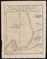
Beinecke Rare Book and Manuscript Library > Kort over Taffelbayen og Reden ved det Gode Haabs Forbierg efter adskillige Manuskripter udkastet af N. Bellin, Ing. de la Marine.
Creator:
Published / Created:
1766]
Call Number:
654 1766
Container / Volume:
BRBL_00344
Image Count:
1
Resource Type:
Maps, Atlases & Globes
Subject (Geographic):
Africa , West--Maps --Early works to 1800
Subject (Topic):
Coasts--Africa , West--Maps --Early works
Found in:
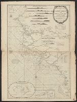
Beinecke Rare Book and Manuscript Library > A new and correct map of the coast of Africa, from Cape Blanco (lat. 20⁰40Ń) to the coast of Angola (lat. 11⁰S) : with explanatory notes of all the forts and settlements belonging to the several European powers / R.W. Seale, sculp.
Creator:
Published / Created:
1789 January 1
Call Number:
1982 Folio 10
Image Count:
1
Subject (Geographic):
Africa , West --Maps --Early works to
Subject (Topic):
Coasts --Africa , West --Maps --Early
Found in:
Beinecke Rare Book and Manuscript Library > The western coast of Africa, from Cape Blanco to Cape Virga, exhibiting Senegambia proper
Creator:
Published / Created:
1st January 1789.
Call Number:
655 1789
Container / Volume:
BRBL_00345
Image Count:
1
Resource Type:
Maps, Atlases & Globes
Subject (Geographic):
Africa , West--Maps --Early works to 1800
Subject (Topic):
Coasts--Africa , West--Maps --Early works
Found in:
Beinecke Rare Book and Manuscript Library > The western coast of Africa, from Cape Blanco to Cape Virga, exhibiting Senegambia proper / by T. Jefferys.
Creator:
Published / Created:
1720?]
Call Number:
49 1740
Container / Volume:
BRBL_00684
Image Count:
1
Resource Type:
Maps, Atlases & Globes
Subject (Topic):
--Maps --Early works to 1800
Found in:
Beinecke Rare Book and Manuscript Library > In notitiam ecclesiasticam Africae tabula geographica / auctore G. De L'Isle ...
Published / Created:
1792
Call Number:
60cea 1792
Container / Volume:
BRBL_00329
Image Count:
1
Resource Type:
Maps, Atlases & Globes
Subject (Geographic):
Africa --Maps --Early works to 1800
Found in:
Beinecke Rare Book and Manuscript Library > A new Survey of the Coast of Africa from Senegal and Cape Verd to Cape St. Ann ...
Creator:
Published / Created:
1794?]
Call Number:
60 1794B
Container / Volume:
BRBL_00324
Image Count:
1
Resource Type:
Maps, Atlases & Globes
Subject (Geographic):
Africa --Maps --Early works to 1800
Found in:
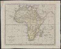
Beinecke Rare Book and Manuscript Library > A new and accurate map of Africa, drawn from the best authorities / by Thos. Bowen.
Published / Created:
1794
Call Number:
60cea 1794
Container / Volume:
BRBL_00329
Image Count:
1
Resource Type:
Maps, Atlases & Globes
Subject (Geographic):
Africa --Maps --Early works to 1800
Found in:
Beinecke Rare Book and Manuscript Library > A new chart of the Coast of Africa from the Straits of Gibralter to Cape Blanco with Madeira & the Canary Islands ...
Creator:
Published / Created:
1721]
Call Number:
60 1721
Container / Volume:
BRBL_00322
Image Count:
1
Resource Type:
Maps, Atlases & Globes
Subject (Geographic):
Africa --Maps --Early works to 1800
Found in:
Beinecke Rare Book and Manuscript Library > A new map of Africa, from the latest observations.
Published / Created:
1700?]
Call Number:
60 1700
Container / Volume:
BRBL_00322
Image Count:
1
Resource Type:
Maps, Atlases & Globes
Subject (Geographic):
Africa --Maps --Early works to 1800
Found in:
Beinecke Rare Book and Manuscript Library > A new map of Africk : shewing its present general divisions, cheif cities or towns, rivers, mountains &c.
Creator:
Published / Created:
1766?]
Call Number:
60 1766
Container / Volume:
BRBL_00323
Image Count:
4
Resource Type:
Maps, Atlases & Globes
Subject (Geographic):
Africa --Maps --Early works to 1800
Found in:
Beinecke Rare Book and Manuscript Library > Africa / performed by the Sr. Danville under the patronage of the Duke of Orleans ; revised and improved by Mr. Bolton ; E. Bowen sculpt.
Creator:
Published / Created:
1774?]
Call Number:
60 1774
Container / Volume:
BRBL_00323
Image Count:
4
Resource Type:
Maps, Atlases & Globes
Subject (Geographic):
Africa --Maps --Early works to 1800
Found in:
Beinecke Rare Book and Manuscript Library > Africa / performed by the Sr. Danville under the patronage of the Duke of Orleans ; revised and improved by Mr. Bolton ; E. Bowen sculpt.
Creator:
Published / Created:
1680
Call Number:
1973 Folio 10
Image Count:
1
Resource Type:
Maps, Atlases & Globes
Subject (Geographic):
Africa --Maps --Early works to 1800
Found in:
Beinecke Rare Book and Manuscript Library > Africa : divided according to the extent of its principall parts in which are distinguished one from the other the empires, monarchies, kingdoms, states and peoples, which at this time inhabite Africa
Creator:
Published / Created:
[1748]
Call Number:
BrSides Folio 2017 11
Image Count:
1
Resource Type:
Maps, Atlases & Globes
Subject (Geographic):
Africa --Maps --Early works to 1800 .
Found in:
Beinecke Rare Book and Manuscript Library > Africa [cartographic material] / drawn from the best maps by T. Jefferys, Geographer to his Royal Highness the Prince of Wales.
Published / Created:
[1968]
Call Number:
60 1710
Container / Volume:
BRBL_00322
Image Count:
1
Resource Type:
Maps, Atlases & Globes
Subject (Geographic):
Africa --Maps --Early works to 1800
Found in:
Beinecke Rare Book and Manuscript Library > Africa according to H. Moll 1710.
Creator:
Published / Created:
1792
Call Number:
60 1795B
Container / Volume:
BRBL_00324
Image Count:
1
Resource Type:
Maps, Atlases & Globes
Subject (Geographic):
Africa --Maps --Early works to 1800
Found in:
Beinecke Rare Book and Manuscript Library > Africa according to the best authorities.
Creator:
Published / Created:
1795]
Call Number:
60 1795A
Container / Volume:
BRBL_00324
Image Count:
1
Resource Type:
Maps, Atlases & Globes
Subject (Geographic):
Africa --Maps --Early works to 1800
Found in:
Beinecke Rare Book and Manuscript Library > Africa according to the best authorities.
Creator:
Published / Created:
1794
Call Number:
60 1794C
Container / Volume:
BRBL_00324
Image Count:
1
Resource Type:
Maps, Atlases & Globes
Subject (Geographic):
Africa --Maps --Early works to 1800
Found in:
Beinecke Rare Book and Manuscript Library > Africa and it's several regions / by Samuel Dunn, mathematician.
Published / Created:
[1968]
Call Number:
60 1668
Container / Volume:
BRBL_00322
Image Count:
1
Resource Type:
Maps, Atlases & Globes
Subject (Geographic):
Africa --Maps --Early works to 1800
Found in:
Beinecke Rare Book and Manuscript Library > Africa by Jacob van Meurs 1668.
Creator:
Published / Created:
1792?]
Call Number:
60 1792
Container / Volume:
BRBL_00324
Image Count:
1
Resource Type:
Maps, Atlases & Globes
Subject (Geographic):
Africa --Maps --Early works to 1800
Found in:
Beinecke Rare Book and Manuscript Library > Africa, 1792 / Ferguson sculpsit.
Call Number:
1976 1233
Collection Title:
Forty-two new maps of Asia, Africa, and America ... : all engrav’d, according to the latest
Image Count:
1
Subject (Geographic):
Africa --Maps --Early works to 1800
Found in:
Beinecke Rare Book and Manuscript Library > Africa, according to ye newest and most exact observations
Creator:
Published / Created:
[1710]
Call Number:
60 1708
Container / Volume:
BRBL_00322
Image Count:
1
Resource Type:
Maps, Atlases & Globes
Subject (Geographic):
Africa --Maps --Early works to 1800
Found in:
Beinecke Rare Book and Manuscript Library > To the right honourable Charles, Earl of Peterborow and Monmouth, &c this map of Africa ... is most humbly dedicated / by your Lordship's humble servant H: Moll geographer.
Call Number:
1976 1233
Collection Title:
Forty-two new maps of Asia, Africa, and America ... : all engrav’d, according to the latest
Image Count:
1
Subject (Geographic):
Africa --Maps --Early works to 1800
Found in:
Beinecke Rare Book and Manuscript Library > A map of Zaara or the Desart, Negroland & Cape Virde Islands &c
Call Number:
1976 1233
Collection Title:
Forty-two new maps of Asia, Africa, and America ... : all engrav’d, according to the latest
Image Count:
1
Subject (Geographic):
Africa --Maps --Early works to 1800
Found in:
Beinecke Rare Book and Manuscript Library > An exact map of the River Nile done by Mr. Lucas
Creator:
Published / Created:
1782 March 20
Call Number:
1982 Folio 10
Image Count:
1
Subject (Geographic):
--Early works to 1800
Found in:
Beinecke Rare Book and Manuscript Library > The Dutch colony of the Cape of Good Hope
Creator:
Published / Created:
[1596?]
Call Number:
Taylor 216A
Collection Title:
John Huighen van Linschoten, his Discours of Voyages into ye Easte & West Indies
Image Count:
1
Subject (Geographic):
Africa --Maps --Early works to 1800
Found in:
Beinecke Rare Book and Manuscript Library > Typus orarum maritimarum Guinae, Manicongo & Angolae ultra promontorium Bonae Spei ...
Creator:
Published / Created:
1787 January 6
Call Number:
1982 Folio 10
Image Count:
2
Subject (Geographic):
Africa --Maps --Early works to 1800
Found in:
Beinecke Rare Book and Manuscript Library > Africa : with all its states, kingdoms, republics, regions, islands, & ca., improved and inlarged from D'Anville's map : to which have been added a particular chart of the Gold Coast wherein are distinguished all the European forts and factories
Creator:
Call Number:
623 1750
Container / Volume:
BRBL_00333
Image Count:
1
Resource Type:
Maps, Atlases & Globes
Subject (Geographic):
Africa , Eastern--Maps --Early works to
Found in:
Beinecke Rare Book and Manuscript Library > A new and accurate map of Nubia & Abissinia, together with all the kingdoms tributary thereto, and bordering upon them / laid down from the latest & best authorities and regulated by astronl. observations ny Emanl. Bowen.
Call Number:
1976 1233
Collection Title:
Forty-two new maps of Asia, Africa, and America ... : all engrav’d, according to the latest
Image Count:
1
Subject (Geographic):
Africa --Maps --Early works to 1800
Found in:
Beinecke Rare Book and Manuscript Library > The west part of Barbary containing Fez, Marocco, Algier, and part of Biledulgerid the Canary Islands &c
Creator:
Published / Created:
1598
Call Number:
Taylor 216A
Collection Title:
John Huighen van Linschoten, his Discours of Voyages into ye Easte & West Indies
Image Count:
1
Subject (Geographic):
Africa --Maps --Early works to 1800
Found in:
Beinecke Rare Book and Manuscript Library > Delineatio orarum maritimarum, terrae vulgo indigitatae terra do Natal item Sofalae, Mozambicae & Melindae, insulaeq[ue] sancti Laurentij ...
Creator:
Call Number:
60 1795
Container / Volume:
BRBL_00324
Image Count:
1
Resource Type:
Maps, Atlases & Globes
Subject (Geographic):
Africa --Maps --Early works to 1800
Found in:
Beinecke Rare Book and Manuscript Library > General map of Africa : corrected according to the best observations and discovereies of the most recent travels / prepared by Citn. Lapie ; under the direction of the author.
Creator:
Published / Created:
[1747]
Call Number:
655 1747
Container / Volume:
BRBL_00345
Image Count:
1
Resource Type:
Maps, Atlases & Globes
Subject (Geographic):
Africa , West--Maps --Early works to 1800 .
Found in:
Beinecke Rare Book and Manuscript Library > A new & accurate map of Negroland and the adjacent countries : also Upper Guinea, shewing the principal European settlements, & distinguishing w[hi]ch belong to England, Denmark, Holland &c., the sea coast & some of the rivers being drawn from surveys & t
Call Number:
1976 1233
Collection Title:
Forty-two new maps of Asia, Africa, and America ... : all engrav’d, according to the latest
Image Count:
1
Subject (Geographic):
Africa --Maps --Early works to 1800
Found in:
Beinecke Rare Book and Manuscript Library > The east part of Barbary containing Tunis, Tripoli, Barca, Egypt, Nubia, part of Biledulgerid and Zaara or desart
Creator:
Published / Created:
Undated
Call Number:
Taylor 216A
Collection Title:
Iohn Huighen van Linschoten, his Discours of Voyages into ye Easte & West Indies : deuided into
Image Count:
1
Subject (Geographic):
Africa --Maps --Early works to 1800
Found in:
Beinecke Rare Book and Manuscript Library > [Map of southern Africa and Madagascar]
Creator:
Published / Created:
June 28th, 1780.
Call Number:
39cea 1780
Container / Volume:
BRBL_00192
Image Count:
1
Resource Type:
Maps, Atlases & Globes
Subject (Topic):
Coasts--Africa , North--Maps --Early
Found in:
Beinecke Rare Book and Manuscript Library > A chart of the coasts of Spain and Portugal, with the Balearic Islands, and part of the coast of Barbary / by L.S. De la Rochette.
Creator:
Published / Created:
August 12th, 1768.
Call Number:
655 1768
Container / Volume:
BRBL_00345
Image Count:
1
Resource Type:
Maps, Atlases & Globes
Subject (Geographic):
Africa , West--Maps --Early works to 1800
Found in:
Beinecke Rare Book and Manuscript Library > The western coast of Africa, from Cape Blanco to Cape Virga, exhibiting Senegambia proper / by T. Jefferys.
Published / Created:
1785
Call Number:
648cea Sa23 1785
Container / Volume:
BRBL_00708
Image Count:
1
Resource Type:
Maps, Atlases & Globes
Subject (Geographic):
, Manuscript--Early works to 1800
Found in:
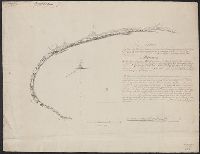
Beinecke Rare Book and Manuscript Library > A chart of a bay [St. Francis Bay?] on the SE coast of Africa ... 1785 ... in Lat. 34°09'S, Long 26°10'E.
Creator:
Published / Created:
1711
Call Number:
53 1711
Container / Volume:
BRBL_00684
Image Count:
1
Resource Type:
Maps, Atlases & Globes
Subject (Geographic):
Africa --Maps --Early works to 1800
Found in:
Beinecke Rare Book and Manuscript Library > A map of Turky [sic] Arabia & Persia : corrected from the latest travels and from the observations of the Royal Societys of London and Paris / by G. De L'Isle.
Published / Created:
[1751]
Call Number:
BrSides 2019 106
Image Count:
1
Resource Type:
Maps, Atlases & Globes
Subject (Geographic):
Africa , Eastern--Maps --Early works to
Found in:
Beinecke Rare Book and Manuscript Library > Riget Monomotapa og de hosligende Stater af de l'Isle og andre Jordbeskrivere.
Creator:
Published / Created:
1780 June 28
Call Number:
1982 Folio 10
Image Count:
1
Subject (Topic):
Coasts --Africa , North --Maps --Early
Found in:
Beinecke Rare Book and Manuscript Library > A chart of the coasts of Spain and Portugal, with the Balearic Islands, and part of the coast of Barbary
Call Number:
1974 Folio 72
Collection Title:
The English pilot: describing the West-India navigation, from Hudson's-Bay to the river Amazones
Image Count:
1
Subject (Geographic):
Africa --Maps --Early works to 1800
Found in:
Beinecke Rare Book and Manuscript Library > A new and correct chart of the western and southern oceans
Call Number:
1973 Folio 116
Collection Title:
The English pilot: describing the West-India navigation, from Hudson's-Bay to the river Amazones
Image Count:
2
Subject (Geographic):
Africa --Maps --Early works to 1800
Found in:
Beinecke Rare Book and Manuscript Library > A new and correct chart of the western and southern oceans
Call Number:
1973 Folio 114
Collection Title:
The English pilot: describing the West-India navigation, from Hudson's-Bay to the river Amazones
Image Count:
1
Resource Type:
Maps, Atlases & Globes
Subject (Geographic):
Africa --Maps --Early works to 1800
Found in:
Beinecke Rare Book and Manuscript Library > A new and correct chart of the western and southern oceans ...
Creator:
Call Number:
1978 Folio 10
Collection Title:
The English pilot: describing the West-India navigation, from Hudson's-Bay to the river Amazones
Image Count:
1
Subject (Geographic):
Africa --Maps --Early works to 1800
Found in:
Beinecke Rare Book and Manuscript Library > A new and correct chart shewing the variations of the compass in the western & southern oceans
Creator:
Published / Created:
1787 January 1
Call Number:
1982 Folio 10
Image Count:
2
Subject (Geographic):
Africa , North --Maps --Early works to
Found in:
Beinecke Rare Book and Manuscript Library > Europe divided into its empires, kingdoms, states, republics, & ca
Creator:
Published / Created:
[ca. 1689?]
Call Number:
1973 Folio 10
Image Count:
1
Resource Type:
Maps, Atlases & Globes
Subject (Geographic):
Africa , North --Maps --Early works to
Found in:
Beinecke Rare Book and Manuscript Library > The empire of the great Turke [sic] in Europe, Asia, [and] Africa : divided into all its Beglerbeglicz or governments in which are also distinguished the states that are tributary to him
Call Number:
1974 Folio 72
Collection Title:
The English pilot: describing the West-India navigation, from Hudson's-Bay to the river Amazones
Image Count:
1
Subject (Geographic):
Africa --Maps --Early works to 1800
Found in:
Beinecke Rare Book and Manuscript Library > A new generall chart for the West Indies
Call Number:
1978 Folio 10
Collection Title:
The English pilot: describing the West-India navigation, from Hudson's-Bay to the river Amazones
Image Count:
1
Subject (Geographic):
Africa --Maps --Early works to 1800
Found in:
Beinecke Rare Book and Manuscript Library > A new generall chart for the West Indies
Call Number:
1973 Folio 116
Collection Title:
The English pilot: describing the West-India navigation, from Hudson's-Bay to the river Amazones
Image Count:
1
Subject (Geographic):
Africa --Maps --Early works to 1800
Found in:
Beinecke Rare Book and Manuscript Library > A new generall chart for the West Indies
Call Number:
1973 Folio 114
Collection Title:
The English pilot: describing the West-India navigation, from Hudson's-Bay to the river Amazones
Image Count:
2
Resource Type:
Maps, Atlases & Globes
Subject (Geographic):
Africa --Maps --Early works to 1800
Found in:
Beinecke Rare Book and Manuscript Library > A new generall chart for the West Indies
Creator:
Published / Created:
[1596]
Call Number:
Taylor 216A
Collection Title:
John Huighen van Linschoten, his Discours of Voyages into ye Easte & West Indies
Image Count:
1
Subject (Geographic):
Africa --Maps --Early works to 1800
Found in:
Beinecke Rare Book and Manuscript Library > Deliniatur in hac tabula, Orae maritimae Abexiae, freti Mecani al Maris Rubri Arabiae ...
Creator:
Call Number:
1973 Folio 76
Collection Title:
The English pilot: describing the sea-coasts, capes, head-lands, rivers, bays, roads, havens
Image Count:
1
Subject (Geographic):
Africa --Maps --Early works to 1800
Found in:
Beinecke Rare Book and Manuscript Library > A generall chart of the West Indies
Call Number:
1974 Folio 72
Collection Title:
The English pilot: describing the West-India navigation, from Hudson's-Bay to the river Amazones
Image Count:
2
Subject (Geographic):
Africa , West --Maps --Early works to
Found in:
Beinecke Rare Book and Manuscript Library > A generall chart of the western ocean
Call Number:
1973 Folio 116
Collection Title:
The English pilot: describing the West-India navigation, from Hudson's-Bay to the river Amazones
Image Count:
1
Subject (Geographic):
Africa , West --Maps --Early works to
Found in:
Beinecke Rare Book and Manuscript Library > A general chart of the western ocean
Call Number:
1973 Folio 114
Collection Title:
The English pilot: describing the West-India navigation, from Hudson's-Bay to the river Amazones
Image Count:
1
Resource Type:
Maps, Atlases & Globes
Subject (Geographic):
Africa , West --Maps --Early works to
Found in:
Beinecke Rare Book and Manuscript Library > A general chart of the western ocean
Call Number:
1978 Folio 10
Collection Title:
The English pilot: describing the West-India navigation, from Hudson's-Bay to the river Amazones
Image Count:
1
Subject (Geographic):
Africa , West --Maps --Early works to
Found in:
Beinecke Rare Book and Manuscript Library > A generall chart of the western ocean
Branch:v1.60.98 ,Deployed:2024-04-17T09:54:14-04:00