Skip to search
Skip to main content
Skip to first result
Search
You Searched For
"Switzerland"
Access
Public
Repository
Beinecke Rare Book and Manuscript Library
Resource Type
Maps, Atlases & Globes
Language
German
New Search
Search Results
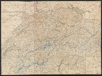
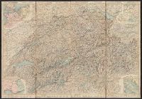
Published / Created:
1820?]
Call Number:
37 1820A
Image Count:
2
Resource Type:
Maps, Atlases & Globes
Description:
5 insets in border.
Publisher:
Heinrich Keller,
Subject (Geographic):
Switzerland --Maps
Found in:
Beinecke Rare Book and Manuscript Library > [Switzerland]
Creator:
Switzerland . Generaldirektion der Post-, Telegraphen- und Telephonverwaltung
Published / Created:
1951
Call Number:
37 Sa5 1951
Container / Volume:
BRBL_00150
Image Count:
2
Resource Type:
Maps, Atlases & Globes
Alternative Title:
Thusis - Splügen
Publisher:
Generaldirektion der Post-, Telegraphen- und Telephonverwaltung,
Subject (Geographic):
Alps, Swiss (Switzerland )--Maps
Subject (Name):
Kümmerly + Frey
Subject (Topic):
Mountain passes--Switzerland --Maps
Found in:
Beinecke Rare Book and Manuscript Library > Schweizerische Alpenposten San Bernardino, Splügen - Mesocco / [cartographic material] / Kümmerly & Frey, Bern.
Creator:
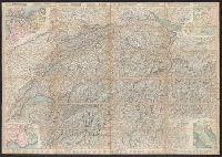
Published / Created:
1860
Call Number:
37 1860A
Image Count:
2
Resource Type:
Maps, Atlases & Globes
Alternative Title:
Road map of Switzerland
Description:
In French. Legend and scales in French, English, German, and Italian., Includes insets of northwestern Europe, north-central Europe, northern Italy, and the French-Italian coastal, and Mounted on verso: Luzern -- Bâle -- Genève -- Zuric -- Berne -- Lausanne.
Publisher:
H.F. Leuthold,
Subject (Geographic):
Switzerland --Maps
Subject (Name):
Bressanini and Mullhaupt
Subject (Topic):
Roads--Switzerland --Maps
Found in:
Beinecke Rare Book and Manuscript Library > Roadmap of Switzerland = Reisekarte der Schweiz = Carta stradale della Svizzera = Carte routière de la Suisse : en partie tirée de l'atlas topographique de la confederation / dresée et gravée par Mullhaupt ; publiée par H.F. Leuthold editeur ; ecrit
Creator:
Published / Created:
1861
Call Number:
37 1861A
Image Count:
2
Resource Type:
Maps, Atlases & Globes
Alternative Title:
Road map of Switzerland
Description:
In French. Legend and scales in French, English, German, and Italian., Includes insets of northwestern Europe, north-central Europe, northern Italy, and the French-Italian coastal region., Mounted on verso: Luzern, and Relief shown by hachures and spot heights.
Publisher:
H.F. Leuthold,
Subject (Geographic):
Switzerland --Maps
Subject (Name):
Bressanini and Mullhaupt
Subject (Topic):
Roads--Switzerland --Maps
Found in:
Beinecke Rare Book and Manuscript Library > Roadmap of Switzerland = Reisekarte der Schweiz = Carta stradale della Svizzera = Carte routière de la Suisse : en partie tirée de l'atlas topographique de la confederation / dresée et gravée par Mullhaupt ; publiée par H.F. Leuthold editeur ; ecrit
Creator:
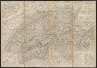
Published / Created:
1858
Call Number:
37 1858
Image Count:
2
Resource Type:
Maps, Atlases & Globes
Alternative Title:
Road map of Switzerland
Description:
In French. Legend and scales in French, English, German, and Italian., Includes insets of northwestern Europe, north-central Europe, northern Italy, and the French-Italian coastal region., Mounted on verso: Luzern, and Relief shown by hachures and spot heights.
Publisher:
H.F. Leuthold,
Subject (Geographic):
Switzerland --Maps
Subject (Name):
Bressanini and Mullhaupt
Subject (Topic):
Roads--Switzerland --Maps
Found in:
Beinecke Rare Book and Manuscript Library > Roadmap of Switzerland = Reisekarte der Schweiz = Carta stradale della Svizzera = Carte routière de la Suisse : en partie tirée de l'atlas topographique de la confederation / dresée et gravée par Mullhaupt ; publiée par H.F. Leuthold editeur ; ecrit
Creator:
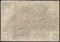
Published / Created:
1867
Call Number:
37 1867
Image Count:
2
Resource Type:
Maps, Atlases & Globes
Alternative Title:
Road map of Switzerland
Description:
In French. Legend and scales in French, English, German, and Italian., Includes insets of northwestern Europe, north-central Europe, northern Italy, and the French-Italian coastal region., Library copy annotated in, and Relief shown by hachures and spot heights.
Publisher:
H.F. Leuthold,
Subject (Geographic):
Switzerland --Maps
Subject (Name):
Bressanini and Mullhaupt
Subject (Topic):
Roads--Switzerland --Maps
Found in:
Beinecke Rare Book and Manuscript Library > Roadmap of Switzerland = Reisekarte der Schweiz = Carta stradale della Svizzera = Carte routière de la Suisse : en partie tirée de l'atlas topographique de la confederation / dresée et gravée par Mullhaupt ; publiée par H.F. Leuthold editeur ; ecrit
Creator:
Published / Created:
1856
Call Number:
37 1856
Image Count:
2
Resource Type:
Maps, Atlases & Globes
Alternative Title:
Road map of Switzerland
Description:
In French. Legend and scales in French, English, German, and Italian., Includes insets of northwestern Europe, north-central Europe, northern Italy, and the French-Italian coastal region., and Mounted on verso: Luzern -- Bâle -- Genève -- Zuric -- Berne -- La
Publisher:
H.F. Leuthold,
Subject (Geographic):
Switzerland --Maps
Subject (Name):
Bressanini and Mullhaupt
Subject (Topic):
Roads--Switzerland --Maps
Found in:
Beinecke Rare Book and Manuscript Library > Roadmap of Switzerland = Reisekarte der Schweiz = Carta stradale della Svizzera = Carte routière de la Suisse : en partie tirée de l'atlas topographique de la confederation / dresée et gravée par Mullhaupt ; publiée par H.F. Leuthold editeur ; ecrit
Creator:
Published / Created:
[1940]-
Call Number:
37 J974 1940
Image Count:
2
Resource Type:
Maps, Atlases & Globes
Alternative Title:
Spezialkarte des Jura
Description:
French and German., Relief shown by contours, gradient tints, and spot heights. Contours at 20 meter intervals., Sheets 2-6 wanting., and Shows hiking trails and paths.
Publisher:
Institut géographique Kümmerly & Frey,
Subject (Geographic):
Jura Mountains (France and Switzerland
Subject (Name):
Kümmerly + Frey
Subject (Topic):
Switzerland )--Maps
Found in:
Beinecke Rare Book and Manuscript Library > Carte du Jura = Spezialkarte des Jura / editée par le Schweizerischen Juraverein.
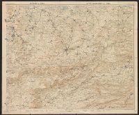
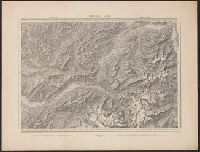
Published / Created:
1864
Call Number:
37 1907B
Container / Volume:
BRBL_00149
Image Count:
1
Resource Type:
Maps, Atlases & Globes
Description:
"Blatt XLII", "Interlachen", "Sarnen Stanz".
Publisher:
Swiss Government],
Subject (Geographic):
Switzerland --Maps
Found in:
Beinecke Rare Book and Manuscript Library > [Switzerland] / G.H. Dufour direxit; H. Müllhaupt sculpsit.
Creator:
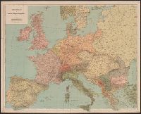
Published / Created:
[1914?]
Call Number:
30 1914A
Container / Volume:
BRBL_00032
Image Count:
1
Resource Type:
Maps, Atlases & Globes
Publisher:
Kartographia Winterthur,
Subject (Geographic):
Europe--Maps
Found in:
Beinecke Rare Book and Manuscript Library > Uebersichtskarte der europ. Kriegsschauplätze.
Branch:v1.61.6 ,Deployed:2024-06-12T09:55:19-04:00