Search
You Searched For
Search Results
- Published / Created:
- ca. 163--1734]
- Call Number:
- 1973 Folio 18
- Image Count:
- 10
- Resource Type:
- Maps, Atlases & Globes
- Found in:
- Beinecke Rare Book and Manuscript Library > [Composite atlas of the world].
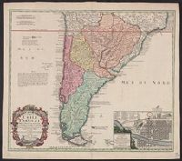
- Creator:
- Ovalle, Alonso de, 1601-1651
- Published / Created:
- A. MDCCXXXIII [1733]
- Call Number:
- 935 1733A
- Container / Volume:
- BRBL_00674
- Image Count:
- 1
- Resource Type:
- Maps, Atlases & Globes
- Found in:
- Beinecke Rare Book and Manuscript Library > Typus geographicus : Chili a Paraguay freti Magellanici &c., ex. PPbg. Alfonso d'Ovalle & Nicol. Techo nec non de Brouwer, Narbouroug, de Beauchesne &c., a Guiliel de l'Islio descripta, insuperque secundum recentiores du Frezier relationes rectificata cui
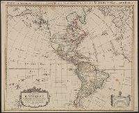
- Creator:
- L'Isle, Guillaume de, 1675-1726
- Published / Created:
- 1774
- Call Number:
- 70 1774A
- Container / Volume:
- BRBL_00724
- Image Count:
- 1
- Resource Type:
- Maps, Atlases & Globes
- Found in:
- Beinecke Rare Book and Manuscript Library > Carte d'Amerique : divisées en ses principales parties / par G. Delisle, premier geographe du Roy, rectifiée apres les nouvelles observations du Sr. D'Anville et autres geographes ; J. Condet, sc.
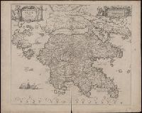
- Creator:
- Lauremberg, Johann, 1590-1658
- Published / Created:
- [approximately 1700?]
- Call Number:
- BrSides Double Folio 2019 71
- Image Count:
- 1
- Resource Type:
- Maps, Atlases & Globes
- Found in:
- Beinecke Rare Book and Manuscript Library > Peloponnesus sive Morea / auth. J. Laurenbergio.
- Creator:
- Blaeu, Willem Janszoon, 1571-1638
- Published / Created:
- 1667?]
- Call Number:
- 85 1667
- Container / Volume:
- BRBL_00636
- Image Count:
- 1
- Resource Type:
- Maps, Atlases & Globes
- Found in:
- Beinecke Rare Book and Manuscript Library > Insulae Americanae in Oceano Septentrionali cum terris adiacentibus.
- Creator:
- Lowitz, G. M. (George Moritz), 1722-1774
- Published / Created:
- 1746
- Call Number:
- 11 1746A
- Container / Volume:
- BRBL_00681
- Image Count:
- 1
- Resource Type:
- Maps, Atlases & Globes
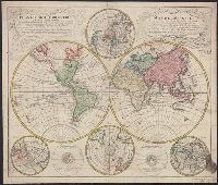
- Found in:
- Beinecke Rare Book and Manuscript Library > Planiglobii terrestris mappa universalis utrumq[ue] hemisphaerium orient. et occidentale repraesentans, ex IV. mappis generalibus, Hasianis composita et adjectis ceteris hemisphaeriis / designata a G.M. Lowizio ; excudentibus Homann. Heredibus = Mappe-mon
- Creator:
- Lowitz, G. M. (George Moritz), 1722-1774, cartographer.
- Call Number:
- 11 1746A
- Image Count:
- 1
- Resource Type:
- Maps, Atlases & Globes
- Found in:
- Beinecke Rare Book and Manuscript Library > Planiglobii terrestris mappa universalis utrumq[ue] hemisphaerium orient. et occidentale repraesentans, ex IV. mappis generalibus, Hasianis composita et adjectis ceteris hemisphaeriis / designata a G.M. Lowizio ; excudentibus Homann. Heredibus = Mappe-monde qui représente les deux hemisphères savoir celui de l'orient et celui de l'occident, tirée des quatre cartes générales de feu M. le profess. Hasius / dressée par M. G.M. Lowitz, et publiée par les Héritiers de Homann.
- Creator:
- Mayer, Tobias, 1723-1762
- Published / Created:
- [after 1772]
- Call Number:
- BrSides Double Folio 2019 28
- Image Count:
- 1
- Resource Type:
- Maps, Atlases & Globes
- Found in:
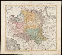
- Beinecke Rare Book and Manuscript Library > Mappa geographica Regni Poloniae : ex novissimis quotquot sunt mappis specialibus composita et ad L.L. stereographica projectionis / revocata à Tob. Mayero.
- Creator:
- Mayer, Tobias, 1723-1762
- Call Number:
- BrSides Double Folio 2019 29
- Image Count:
- 1
- Resource Type:
- Maps, Atlases & Globes
- Found in:
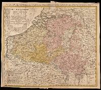
- Beinecke Rare Book and Manuscript Library > Belgivm Catholicvm seu decem provinciae Germaniae inferioris : cum confiniis Germaniae svp. et Franciae legitime omnia delineata et ad ductum observationum astronomicarum, nec non geometricarum operationum a Cassinio Snellio Muschenbrokio aliisqve rite ha
- Creator:
- Homann, Johann Baptist, 1663-1724
- Published / Created:
- ca. 1730]
- Call Number:
- 783 1759
- Container / Volume:
- BRBL_00691
- Image Count:
- 1
- Resource Type:
- Maps, Atlases & Globes
- Found in:
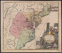
- Beinecke Rare Book and Manuscript Library > Virginia, Marylandia et Carolina in America septentrionali Brittannorum industria excultæ / repraesentatae à Ioh. Bapt. Homann, S.C.M. Geog.
- Creator:
- Jansson, Jan, 1588-1664
- Published / Created:
- 1630]
- Call Number:
- 783 1622
- Container / Volume:
- BRBL_00691
- Image Count:
- 1
- Resource Type:
- Maps, Atlases & Globes
- Found in:
- Beinecke Rare Book and Manuscript Library > Nova Virginiae tabvla / [cartographic material] / Petrus Koerius caelavit.
- Creator:
- Cóvens et Mortier
- Published / Created:
- ca. 1730-ca. 1800]
- Call Number:
- 1973 Folio 71
- Image Count:
- 1
- Resource Type:
- Maps, Atlases & Globes
- Found in:
- Beinecke Rare Book and Manuscript Library > [Atlas nouveau contenant toutes les parties du monde ou sont exactement marqués les empires, monarchies, royaumes, états, republiques &c. Le tout recueilli par les meilleurs geógraphes.]
- Creator:
- Homann, Johann Baptist, 1663-1724
- Published / Created:
- ca. 1714]
- Call Number:
- 755 1759
- Container / Volume:
- BRBL_00728
- Image Count:
- 1
- Resource Type:
- Maps, Atlases & Globes
- Found in:
- Beinecke Rare Book and Manuscript Library > Virginia, Marylandia et Carolina in America septentrionali Brittannorum industria excultae / repraesentatae à Ioh. Bapt. Homann, S.C.M. Geog.
- Creator:
- Homann, Johann Baptist, 1663-1724
- Published / Created:
- ca. 1714]
- Call Number:
- 755 1714
- Container / Volume:
- BRBL_00425
- Image Count:
- 1
- Resource Type:
- Maps, Atlases & Globes
- Found in:
- Beinecke Rare Book and Manuscript Library > Virginia, Marylandia et Carolina in America septentrionali Brittannorum industria excultae / repraesentatae à Ioh. Bapt. Homann, S.C.M. Geog.
- Creator:
- Homann Erben (Firm)
- Published / Created:
- 1749
- Call Number:
- BrSides Double Folio 2017 5
- Image Count:
- 1
- Resource Type:
- Maps, Atlases & Globes
- Found in:
- Beinecke Rare Book and Manuscript Library > Tatariae sinensis mappa geographica [cartographic material] / ex tabuli specialibus R.R.P.P. Iesuitarum nec non relationibus R.P. Gerbillon per Dom D'Anville geographum parisiensem primum Ao. 1732 nunc secundam LL. projectionis stereographicae in usum tra
- Creator:
- Hondius, Jodocus, 1563-1612
- Published / Created:
- [1609]
- Call Number:
- 60 1609
- Container / Volume:
- BRBL_00321
- Image Count:
- 2
- Resource Type:
- Maps, Atlases & Globes
- Found in:
- Beinecke Rare Book and Manuscript Library > Nova Africae tabula / auctore Jodoco Hondio.
- Creator:
- Hondius, Hendrik, 1597-1651
- Published / Created:
- between 1639 and 1649?]
- Call Number:
- 60 1639
- Container / Volume:
- BRBL_00321
- Image Count:
- 2
- Resource Type:
- Maps, Atlases & Globes
- Found in:
- Beinecke Rare Book and Manuscript Library > Africae nova tabula / auct. Hen. Hondio, 1631.
- Creator:
- Hondius, Hendrik, 1597-1651
- Published / Created:
- between 1639 and 1644?]
- Call Number:
- 70 163X
- Container / Volume:
- BRBL_00353
- Image Count:
- 2
- Resource Type:
- Maps, Atlases & Globes
- Found in:
- Beinecke Rare Book and Manuscript Library > America noviter delineata / auct. Henrico Hondio, 1631.
- Creator:
- Blaeu, Willem Janszoon, 1571-1638
- Published / Created:
- between 1643 and 1650]
- Call Number:
- 64 1643
- Container / Volume:
- BRBL_00338
- Image Count:
- 2
- Resource Type:
- Maps, Atlases & Globes
- Found in:
- Beinecke Rare Book and Manuscript Library > Aethiopia inferior vel exterior.