Search
You Searched For
Search Results
- Creator:
- Seutter, Matthaeus, 1678-1756
- Published / Created:
- [after 1741]
- Call Number:
- BrSides Double Folio 2019 46
- Image Count:
- 1
- Resource Type:
- Maps, Atlases & Globes
- Subject (Geographic):
- Austria--Maps
- Found in:
- Beinecke Rare Book and Manuscript Library > Archiducatus Austriae inferioris accuratissima tabula : cujus ditiones in suos quadrant. / designatae edita opera et studio M. Seutt. Ch. Aug.
- Published / Created:
- 1805
- Call Number:
- 41 1805
- Container / Volume:
- BRBL_00241
- Image Count:
- 4
- Resource Type:
- Maps, Atlases & Globes
- Subject (Geographic):
- Austria--Maps
- Found in:
- Beinecke Rare Book and Manuscript Library > Mappa novissima regnorum Hungariae, Croatiae, Sclavoniae ... / F. Muller, sculpsit.
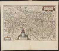
- Creator:
- Lazius, Wolfgang, 1514-1565
- Published / Created:
- [1641?]
- Call Number:
- 42 1640
- Container / Volume:
- BRBL_00244
- Image Count:
- 2
- Resource Type:
- Maps, Atlases & Globes
- Subject (Geographic):
- Austria--Maps--Early works to 1800
- Found in:
- Beinecke Rare Book and Manuscript Library > Austria archiducatus / [cartographic material] / auctore Wolfgango Lazio.
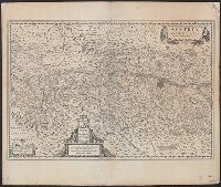
- Creator:
- Lazius, Wolfgang, 1514-1565
- Published / Created:
- [1635]
- Call Number:
- 42 1630
- Container / Volume:
- BRBL_00244
- Image Count:
- 2
- Resource Type:
- Maps, Atlases & Globes
- Subject (Geographic):
- Austria--Maps--Early works to 1800
- Found in:
- Beinecke Rare Book and Manuscript Library > Austria archiducatus / auctore Wolfgango Lazio.
- Creator:
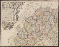
- Visscher, Nicolaes, 1649-1702, cartographer
- Published / Created:
- [ca. 1700?]
- Call Number:
- 41 AU79 1700
- Container / Volume:
- BRBL_00242
- Image Count:
- 1
- Resource Type:
- Maps, Atlases & Globes
- Subject (Geographic):
- Austria--Maps--Early works to 1800
- Found in:
- Beinecke Rare Book and Manuscript Library > Austriae archiducatus pars superior in omnes ejusdem quadrantes ditiones accuratissime et distincte delineata [cartographic material] / per Nic. Visscher.
- Published / Created:
- [1760?]
- Call Number:
- 428 1760
- Container / Volume:
- BRBL_00247
- Image Count:
- 5
- Resource Type:
- Maps, Atlases & Globes
- Subject (Geographic):
- Tyrol (Austria)--Maps--Early works to
- Found in:
- Beinecke Rare Book and Manuscript Library > Atlas Tyrolensis.
- Creator:
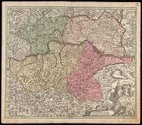
- Homann, Johann Baptist, 1663-1724
- Published / Created:
- [before 1724?]
- Call Number:
- BrSides Double Folio 2019 42
- Image Count:
- 1
- Resource Type:
- Maps, Atlases & Globes
- Subject (Geographic):
- Tyrol (Austria)--Maps--Early works to
- Found in:
- Beinecke Rare Book and Manuscript Library > Comitatus principalis Tirolis : in quo Episc. Tridentin[us] et Brixensis, Comitatus Brigantinus, Feldkirchiae Sonnebergae et Pludentii accuratè exhibentur / editore Ioh. Baptista Homanno, Sacrae Caes. Majestatis Geographo.
- Creator:
- Homann, Johann Baptist, 1663-1724
- Published / Created:
- [after 1724]
- Call Number:
- 428 1720
- Container / Volume:
- BRBL_00247
- Image Count:
- 1
- Resource Type:
- Maps, Atlases & Globes
- Subject (Geographic):
- Tyrol (Austria)--Maps--Early works to
- Found in:
- Beinecke Rare Book and Manuscript Library > Comitatus principalis Tirolis : in quo Episc. Tridentin[us] et Brixensis, Comitatus Brigantinus, Feldkirchiae Sonnebergae et Pludentii accuratè exhibentur / editore Ioh. Baptista Homanno, Sacrae Caes. Majestatis Geographo.
- Published / Created:
- 1783
- Call Number:
- 429 1783
- Container / Volume:
- BRBL_00249
- Image Count:
- 3
- Resource Type:
- Maps, Atlases & Globes
- Subject (Geographic):
- Vorarlberg (Austria)--Maps--Early works
- Found in:
- Beinecke Rare Book and Manuscript Library > Provincia Arlbergica ... / per Joannem Antonium Pfaundler.
- Published / Created:
- 1625?]
- Call Number:
- 426 1625
- Container / Volume:
- BRBL_00246
- Image Count:
- 2
- Resource Type:
- Maps, Atlases & Globes
- Subject (Geographic):
- Styria (Austria)--Maps--Early works to
- Found in:
- Beinecke Rare Book and Manuscript Library > Stiria / per Gerardum Mercatorem ...