Search
You Searched For
Search Results
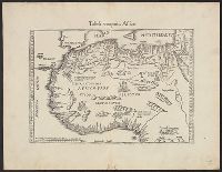
- Creator:
- Ogilby, John, 1600-1676
- Published / Created:
- 1670]
- Call Number:
- 655 1670
- Container / Volume:
- BRBL_00345
- Image Count:
- 1
- Resource Type:
- Maps, Atlases & Globes
- Subject (Geographic):
- Africa, West--Maps--Early works to 1800
- Subject (Topic):
- Coasts--Africa, West--Maps--Early works
- Found in:
- Beinecke Rare Book and Manuscript Library > Guinea.
- Creator:
- Linschoten, Jan Huygen van, 1563-1611
- Published / Created:
- 1596?]
- Call Number:
- 63 1596
- Container / Volume:
- BRBL_00334
- Image Count:
- 1
- Resource Type:
- Maps, Atlases & Globes
- Subject (Geographic):
- Africa, Eastern--Maps--Early works to
- Subject (Topic):
- Coasts--Africa, Eastern--Maps--Early
- Found in:
- Beinecke Rare Book and Manuscript Library > Delineatio orarum maritimarum, terrae vulgo indigetatae terra do Natal item Sofalae, Mozambicae & Melindae ... [cartographic material] = Affbeeldinghe der custen des landts genaempt terra do Natal, item van alle de custen van Coffala, Mozambique, Melinde
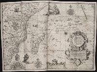
- Creator:
- Linschoten, Jan Huygen van, 1563-1611
- Published / Created:
- 1596]
- Call Number:
- 64 1596
- Container / Volume:
- BRBL_00337
- Image Count:
- 1
- Resource Type:
- Maps, Atlases & Globes
- Subject (Geographic):
- Africa, Southern--Maps--Early works to
- Subject (Topic):
- Coasts--Africa, Southern--Maps--Early
- Found in:
- Beinecke Rare Book and Manuscript Library > Typus orarum maritimarum Guineae, Manicongo, & Angôlae ultra promontorium Bonae Spei ... [cartographic material] = Afheeldinghe der custen des landts Guinea, Manicongo, ende Angôla, ende voorts tot voorby de C. de boa esperança ... / Arnoldus F. á Lan
- Creator:
- L'Isle, Guillaume de, 1675-1726
- Published / Created:
- 1720?]
- Call Number:
- 49 1740
- Container / Volume:
- BRBL_00684
- Image Count:
- 1
- Resource Type:
- Maps, Atlases & Globes
- Subject (Topic):
- --Maps--Early works to 1800
- Found in:
- Beinecke Rare Book and Manuscript Library > In notitiam ecclesiasticam Africae tabula geographica / auctore G. De L'Isle ...
- Creator:
- L'Isle, Guillaume de, 1675-1726
- Published / Created:
- 1780
- Call Number:
- 49 1780
- Container / Volume:
- BRBL_00267
- Image Count:
- 1
- Resource Type:
- Maps, Atlases & Globes
- Subject (Topic):
- --Maps--Early works to 1800
- Found in:
- Beinecke Rare Book and Manuscript Library > In notitiam ecclesiasticam Africæ tabula geographica [cartographic material] / Auctore G. de l'Isle ; Joan. Bap. Liébaux inv. et sculp.
- Creator:
- Sandrart, Jakob von, 1630-1708
- Published / Created:
- 1700]
- Call Number:
- 60 1700A
- Container / Volume:
- BRBL_00322
- Image Count:
- 1
- Resource Type:
- Maps, Atlases & Globes
- Subject (Geographic):
- Africa--Maps--Early works to 1800
- Found in:
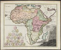
- Beinecke Rare Book and Manuscript Library > Accuratissima totius Africae tabula / in lucem producta per Iacobum de Sandrart ; Joann. Bapt. Homann, sculpsit.
- Creator:
- L'Isle, Guillaume de, 1675-1726
- Published / Created:
- [ca. 1760]
- Call Number:
- 60 1760B
- Container / Volume:
- BRBL_00323
- Image Count:
- 1
- Resource Type:
- Maps, Atlases & Globes
- Subject (Geographic):
- Africa--Maps--Early works to 1800
- Found in:
- Beinecke Rare Book and Manuscript Library > Africa : concinnata secundum observationes membror. acad. regal. scientiarum et non nullorum aliorum, et juxta recentissimas annotationes / per G. de l'Isle, geographum.
- Creator:
- Seutter, Matthaeus, 1678-1756, cartographer.
- Published / Created:
- after 1741]
- Call Number:
- 60 1735
- Container / Volume:
- BRBL_00323
- Image Count:
- 1
- Resource Type:
- Maps, Atlases & Globes
- Subject (Geographic):
- Africa--Maps--Early works to 1800.
- Found in:
- Beinecke Rare Book and Manuscript Library > Africa iuxta navigationes et observationaes recentissimas aucta, correcta et in sua regna et status divisa / in lucem edita a Matth. Seuttero, s. Caes. maj. geographo aug.
- Creator:
- Hase, Johann Matthias, 1684-1742
- Published / Created:
- [1737?]
- Call Number:
- 60 1737B
- Container / Volume:
- BRBL_00323
- Image Count:
- 1
- Resource Type:
- Maps, Atlases & Globes
- Subject (Geographic):
- Africa--Maps--Early works to 1800
- Found in:
- Beinecke Rare Book and Manuscript Library > Africa secundum legitimas projectionis stereographicae regulas : et juxta recentissimas relationes et observationes in subsidium vocatis quoque veterum Leonis Africani ... / à Joh. Matthia Hasio, M.P.P.O. ...
- Creator:
- Hase, Johann Matthias, 1684-1742
- Published / Created:
- [ca. 1737]
- Call Number:
- 60 1737A
- Container / Volume:
- BRBL_00323
- Image Count:
- 1
- Resource Type:
- Maps, Atlases & Globes
- Subject (Geographic):
- Africa--Maps--Early works to 1800
- Found in:
- Beinecke Rare Book and Manuscript Library > Africa secundum legitimas projectionis stereographicae regulas et juxta recentissimas relationes et observationes in subsidium vocatis quoque veterum Leonis Africani Nubiensis Geographi et aliorum monumentis et eleminatis fabulosis aliorum designationibus
- Creator:
- Hase, Johann Matthias, 1684-1742
- Published / Created:
- 1737
- Call Number:
- 60 1737
- Container / Volume:
- BRBL_00323
- Image Count:
- 1
- Resource Type:
- Maps, Atlases & Globes
- Subject (Geographic):
- Africa--Maps--Early works to 1800
- Found in:
- Beinecke Rare Book and Manuscript Library > Africa secundum legitimas projectionis stereographicae regulas et juxta recentissimas relationes et observationes in subsidium vocatis quoque veterum Leonis Africani Nubiensis Geographi et aliorum monumentis et eleminatis fabulosis aliorum designationibus
- Creator:
- Hase, Johann Matthias, 1684-1742
Homann Erben (Firm)
- Published / Created:
- [ca. 1737]
- Call Number:
- 1983 Folio 23
- Collection Title:
- [Atlas factice of 50 maps, primarily by Johann Baptist Homann and/or issued by the Homann Erben
- Image Count:
- 1
- Subject (Geographic):
- Africa --Maps --Early works to 1800
- Found in:
- Beinecke Rare Book and Manuscript Library > Africa secundum legitimas projectionis stereographicae regulas et juxta recentissimas relationes et observationes in subsidium vocatis quoque veterum Leonis Africani Nubiensis Geographi et aliorum monumentis et eleminatis fabulosis aliorum designationibus
- Creator:
- Hase, Johann Matthias, 1684-1742
Homann Erben (Firm)
- Published / Created:
- 1737
- Call Number:
- 1975 Folio 31
- Collection Title:
- [Atlas factice of 42 maps, produced by the Homann Erben firm]
- Image Count:
- 1
- Subject (Geographic):
- Africa --Maps --Early works to 1800
- Found in:
- Beinecke Rare Book and Manuscript Library > Africa secundum legitimas projectionis stereographicae regulas et juxta recentissimas relationes et observationes in subsidium vocatis quoque veterum Leonis Africani Nubiensis Geographi et aliorum monumentis et eleminatis fabulosis aliorum designationibus
- Creator:
- Hase, Johann Matthias, 1684-1742
Homann Erben (Firm)
- Published / Created:
- 1737
- Call Number:
- 1973 Folio 30
- Collection Title:
- [Atlas factice of 32 maps and 1 distance table, produced by the Homann Erben firm]
- Image Count:
- 2
- Subject (Geographic):
- Africa --Maps --Early works to 1800
- Found in:
- Beinecke Rare Book and Manuscript Library > Africa secundum legitimas projectionis stereographicae regulas et juxta recentissimas relationes et observationes in subsidium vocatis quoque veterum Leonis Africani Nubiensis Geographi et aliorum monumentis et eleminatis fabulosis aliorum designationibus
- Creator:
- Bünting, Heinrich, 1545-1606
- Published / Created:
- 1592]
- Call Number:
- 60 1592
- Container / Volume:
- BRBL_00321
- Image Count:
- 2
- Resource Type:
- Maps, Atlases & Globes
- Subject (Geographic):
- Africa--Maps--Early works to 1800
- Found in:
- Beinecke Rare Book and Manuscript Library > Africa tertia pars terrae.
- Creator:
- Münster, Sebastian, 1489-1552
- Published / Created:
- ca. 1545]
- Call Number:
- 60 1545
- Container / Volume:
- BRBL_00321
- Image Count:
- 2
- Resource Type:
- Maps, Atlases & Globes
- Subject (Geographic):
- Africa--Maps--Early works to 1800
- Found in:
- Beinecke Rare Book and Manuscript Library > Africa, Lybia, Mörenlandt, mit allen Königreichen, so zü unsern Zeiten darin̄ gefunden werden.
- Creator:
- Mercator, Gerard, ca. 1565-1656
- Published / Created:
- 1595]
- Call Number:
- 60 1595
- Container / Volume:
- BRBL_00321
- Image Count:
- 2
- Resource Type:
- Maps, Atlases & Globes
- Subject (Geographic):
- Africa--Maps--Early works to 1800
- Found in:
- Beinecke Rare Book and Manuscript Library > Africa, ex magna orbis terre descriptione Gerardi Mercatoris / desumpta, studio & industria G.M. Iunioris.
- Creator:
- Meurs, Jacob van, 1619-1680
- Published / Created:
- 1670]
- Call Number:
- 60 1670
- Container / Volume:
- BRBL_00322
- Image Count:
- 1
- Resource Type:
- Maps, Atlases & Globes
- Subject (Geographic):
- Africa--Maps--Early works to 1800
- Found in:
- Beinecke Rare Book and Manuscript Library > Africae accurata tabula / ex officina Iacobum Meursium.
- Creator:
- Blaeu, Willem Janszoon, 1571-1638
- Published / Created:
- 1641?]
- Call Number:
- 60 1641
- Container / Volume:
- BRBL_00321
- Image Count:
- 2
- Resource Type:
- Maps, Atlases & Globes
- Subject (Geographic):
- Africa--Maps--Early works to 1800
- Found in:
- Beinecke Rare Book and Manuscript Library > Africae nova descriptio / auct. Guiljelmo Blaeuw.
- Creator:
- Hondius, Hendrik, 1597-1651
- Published / Created:
- between 1639 and 1649?]
- Call Number:
- 60 1639
- Container / Volume:
- BRBL_00321
- Image Count:
- 2
- Resource Type:
- Maps, Atlases & Globes
- Subject (Geographic):
- Africa--Maps--Early works to 1800
- Found in:
- Beinecke Rare Book and Manuscript Library > Africae nova tabula / auct. Hen. Hondio, 1631.
- Creator:
- Ortelius, Abraham, 1527-1598
- Published / Created:
- 1570
- Call Number:
- 60 1570
- Container / Volume:
- BRBL_00321
- Image Count:
- 2
- Resource Type:
- Maps, Atlases & Globes
- Subject (Geographic):
- Africa--Maps--Early works to 1800
- Found in:
- Beinecke Rare Book and Manuscript Library > Africae tabula nova.
- Creator:
- Münster, Sebastian, 1489-1552
- Published / Created:
- 1571?]
- Call Number:
- 60 1571
- Container / Volume:
- BRBL_00321
- Image Count:
- 2
- Resource Type:
- Maps, Atlases & Globes
- Subject (Geographic):
- Africa--Maps--Early works to 1800
- Found in:
- Beinecke Rare Book and Manuscript Library > Aphricae tabula IIII.
- Creator:
- Fries, Lorenz, ca. 1490-1531
- Published / Created:
- 1535?]
- Call Number:
- 60 1535
- Container / Volume:
- BRBL_00321
- Image Count:
- 2
- Resource Type:
- Maps, Atlases & Globes
- Subject (Geographic):
- Africa--Maps--Early works to 1800
- Found in:
- Beinecke Rare Book and Manuscript Library > Aphricae tabula quarta continet Libyam & duas Aethiopias.
- Creator:
- L'Isle, Guillaume de, 1675-1726
- Published / Created:
- [1730]
- Call Number:
- 60 1730A
- Container / Volume:
- BRBL_00323
- Image Count:
- 1
- Resource Type:
- Maps, Atlases & Globes
- Subject (Geographic):
- Africa--Maps--Early works to 1800
- Found in:
- Beinecke Rare Book and Manuscript Library > L'Afrique dressée sur les observations de mrs. de l'Académie royale des sciences et quelques autres, and sur les memoires les plus recens [cartographic material] / par G. De L'Isle geographe.
- Creator:
- Hondius, Jodocus, 1563-1612
- Published / Created:
- [1609]
- Call Number:
- 60 1609
- Container / Volume:
- BRBL_00321
- Image Count:
- 2
- Resource Type:
- Maps, Atlases & Globes
- Subject (Geographic):
- Africa--Maps--Early works to 1800
- Found in:
- Beinecke Rare Book and Manuscript Library > Nova Africae tabula / auctore Jodoco Hondio.
- Creator:
- Danckerts, Justus, d. 1692
- Published / Created:
- ca. 1680]
- Call Number:
- 60 1680
- Container / Volume:
- BRBL_00322
- Image Count:
- 1
- Resource Type:
- Maps, Atlases & Globes
- Subject (Geographic):
- Africa--Maps--Early works to 1800
- Found in:
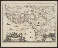
- Beinecke Rare Book and Manuscript Library > Novissima et perfectissima Africae descriptio / authore I. Danckerts.
- Creator:
- Allard, Carel, 1648-ca. 1709
- Published / Created:
- 1690]
- Call Number:
- 60 1690A
- Container / Volume:
- BRBL_00322
- Image Count:
- 1
- Resource Type:
- Maps, Atlases & Globes
- Subject (Geographic):
- Africa--Maps--Early works to 1800
- Found in:
- Beinecke Rare Book and Manuscript Library > Novissima et perfectissima Africae descriptio / ex formis Caroli Allard ; Ph. Tideman, del. ; G. v. Gouwen, sculp.
- Creator:
- Pigafetta, Filippo, 1533-1604
- Published / Created:
- 1598?]
- Call Number:
- 60 1598
- Container / Volume:
- BRBL_00321
- Image Count:
- 1
- Resource Type:
- Maps, Atlases & Globes
- Subject (Geographic):
- Africa--Maps--Early works to 1800
- Found in:
- Beinecke Rare Book and Manuscript Library > Tabulam hanc Aegypti, si aequus ac diligens lector ...
- Creator:
- Wit, Frederik de
- Published / Created:
- [1688?]
- Call Number:
- BrSides Double Folio 2019 114
- Image Count:
- 1
- Resource Type:
- Maps, Atlases & Globes
- Subject (Geographic):
- Africa--Maps--Early works to 1800.
- Found in:
- Beinecke Rare Book and Manuscript Library > Totius Africae accuratissima tabula [cartographic material] : denuo correcte revisa multis locis aucta, in partes tam maiores quam minores divisa / per F. de Witt.
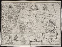
- Creator:
- Rogers, William, b. ca. 1545, engraver
- Published / Created:
- [1596?]
- Call Number:
- Taylor 216A
- Collection Title:
- John Huighen van Linschoten, his Discours of Voyages into ye Easte & West Indies
- Image Count:
- 1
- Subject (Geographic):
- Africa --Maps --Early works to 1800
- Found in:
- Beinecke Rare Book and Manuscript Library > Typus orarum maritimarum Guinae, Manicongo & Angolae ultra promontorium Bonae Spei ...
- Creator:
- Ogilby, John, 1600-1676
- Published / Created:
- 1670]
- Call Number:
- 66 1670A
- Container / Volume:
- BRBL_00347
- Image Count:
- 1
- Resource Type:
- Maps, Atlases & Globes
- Subject (Geographic):
- Africa, Central--Maps--Early works to
- Found in:
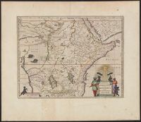
- Beinecke Rare Book and Manuscript Library > Aethiopia superior vel interior vulgo Abissinorum sive Presbiteriioannis Imperior.
- Creator:
- Blaeu, Joan, 1596-1673, creator
- Published / Created:
- [ca. 1690]
- Call Number:
- 1973 Folio 10
- Image Count:
- 1
- Resource Type:
- Maps, Atlases & Globes
- Subject (Geographic):
- Africa, Central --Maps --Early works to
- Found in:
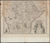
- Beinecke Rare Book and Manuscript Library > Aethiopia inferior vel exterior: partes magis Septentrionales, quae hic desiderantur, vide in tabula Aethiopiae superioris
- Creator:
- Blaeu, Joan, 1596-1673, creator
- Published / Created:
- [ca. 1690?]
- Call Number:
- 1973 Folio 10
- Image Count:
- 1
- Resource Type:
- Maps, Atlases & Globes
- Subject (Geographic):
- Africa, Central --Maps --Early works to
- Found in:
- Beinecke Rare Book and Manuscript Library > Aethiopia superior vel interior, vulgo Abissinorum sive Presbiteri Ioannis imperium
- Creator:
- Blaeu, Joan, 1596-1673
- Published / Created:
- 1635]
- Call Number:
- 62 1635
- Container / Volume:
- BRBL_00734
- Image Count:
- 2
- Resource Type:
- Maps, Atlases & Globes
- Subject (Geographic):
- Africa, Central--Maps--Early works to
- Found in:
- Beinecke Rare Book and Manuscript Library > Aethiopia svperior vel interior : vulgo Abissinorvm sive Presbiteri Ioannis imperivm.
- Creator:
- Blaeu, Joan, 1596-1673
- Published / Created:
- 1672]
- Call Number:
- 63 1662
- Container / Volume:
- BRBL_00334
- Image Count:
- 2
- Resource Type:
- Maps, Atlases & Globes
- Subject (Geographic):
- Africa, Central--Maps--Early works to
- Found in:
- Beinecke Rare Book and Manuscript Library > Aethiopia svperior vel interior, vulgo Abissinorvm sive Presbiteri Ioannis imperivm.
- Creator:
- Blaeu, Joan, 1596-1673
- Published / Created:
- 1670?]
- Call Number:
- 63 1670
- Container / Volume:
- BRBL_00334
- Image Count:
- 1
- Resource Type:
- Maps, Atlases & Globes
- Subject (Geographic):
- Africa, Central--Maps--Early works to
- Found in:
- Beinecke Rare Book and Manuscript Library > Aethiopia svperior vel interior, vulgo Abissinorvm sive Presbiteri Ioannis imperivm.
- Creator:
- Weigel, Christoph, 1654-1725, cartographer
- Published / Created:
- 1720?]
- Call Number:
- 60 1720
- Container / Volume:
- BRBL_00322
- Image Count:
- 1
- Resource Type:
- Maps, Atlases & Globes
- Subject (Geographic):
- Africa--Maps--Early works to 1800
- Found in:
- Beinecke Rare Book and Manuscript Library > Africa vetus / per Christophorum Wegelium, Normibergae, cum privilegio sac[ra] Caes[areae] Majestatis.
- Creator:
- Ogilby, John, 1600-1676
- Published / Created:
- 1670]
- Call Number:
- 655 1670A
- Container / Volume:
- BRBL_00345
- Image Count:
- 1
- Resource Type:
- Maps, Atlases & Globes
- Subject (Geographic):
- Africa, West--Maps--Early works to 1800
- Found in:
- Beinecke Rare Book and Manuscript Library > Nigritarum regio.
- Creator:
- Fries, Lorenz, ca. 1490-1531
- Published / Created:
- 1541?]
- Call Number:
- 655 1541
- Container / Volume:
- BRBL_00345
- Image Count:
- 1
- Resource Type:
- Maps, Atlases & Globes
- Subject (Geographic):
- Africa, West--Maps--Early works to 1800
- Found in:
- Beinecke Rare Book and Manuscript Library > Tabula noua partis Africae.
- Creator:
- Langren, Arnold Florent van, 1580-1644
- Published / Created:
- [1596]
- Call Number:
- Taylor 219
- Collection Title:
- Navigatio ac itinerarivm Iohannis Hvgonis Linscotani in Orientalem sive Lvsitanorvm Indiam
- Image Count:
- 1
- Subject (Geographic):
- Africa --Maps --Early works to 1800
- Found in:
- Beinecke Rare Book and Manuscript Library > Delineatio orarum maritimarum, terrae vulgo indigetatae terra do Natal ...
- Creator:
- Langren, Arnold Florent van, 1580-1644
- Published / Created:
- [1596]
- Call Number:
- Pequot +L65
- Collection Title:
- Nauigatio ac itinerarium Iohannis Hugonis Linscotani in Orientalem siue Lusitanorum Indiam
- Image Count:
- 1
- Subject (Geographic):
- Africa --Maps --Early works to 1800
- Found in:
- Beinecke Rare Book and Manuscript Library > Delineatio orarum maritimarum, terrae vulgo indigetatae terra do Natal ...
- Creator:
- Langren, Arnold Florent van, 1580-1644
- Published / Created:
- 1598
- Call Number:
- Z3 017
- Collection Title:
- ... Iohn Hvighen van Linschoten. his Discours of Voyages into ye Easte & West Indies. Deuided into
- Image Count:
- 1
- Subject (Geographic):
- Africa --Maps --Early works to 1800
- Found in:
- Beinecke Rare Book and Manuscript Library > Delineatio orarum maritimarum, terrae vulgo indigetatae terra do Natal item Sofalae, Mozambicae & Melindae, insulaeq[ue] sancti Laurentij ...
- Creator:
- Beckit, Robert, engraver
- Published / Created:
- 1598
- Call Number:
- Taylor 216A
- Collection Title:
- John Huighen van Linschoten, his Discours of Voyages into ye Easte & West Indies
- Image Count:
- 1
- Subject (Geographic):
- Africa --Maps --Early works to 1800
- Found in:
- Beinecke Rare Book and Manuscript Library > Delineatio orarum maritimarum, terrae vulgo indigitatae terra do Natal item Sofalae, Mozambicae & Melindae, insulaeq[ue] sancti Laurentij ...
- Creator:
- Hondius, Jodocus, 1563-1612, cartographer.
- Published / Created:
- [1625]
- Call Number:
- BrSides Box 2019 15
- Image Count:
- 2
- Resource Type:
- Maps, Atlases & Globes
- Subject (Geographic):
- Africa, Central--Maps--Early works to
- Found in:
- Beinecke Rare Book and Manuscript Library > Abissinorum Regnu[m].
- Creator:
- Blaeu, Willem Janszoon, 1571-1638
- Published / Created:
- between 1643 and 1650]
- Call Number:
- 64 1643
- Container / Volume:
- BRBL_00338
- Image Count:
- 2
- Resource Type:
- Maps, Atlases & Globes
- Subject (Geographic):
- Africa, Southern--Maps--Early works to
- Found in:
- Beinecke Rare Book and Manuscript Library > Aethiopia inferior vel exterior.
- Creator:
- Blaeu, Willem Janszoon, 1571-1638
- Published / Created:
- anno 1635]
- Call Number:
- 62 1635A
- Container / Volume:
- BRBL_00734
- Image Count:
- 2
- Resource Type:
- Maps, Atlases & Globes
- Subject (Geographic):
- Africa, Southern--Maps--Early works to
- Found in:
- Beinecke Rare Book and Manuscript Library > Aethiopia inferior vel exterior.
- Creator:
- Sanson, Nicolas, 1600-1667, cartographer
- Published / Created:
- 1667
- Call Number:
- 60 1667
- Container / Volume:
- BRBL_00322
- Image Count:
- 1
- Resource Type:
- Maps, Atlases & Globes
- Subject (Geographic):
- Africa--History--Maps--Early works to
- Found in:
- Beinecke Rare Book and Manuscript Library > Africa vetus / Nicolai Sanson, Christianiss. Galliar. Regis geographi ; recognita emendata et multis in locis mutata, conatibus geographicis Gulielmi Sanson N[icolai] filii.
- Creator:
- Blankaart, Nikolaas, 1624-1703
- Published / Created:
- ca. 1662]
- Call Number:
- 60 1662A
- Container / Volume:
- BRBL_00322
- Image Count:
- 1
- Resource Type:
- Maps, Atlases & Globes
- Subject (Geographic):
- Africa--History--Maps--Early works to
- Found in:
- Beinecke Rare Book and Manuscript Library > Africae antiquae, et quarundam Europae, Asiaeque adiacentium regionum / accurata delineatio ad historiarum lucem a Nicolao Blancardo, Batavo, Leidensi historiarum et politices professore.