Search
You Searched For
Search Results
- Published / Created:
- [1780]
- Call Number:
- 29cea 1780
- Container / Volume:
- BRBL_00701
- Image Count:
- 1
- Resource Type:
- Maps, Atlases & Globes
- Found in:
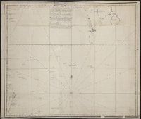
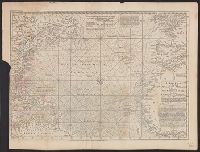
- Beinecke Rare Book and Manuscript Library > A Plane Chart of several Islands Bank Shoals & Soundings ...
- Published / Created:
- 1772
- Call Number:
- 766 L49 1772
- Container / Volume:
- BRBL_00711
- Image Count:
- 1
- Resource Type:
- Maps, Atlases & Globes
- Found in:
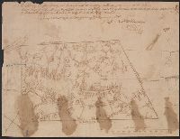
- Beinecke Rare Book and Manuscript Library > A Plan of the first Society in Lebanon with the high ways and buildings thereon with the Distance of each house from the Meeting House, also the center of said Society, said Society contains ... Nath. Webb. County Surveyor 1772.
- Published / Created:
- [1830?]
- Call Number:
- 764 ST78 1830
- Container / Volume:
- BRBL_00460
- Image Count:
- 1
- Resource Type:
- Maps, Atlases & Globes
- Found in:
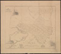
- Beinecke Rare Book and Manuscript Library > A Plan of the Town of Stow ... by Augustus Tower in 1830.
- Published / Created:
- [1800?]
- Call Number:
- 785 N423 1800
- Container / Volume:
- BRBL_00513
- Image Count:
- 1
- Resource Type:
- Maps, Atlases & Globes
- Found in:
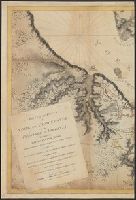
- Beinecke Rare Book and Manuscript Library > A Plan of the Town of New Bern and Dryborough ... By Jonathan Price.
- Published / Created:
- 1758
- Call Number:
- 7325 L93 1758A
- Container / Volume:
- BRBL_00709
- Image Count:
- 1
- Resource Type:
- Maps, Atlases & Globes
- Found in:
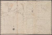
- Beinecke Rare Book and Manuscript Library > A Plan of the Town and Harbour of Louisburg ... 1758. By Lieut. Joseph Norwood.
- Published / Created:
- 1782
- Call Number:
- 783hc Y82 1782
- Container / Volume:
- BRBL_00512
- Image Count:
- 2
- Resource Type:
- Maps, Atlases & Globes
- Found in:
- Beinecke Rare Book and Manuscript Library > A Plan of the Posts of York And Gloucester in the province of Virginia, Established by his MAjesty's Army under the Command of Lieuttt. General Earl Cornwallis, together with the Attacks and operations of the American & French Forces Commanded by General
- Published / Created:
- 1745
- Call Number:
- 7325cea L93 1745
- Container / Volume:
- BRBL_00709
- Image Count:
- 1
- Resource Type:
- Maps, Atlases & Globes
- Found in:
- Beinecke Rare Book and Manuscript Library > A Plan of the Harbour and Fortifications of Louisburg. The Harbour Survey'd by Capt. Phil: Durell. The fortifications by Capt. Will: Henry Bastide. Anne. 1745.
- Published / Created:
- 1821
- Call Number:
- 764 W688 1821
- Container / Volume:
- BRBL_00710
- Image Count:
- 1
- Resource Type:
- Maps, Atlases & Globes
- Found in:
- Beinecke Rare Book and Manuscript Library > A Plan of Wilmington Taken October 1821 by Edmund Parker.
- Published / Created:
- 1776
- Call Number:
- 786cea P838 1776
- Container / Volume:
- BRBL_00516
- Image Count:
- 1
- Resource Type:
- Maps, Atlases & Globes
- Found in:
- Beinecke Rare Book and Manuscript Library > A Plan of Port Royal in South Carolina ...
- Published / Created:
- 1777
- Call Number:
- 774hc M88 1777A
- Container / Volume:
- BRBL_00714
- Image Count:
- 1
- Resource Type:
- Maps, Atlases & Globes
- Found in:
- Beinecke Rare Book and Manuscript Library > A Plan of Mud Island and Fort Mifflin with the Siege thereof, and its Evacuation the 15th of November 1777. Also Red Bank with the Shoals Banks Islands & Flats in the Extent. Drawn by Charles Blaskowitz, Captain of Guides & Pioneers.
- Published / Created:
- 1786
- Call Number:
- 326 Ed43 1786
- Container / Volume:
- BRBL_00070
- Image Count:
- 1
- Resource Type:
- Maps, Atlases & Globes
- Found in:
- Beinecke Rare Book and Manuscript Library > A Plan of Edinburgh and the country adjacent ... by John Laurie ...
- Published / Created:
- [1790]
- Call Number:
- 785cea C17 1790
- Container / Volume:
- BRBL_00715
- Image Count:
- 1
- Resource Type:
- Maps, Atlases & Globes
- Found in:
- Beinecke Rare Book and Manuscript Library > A Plan of Cape Fear River from the Bar to Brunswick. [By Robert Sayer].
- Published / Created:
- 1776
- Call Number:
- 792cea Am32 1776
- Container / Volume:
- BRBL_00519
- Image Count:
- 1
- Resource Type:
- Maps, Atlases & Globes
- Found in:
- Beinecke Rare Book and Manuscript Library > A Plan of Amelia Harbour and Barr in east Florida ...
- Published / Created:
- 1828
- Call Number:
- 38GMD 1828
- Container / Volume:
- BRBL_00171
- Image Count:
- 1
- Resource Type:
- Maps, Atlases & Globes
- Found in:
- Beinecke Rare Book and Manuscript Library > A Physical and Topographical map of France ... the post Roads & Relays ... inland Navigation &c. Pickett Sculp. J. Smith Delin.
- Published / Created:
- 1790
- Call Number:
- 755 1790A
- Container / Volume:
- BRBL_00435
- Image Count:
- 1
- Resource Type:
- Maps, Atlases & Globes
- Found in:
- Beinecke Rare Book and Manuscript Library > A Particular Map of the American Lakes, Rivers, &c. Par le Sr. D'Anville. Drawn & Engraved for John Harrison.
- Published / Created:
- 1711
- Call Number:
- 764 B65 1711
- Container / Volume:
- BRBL_00710
- Image Count:
- 1
- Resource Type:
- Maps, Atlases & Globes
- Found in:
- Beinecke Rare Book and Manuscript Library > A New plan of the Harbour of Boston in New England. Lat. 42, 29 North. Long. 71 West. Surveyed by Order of the Commissioners of her Majesty's Navy.
- Published / Created:
- 1793
- Call Number:
- 304gmd 1793
- Container / Volume:
- BRBL_00034B
- Image Count:
- 1
- Resource Type:
- Maps, Atlases & Globes
- Found in:
- Beinecke Rare Book and Manuscript Library > A New map of the Emperor's Dominions exhibiting the Post Roads of Germany, Hungary, and the Netherlands ... parts of France, Italy, Switzerland and Poland ...
- Published / Created:
- 1811
- Call Number:
- 319 1811
- Container / Volume:
- BRBL_00040
- Image Count:
- 1
- Resource Type:
- Maps, Atlases & Globes
- Found in:
- Beinecke Rare Book and Manuscript Library > A New map of the British Isles ... By John Cary, Engraver.
- Published / Created:
- 1743
- Call Number:
- 319 1743
- Container / Volume:
- BRBL_00040
- Image Count:
- 1
- Resource Type:
- Maps, Atlases & Globes
- Found in:
- Beinecke Rare Book and Manuscript Library > A New and exact map of Great Britain ... [Including Ireland].
- Published / Created:
- 1794
- Call Number:
- 303cea 1794
- Container / Volume:
- BRBL_00033
- Image Count:
- 1
- Resource Type:
- Maps, Atlases & Globes
- Found in:
- Beinecke Rare Book and Manuscript Library > A New and Correct chart of the Gulf of Finland ... Published by command of the Empress of all the Russias.
- Published / Created:
- [1764?]
- Call Number:
- 76cea 1764
- Container / Volume:
- BRBL_00446
- Image Count:
- 1
- Resource Type:
- Maps, Atlases & Globes
- Found in:
- Beinecke Rare Book and Manuscript Library > A New and Correct Chart of the Sea Coast of New-England, from Cape Codd to Casco Bay. Lately Surbey'd by Capt. Henry Barnsley.
- Published / Created:
- 1794
- Call Number:
- 755cea 1794
- Container / Volume:
- BRBL_00441
- Image Count:
- 4
- Resource Type:
- Maps, Atlases & Globes
- Found in:
- Beinecke Rare Book and Manuscript Library > A New and Correct Chart of the Coast of New England and New York with the adjacent parts of Nova Scotia and New Brunswick from Cape Sable to the entrance of Hudsons or North River by Captain Holland.
- Published / Created:
- 1770?]
- Call Number:
- 501 1770
- Container / Volume:
- BRBL_00275
- Image Count:
- 1
- Resource Type:
- Maps, Atlases & Globes
- Found in:
- Beinecke Rare Book and Manuscript Library > A New and Accurate Map of Anatolia or Asia Minor with Syria and such other Provinces of the Turkish Empire as border thereupon ... By Eman. Bowen.
- Published / Created:
- [ca. 1789]
- Call Number:
- 6555cea 1789
- Container / Volume:
- BRBL_00708
- Image Count:
- 3
- Resource Type:
- Maps, Atlases & Globes
- Found in:
- Beinecke Rare Book and Manuscript Library > A New Survey of that part of the Coast of Africa comprised between Cape Verga and Cape Formoso, including chiefly the Windward and Gold Coasts in which the Latitudes of all the Principal Places are determined by Actual observations, the bearings and cours
- Published / Created:
- [1749?]
- Call Number:
- 7855 1749
- Container / Volume:
- BRBL_00515
- Image Count:
- 1
- Resource Type:
- Maps, Atlases & Globes
- Found in:
- Beinecke Rare Book and Manuscript Library > A New Mapp of Carolina By John Thornton at ye Platt in ye Minories And Will: Fisher at ye Postorn Gate on Towerhill, London.
- Published / Created:
- 1704
- Call Number:
- 1973 Folio 70
- Collection Title:
- A new sett of maps, both of antient and present geography ... Together with a Geographical treatise
- Image Count:
- 1
- Resource Type:
- Maps, Atlases & Globes
- Found in:
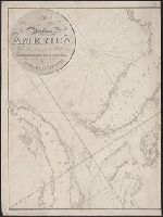
- Beinecke Rare Book and Manuscript Library > A New Map of the Most Considerable Plantations of the English in America. Dedicated to His Highness William Duke of Glocester
- Published / Created:
- 1701]
- Call Number:
- 51 1701
- Container / Volume:
- BRBL_00278
- Image Count:
- 1
- Resource Type:
- Maps, Atlases & Globes
- Found in:
- Beinecke Rare Book and Manuscript Library > A New Map of the Land of Canaan ...
- Published / Created:
- 1794
- Call Number:
- 534 1794
- Container / Volume:
- BRBL_00289
- Image Count:
- 1
- Resource Type:
- Maps, Atlases & Globes
- Found in:
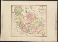
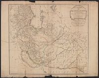
- Beinecke Rare Book and Manuscript Library > A New Map of the Empire of Persia from Monsr. DAnville ... with several Additions and Emendations.
- Published / Created:
- 1794
- Call Number:
- 534 1794
- Container / Volume:
- BRBL_00289
- Image Count:
- 1
- Resource Type:
- Maps, Atlases & Globes
- Found in:
- Beinecke Rare Book and Manuscript Library > A New Map of the Empire of Persia from Monsr. DAnville ... with several Additions and Emendations.
- Published / Created:
- 1701
- Call Number:
- 501 1701
- Container / Volume:
- BRBL_00275
- Image Count:
- 1
- Resource Type:
- Maps, Atlases & Globes
- Found in:
- Beinecke Rare Book and Manuscript Library > A New Map of the Eastern Parts of Asia Minor ...
- Published / Created:
- 1801
- Call Number:
- 27 1801
- Container / Volume:
- BRBL_00023A
- Image Count:
- 1
- Resource Type:
- Maps, Atlases & Globes
- Found in:
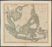
- Beinecke Rare Book and Manuscript Library > A New Map of the East India Isles. From the Latest Authorities. By John Cary, Engraver.
- Published / Created:
- 1811
- Call Number:
- 27 1811
- Container / Volume:
- BRBL_00023A
- Image Count:
- 1
- Resource Type:
- Maps, Atlases & Globes
- Found in:
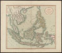
- Beinecke Rare Book and Manuscript Library > A New Map of the East India Isles ... John Cary, Engraver.
- Published / Created:
- 1801
- Call Number:
- 501 1801
- Container / Volume:
- BRBL_00276
- Image Count:
- 1
- Resource Type:
- Maps, Atlases & Globes
- Found in:
- Beinecke Rare Book and Manuscript Library > A New Map of Turkey in Asia divided into its provinces, from the best authorities. By John Cary, Engraver.
- Published / Created:
- 1704
- Call Number:
- 1973 Folio 70
- Collection Title:
- A new sett of maps, both of antient and present geography ... Together with a Geographical treatise
- Image Count:
- 1
- Resource Type:
- Maps, Atlases & Globes
- Found in:
- Beinecke Rare Book and Manuscript Library > A New Map of South America; Shewing its General Divisions, Chief Cities, Towns; Rivers, Mountains &c. Dedicated to His Highness William Duke of Gloucester
- Published / Created:
- [1795?]
- Call Number:
- 90 1795
- Container / Volume:
- BRBL_00661
- Image Count:
- 1
- Resource Type:
- Maps, Atlases & Globes
- Found in:
- Beinecke Rare Book and Manuscript Library > A New Map of South America ....
- Published / Created:
- 1811
- Call Number:
- 3251 1811
- Container / Volume:
- BRBL_00067
- Image Count:
- 1
- Resource Type:
- Maps, Atlases & Globes
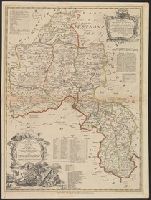
- Found in:
- Beinecke Rare Book and Manuscript Library > A New Map of Rutlandshire, Divided into Hundreds ... By John Cary.
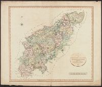
- Published / Created:
- 1811
- Call Number:
- 3247 1811
- Container / Volume:
- BRBL_00066
- Image Count:
- 1
- Resource Type:
- Maps, Atlases & Globes
- Found in:
- Beinecke Rare Book and Manuscript Library > A New Map of Northamptonshire, Divided Into Hundreds ... by John Cary.
- Published / Created:
- 1704
- Call Number:
- 1973 Folio 70
- Collection Title:
- A new sett of maps, both of antient and present geography ... Together with a Geographical treatise
- Image Count:
- 1
- Resource Type:
- Maps, Atlases & Globes
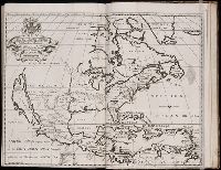
- Found in:
- Beinecke Rare Book and Manuscript Library > A New Map of North America Shewing its Principal Divisions, Chief Cities, Townes, Rivers, Mountains &c. Dedicated to His Highness William Duke of Glocester
- Published / Created:
- 1803
- Call Number:
- 85 1803C
- Container / Volume:
- BRBL_00637
- Image Count:
- 1
- Resource Type:
- Maps, Atlases & Globes
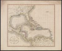
- Found in:
- Beinecke Rare Book and Manuscript Library > A New MAp of the West India Isles, from the latest authorities.
- Published / Created:
- 1750
- Call Number:
- 3218 1750A
- Container / Volume:
- BRBL_00057
- Image Count:
- 1
- Resource Type:
- Maps, Atlases & Globes
- Found in:
- Beinecke Rare Book and Manuscript Library > A New Improved Map of Oxfordshire ... Thos. Kitchin ... 1750.
- Published / Created:
- 1792
- Call Number:
- 326 1792
- Container / Volume:
- BRBL_00069
- Image Count:
- 1
- Resource Type:
- Maps, Atlases & Globes
- Found in:
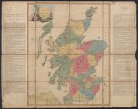
- Beinecke Rare Book and Manuscript Library > A New Geographical Game exhibiting a complete Tour through Scotland and the Western Isles. Neele Sc.
- Published / Created:
- 1831
- Call Number:
- 911cea 1831
- Container / Volume:
- BRBL_00670
- Image Count:
- 1
- Resource Type:
- Maps, Atlases & Globes
- Found in:
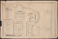
- Beinecke Rare Book and Manuscript Library > A New General Chart of the Coast of Brazil ... order of the Portuguese Government ... by Joseph Foss Dessiou ... London by W. Faden ... 1818.
- Published / Created:
- 1794
- Call Number:
- 11 1794A
- Container / Volume:
- BRBL_00006
- Image Count:
- 1
- Resource Type:
- Maps, Atlases & Globes
- Found in:
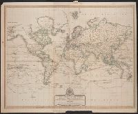
- Beinecke Rare Book and Manuscript Library > A New Chart of the World ... with the tracks of the British Circumnavigators Bryon, Wallis, Carteret and Cook, &c.
- Published / Created:
- 1755
- Call Number:
- 21 1755
- Container / Volume:
- BRBL_00014
- Image Count:
- 1
- Resource Type:
- Maps, Atlases & Globes
- Found in:
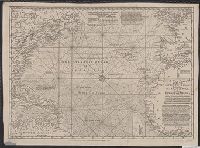
- Beinecke Rare Book and Manuscript Library > A New Chart of the Vast Atlantic Ocean; Exhibiting the Seat of War, both in Europe and America ...
- Published / Created:
- 1755
- Call Number:
- 21 1755
- Container / Volume:
- BRBL_00014
- Image Count:
- 1
- Resource Type:
- Maps, Atlases & Globes
- Found in:
- Beinecke Rare Book and Manuscript Library > A New Chart of the Vast Atlantic Ocean; Exhibiting the Seat of War, both in Europe and America ...
- Published / Created:
- 1798
- Call Number:
- 27cea 1798
- Container / Volume:
- BRBL_00700
- Image Count:
- 1
- Resource Type:
- Maps, Atlases & Globes
- Found in:
- Beinecke Rare Book and Manuscript Library > A New Chart of the Eastern Straits or the Straits of the East of Java, with a part of the Banda Sea; corrected and improved chiefly from the observation of Captn. - Williams.
- Published / Created:
- [1821?]
- Call Number:
- 7645cea 1821
- Container / Volume:
- BRBL_00463
- Image Count:
- 1
- Resource Type:
- Maps, Atlases & Globes
- Found in:
- Beinecke Rare Book and Manuscript Library > A New Chart of Nantucket Shoals & George's Bank with the adjacent coast drawn from the latest authorities. 2nd Edition. By Samuel Lambert. Salem. Cushing, Appleton & S. Lambert, of the State of Mass. Corrected June 1821.
- Published / Created:
- 1818
- Call Number:
- 755cea 1818
- Container / Volume:
- BRBL_00442
- Image Count:
- 4
- Resource Type:
- Maps, Atlases & Globes
- Found in:
- Beinecke Rare Book and Manuscript Library > A New Chart of America, by Robt. Blachford. To His Excellency James Monroe ...
- Published / Created:
- [1780]
- Call Number:
- 32 L84 1780
- Container / Volume:
- BRBL_00048
- Image Count:
- 1
- Resource Type:
- Maps, Atlases & Globes
- Found in:
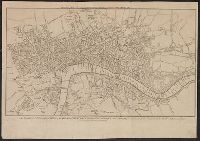
- Beinecke Rare Book and Manuscript Library > A New & Correct Plan of the Cities of London and Westminister, with the Borough of Southwark ...
- Published / Created:
- [1790?]
- Call Number:
- 3191 1790A
- Container / Volume:
- BRBL_00041
- Image Count:
- 1
- Resource Type:
- Maps, Atlases & Globes
- Found in:
- Beinecke Rare Book and Manuscript Library > A New & Correct Map of Six Hundred Miles around London, with the Roads & Post Miles in England, Ireland & Scotland, and the Post Leagues in France.