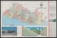
Morgan, Nicholas G. (Nicholas Groesbeck), 1884-1971
Published / Created:
195-?]
Call Number:
836 Sa37 1856
Container / Volume:
BRBL_00592
Image Count:
1
Resource Type:
Maps, Atlases & Globes
Description:
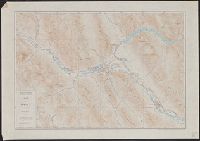
"This drawing is compiled from Pioneer maps and records and government plats. It is based upon official plats ... dated September 10, 1856. ... Courses of the various streams ... were not accurate on the 1856 plats. These are located here as shown upon a map ... dated August 27, 1867, compiled by Jesse Fox .... The present-day landmarks ... are located from modern maps."
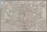
Also shows streetcar routes., Indexed., Ms notes in ink to indicate "historic annexations.", and Oriented with north toward the upper right.
Publisher:
H.W. Gross,
Subject (Geographic):
Saint Louis (Mo.)--Maps and Saint Louis Metropolitan Area (Mo.)--Maps
Subject (Topic):
Roads--Missouri--Saint Louis Metropolitan Area--Maps, Street-railroads--Missouri--Saint Louis Metropolitan Area--Maps, Street-railroads--Missouri--Saint Louis--Maps, and Streets--Missouri--Saint Louis--Maps
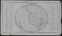
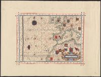
Annotated in pencil: One of the facsimiles made by J.H. Wright of Dallas, Texas. Rec'd April 24 1944., Facsimile., Includes list of land districts, counties, and county towns., and Relief shown by hachures.
Publisher:
J.H. Wright,
Subject (Geographic):
Maps--Facsimiles, Texas--Administrative and political divisions--Maps, and Texas--Maps--Facsimiles
Subject (Name):
R.B. Moody & Co, Smith, Edward, 1818?-1874. Account of a journey through north-eastern Texas, undertaken in 1849, for the purposes of emigration, Streeter, Thomas W.--(Thomas Winthrop),--1883-1965--Ownership, and Wright, J. H.
Includes text advertising real estate services by C.H. Anderson, Pierre, S.D., Library's copy stamped in bottom margin: Burg Brown, Att'y, Corning, Iowa., Prime meridians: Greenwich and Washington., and Shows counties, railroads, and drainage.
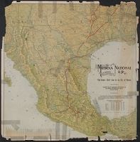
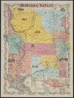
Map of the territory acquired from Mexico by the Gadsden Treaty, 1854.
Description:
Covers Nebraska extending to the Canadian border and westward to Oregon and Kansas including present day Colorado., Includes ill. and insets of United States and "Map of the territory acquired from Mexico by the Gadsden Treaty, 1854.", and Relief shown by hachures.
Publisher:
s.n.,
Subject (Geographic):
Kansas--Maps, Nebraska--Maps, and West (U.S.)--Maps