Search
You Searched For
Search Results
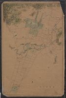
- Creator:
- United States. War Department. Corps of Engineers, cartographer, publisher
- Published / Created:
- [1875?]
- Call Number:
- 831 1875
- Image Count:
- 1
- Resource Type:
- cartographic image
- Found in:
- Beinecke Rare Book and Manuscript Library > Montana Territory
- Creator:
- Mitchell, Donald Grant, 1822-1908, cartographer
- Published / Created:
- [not before 1876]
- Call Number:
- Manuscript 766 N46 1870E
- Image Count:
- 1
- Resource Type:
- cartographic image
- Found in:
- Beinecke Rare Book and Manuscript Library > Manuscript map of New Haven Green to Edgewood by Donald G. Mitchell
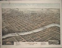
- Creator:
- Morse, D. D., artist
- Published / Created:
- ©1880.
- Call Number:
- BrSides Zc39 880mo
- Image Count:
- 1
- Resource Type:
- cartographic image
- Found in:
- Beinecke Rare Book and Manuscript Library > Bird's eye view of Lawrence, Kansas, 1880 [cartographic material]
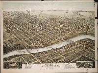
- Creator:
- Morse, D. D., artist
- Published / Created:
- ©1880.
- Call Number:
- BrSides Zc39 880mo
- Image Count:
- 1
- Resource Type:
- cartographic image
- Found in:
- Beinecke Rare Book and Manuscript Library > Bird's eye view of Lawrence, Kansas, 1880 [cartographic material]
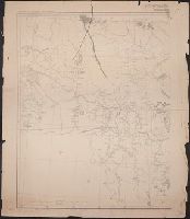
- Creator:
- United States. War Department. Corps of Engineers, cartographer, publisher
- Published / Created:
- [1881]
- Call Number:
- 831 1881A
- Image Count:
- 2
- Resource Type:
- cartographic image
- Found in:
- Beinecke Rare Book and Manuscript Library > Montana Territory
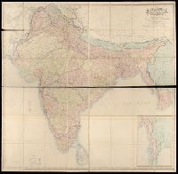
- Creator:
- Walker, John, 1786-1873, cartographer
- Published / Created:
- 1882.
- Call Number:
- Covers 59 +1882
- Image Count:
- 2
- Resource Type:
- cartographic image
- Found in:
- Beinecke Rare Book and Manuscript Library > Map of India : shewing the British territories, subdivided into collectorates and including British Burmah, with the position and boundary of each native state
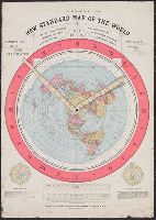
- Published / Created:
- 1892.
- Call Number:
- 11 1892
- Image Count:
- 2
- Resource Type:
- cartographic image
- Found in:
- Beinecke Rare Book and Manuscript Library > Gleason's new standard map of the world : on the projection of J.S. Christopher, Modern College, Blackheath, England ; scientifically and practically correct ; as "it is."
- Creator:
- United States. General Land Office
- Published / Created:
- [1908]
- Call Number:
- BrSides Zc35 908un
- Image Count:
- 2
- Resource Type:
- cartographic image
- Found in:
- Beinecke Rare Book and Manuscript Library > Sectionized map of Cheyenne River and Standing Rock Indian Reservation opened by act of May 29, 1908 [cartographic material]
- Published / Created:
- [between 1910 and 1920]
- Call Number:
- BrSides Zc72 910cu
- Image Count:
- 2
- Resource Type:
- cartographic image
- Found in:
- Beinecke Rare Book and Manuscript Library > Cragmont
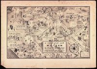
- Creator:
- Campbell, E. Simms (Elmer Simms), 1906-1971, creator
- Call Number:
- BrSides Double Folio 2016 34
- Image Count:
- 1
- Resource Type:
- cartographic image
- Found in:
- Beinecke Rare Book and Manuscript Library > A night-club map of Harlem : the stars indicate the places that are open all night, the only important omission is the location of the various speakeasies but since there are about 500 of them you won't have much trouble