Search
You Searched For
Search Results
- Creator:
- Jacobsz, Theunis, 1632?-1679
- Published / Created:
- [1666?]
- Call Number:
- BrSides Folio 2019 84
- Image Count:
- 1
- Resource Type:
- Maps, Atlases & Globes
- Found in:
- Beinecke Rare Book and Manuscript Library > Pascaarte van t'westlyckste deel vande Middelandsche Zee : waer in vertoont wort de ware gelegenheden van alle rivieren, havens, capen, droogten ende bayen alles synde op hare streckingen en distantien geleyt.
- Creator:
- Comberford, Nicholas, -1673, cartographer.
- Published / Created:
- [1647]
- Call Number:
- 49 1647
- Image Count:
- 2
- Resource Type:
- Maps, Atlases & Globes
- Found in:
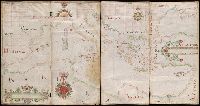
- Beinecke Rare Book and Manuscript Library > Portolan chart of the Mediterranean Sea, the Black Sea, and the northern coast of Africa.
- Creator:
- Aguilar, Jorge de.
- Published / Created:
- no anno dominus nostris Jh[es]u Xpi de 1492.
- Call Number:
- Art Storage 30cea 1492
- Image Count:
- 2
- Resource Type:
- Maps, Atlases & Globes
- Found in:
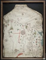
- Beinecke Rare Book and Manuscript Library > Portolan chart of the Mediterranean Sea, the North Atlantic Ocean, the Black Sea, and the West African coast as far south as Sierra Leone.
- Creator:
- Abenzara, Judah.
- Published / Created:
- [1505]
- Call Number:
- Art Storage 30cea 1505
- Image Count:
- 2
- Resource Type:
- Maps, Atlases & Globes
- Found in:
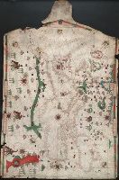
- Beinecke Rare Book and Manuscript Library > Portolan chart of the Mediterranean Sea, the North Atlantic Ocean, the Black Sea, and the northwestern African coast.
- Creator:
- Becharius, Franciscus.
- Published / Created:
- [1403]
- Call Number:
- Art Storage 1980 158
- Image Count:
- 2
- Resource Type:
- Maps, Atlases & Globes
- Found in:
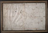
- Beinecke Rare Book and Manuscript Library > Portolan chart of the Mediterranean Sea, the North Atlantic Ocean, the Black Sea, and the northwestern African coast.
- Published / Created:
- [approximately 1600?]
- Call Number:
- Art Storage 986
- Image Count:
- 2
- Resource Type:
- Maps, Atlases & Globes
- Found in:
- Beinecke Rare Book and Manuscript Library > Portolan chart of the Mediterranean Sea.
- Creator:
- Villarroel, Domingo, cartographer.
- Call Number:
- Manuscript 49 1577
- Image Count:
- 2
- Resource Type:
- Maps, Atlases & Globes
- Found in:
- Beinecke Rare Book and Manuscript Library > Portolan chart of the Mediterranean and Black Seas.
- Creator:
- Oliva, Joan, active 1580-1615, cartographer.
- Published / Created:
- [approximately 1587]
- Call Number:
- Art Storage 49cea 1587
- Image Count:
- 2
- Resource Type:
- Maps, Atlases & Globes
- Found in:
- Beinecke Rare Book and Manuscript Library > [Portolan chart of the Mediterranean Sea and the Baltic Sea].
- Creator:
- Maggiolo, Vesconte, active 1504-1549.
- Call Number:
- Art Storage 1980 156
- Image Count:
- 2
- Resource Type:
- Maps, Atlases & Globes
- Found in:
- Beinecke Rare Book and Manuscript Library > [Portolan chart of the Mediterranean Sea, the North Atlantic Ocean, the Baltic Sea, and the West African coast].
- Creator:
- Oliva, Joan, active 1580-1615.
- Published / Created:
- 1563
- Call Number:
- Art Storage 30cea 1563
- Image Count:
- 2
- Resource Type:
- Maps, Atlases & Globes
- Found in:
- Beinecke Rare Book and Manuscript Library > [Portolan chart of the Mediterranean Sea, the North Atlantic Ocean, the Baltic Sea, and the northwestern African coast].