Search
You Searched For
Search Results
- Creator:
- Keulen, Gerard van.
- Published / Created:
- [ca. 1720?]
- Call Number:
- 1973 Folio 18
- Image Count:
- 1
- Resource Type:
- Maps, Atlases & Globes
- Found in:
- Beinecke Rare Book and Manuscript Library > Nieuwe en nette afteekening van het eyland of Koninkryk Sardinia vertoonende alle desselfs zee havenen anker plaetsen rivieren dieptens klippen steeden en vastigheeen als mede de Straet van Bonifacio aent eyland Corsica [cartographic material] / J. Keyser sculp.
- Creator:
- Jacobsz, Theunis, 1632?-1679
- Published / Created:
- [1666?]
- Call Number:
- BrSides Folio 2019 84
- Image Count:
- 1
- Resource Type:
- Maps, Atlases & Globes
- Found in:
- Beinecke Rare Book and Manuscript Library > Pascaarte van t'westlyckste deel vande Middelandsche Zee : waer in vertoont wort de ware gelegenheden van alle rivieren, havens, capen, droogten ende bayen alles synde op hare streckingen en distantien geleyt.
- Creator:
- Comberford, Nicholas, -1673, cartographer.
- Published / Created:
- [1647]
- Call Number:
- 49 1647
- Image Count:
- 2
- Resource Type:
- Maps, Atlases & Globes
- Found in:
- Beinecke Rare Book and Manuscript Library > Portolan chart of the Mediterranean Sea, the Black Sea, and the northern coast of Africa.
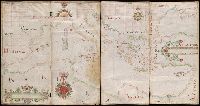
- Creator:
- Aguilar, Jorge de.
- Published / Created:
- no anno dominus nostris Jh[es]u Xpi de 1492.
- Call Number:
- Art Storage 30cea 1492
- Image Count:
- 2
- Resource Type:
- Maps, Atlases & Globes
- Found in:
- Beinecke Rare Book and Manuscript Library > Portolan chart of the Mediterranean Sea, the North Atlantic Ocean, the Black Sea, and the West African coast as far south as Sierra Leone.
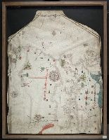
- Creator:
- Abenzara, Judah.
- Published / Created:
- [1505]
- Call Number:
- Art Storage 30cea 1505
- Image Count:
- 2
- Resource Type:
- Maps, Atlases & Globes
- Found in:
- Beinecke Rare Book and Manuscript Library > Portolan chart of the Mediterranean Sea, the North Atlantic Ocean, the Black Sea, and the northwestern African coast.
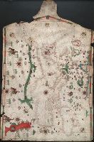
- Creator:
- Becharius, Franciscus.
- Published / Created:
- [1403]
- Call Number:
- Art Storage 1980 158
- Image Count:
- 2
- Resource Type:
- Maps, Atlases & Globes
- Found in:
- Beinecke Rare Book and Manuscript Library > Portolan chart of the Mediterranean Sea, the North Atlantic Ocean, the Black Sea, and the northwestern African coast.
- Published / Created:
- [approximately 1600?]
- Call Number:
- Art Storage 986
- Image Count:
- 2
- Resource Type:
- Maps, Atlases & Globes
- Found in:
- Beinecke Rare Book and Manuscript Library > Portolan chart of the Mediterranean Sea.
- Creator:
- Villarroel, Domingo, cartographer.
- Call Number:
- Manuscript 49 1577
- Image Count:
- 2
- Resource Type:
- Maps, Atlases & Globes
- Found in:
- Beinecke Rare Book and Manuscript Library > Portolan chart of the Mediterranean and Black Seas.
- Creator:
- Oliva, Joan, active 1580-1615, cartographer.
- Published / Created:
- [approximately 1587]
- Call Number:
- Art Storage 49cea 1587
- Image Count:
- 2
- Resource Type:
- Maps, Atlases & Globes
- Found in:
- Beinecke Rare Book and Manuscript Library > [Portolan chart of the Mediterranean Sea and the Baltic Sea].
- Creator:
- Doran, Edmund.
- Published / Created:
- 1586
- Call Number:
- Art Storage 30cea 1586
- Image Count:
- 2
- Resource Type:
- Maps, Atlases & Globes
- Found in:
- Beinecke Rare Book and Manuscript Library > [Portolan chart of the Mediterranean Sea, the North Atlantic Ocean, the Baltic Sea, and the northwestern African coast].