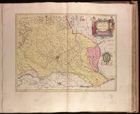
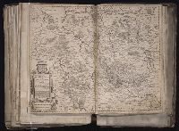
Bar scale given in "miglia sette.", Relief shown pictorially., and Sheet printed from cracked plate. Backed with paper. Ms. no. "72" in upper right corner. Sheet measures 53.7 x 62.6 cm. No. 67 of 87 maps bound together.
Publisher:
Joan Blaeu,
Subject (Geographic):
Parma (Italy : Province)--Maps--Early works to 1800. and Piacenza (Italy : Province)--Maps--Early works to 1800.
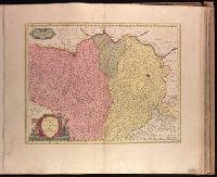
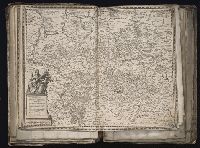
Bar scale given in "miglia sette.", Decorative cartouche., In Latin on verso, with running title "Ducatus Parma et Placentia," paginated 29, with signature 2A., Relief shown pictorially., and Stamp on verso: Karpinski-von Wieser Map Collection.
Publisher:
Blaeu,
Subject (Geographic):
Parma (Italy : Province)--Maps--Early works to 1800 and Piacenza (Italy : Province)--Maps--Early works to 1800
Backed with paper. Ms. no. "73" in upper right corner. Sheet measures 53.6 x 63.0 cm. No. 68 of 87 maps bound together., Bar scale given in "miglia sette d'Italia.", and Relief shown pictorially.
Publisher:
Joan Blaeu,
Subject (Geographic):
Milan (Italy : Province)--Maps--Early works to 1800.
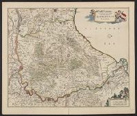
[Atlas factice of 96 maps by Blaeu, Visscher, Jansson, Hondius and others]
Image Count:
1
Description:
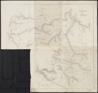
Imperfect: torn and mutilated along fold, with some loss of text; edges reinforced with ms. waste. Sheet measures 41.0 x 51.8 cm. No. 73 of 92 maps bound together. and Numbered 79 [and 74, cancelled] on verso.
Publisher:
Joan and Cornelis Blaeu
Subject (Geographic):
Lower Saxony (Germany) --Maps --Early works to 1800
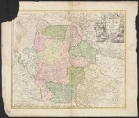
[Atlas factice of 96 maps by Blaeu, Visscher, Jansson, Hondius and others]
Image Count:
1
Description:
Imperfect: torn and mutilated along fold and edges, partially repaired, with some loss of text. Sheet measures 41.8 x 52.6 cm. No. 11 of 92 maps bound together.
Publisher:
C.J. Visscher excudit
Subject (Geographic):
Lower Saxony (Germany) --Maps --Early works to 1800