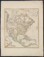
"Ergänzt und nach den neuern Entdeckungen der Hrn. Lewis Clarke u: Pike vervollstandigt.", Includes inset of "Nordwestlichster Theil von Nord America.", Relief shown by hachures., and Yale's copy stamped on backing: Yale University Library, Karpinski-Von Wieser
Colors used to represent United States and colonial possessions of England, Germany, Spain, France, Holland, Denmark and Sweden., Has watermarks., Prime meridian: Paris., and Relief shown by hachures.
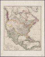
Appears in Carey's Complete historical chronological, and geographical American atlas. Philadelphia, Pa. : H.C. Carey & I. Lea, 1822., Historical and descriptive text in margin., North America -- South America., and Relief shown pictorially.
Publisher:
H.C. Carey & I. Lea,
Subject (Geographic):
North America--Maps and South America--Maps
Subject (Name):
Carey & Lea, Carey, Henry Charles, 1793-1879. A complete historical, chronological, and geographical American atlas, Lea, Isaac, 1792-1886, and Young & Delleker
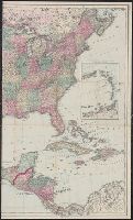
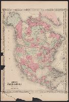
Appears in Johnson's New illustrated family atlas .... 1866., Numbers in right margin: 15, 16., On verso: Geographical index, or ready reference, [p.] 27, 28., Prime meridians: Washington and Greenwich., and Relief shown by hachures.
Publisher:
A.J. Johnson?,
Subject (Geographic):
North America--Maps
Subject (Name):
Johnson, A. J. (Alvin Jewett), 1827-1884. Johnson's New illustrated family atlas of the world
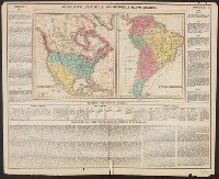
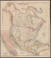
Includes tables of distances for overland routes and sea routes., Inset: Map of the gold region California. Scale [ca. 1:4,752,000]., Prime meridian: Washington, D.C., and Relief shown by hachures.
Includes tables of distances for overland routes and sea routes., Inset map: Map of the gold region, California., Prime meridian: Washington, D.C., and Relief shown by hachures.