Search
You Searched For
Search Results
- Creator:
- Maury, Matthew Fontaine, 1806-1873
- Published / Created:
- 1850
- Call Number:
- 11cfk 1850D-1
- Container / Volume:
- BRBL_00773
- Image Count:
- 1
- Resource Type:
- Maps, Atlases & Globes
- Found in:
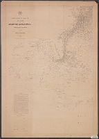
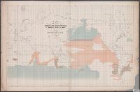
- Beinecke Rare Book and Manuscript Library > Wind and current chart of the North Atlantic [cartographic material] : thermal sheet / by M.F. Maury, A.M. Lieut. U.S. Navy, Superint'dt. of U.S.N. Observatory ; compiled from materials in the Bureau of Ordnance and Hydrography, Commodore Lewis Warrington, Chief of Bureau ; drawn by Lt. Benjn. S. Gantt, U.S.N.
- Creator:
- Maury, Matthew Fontaine, 1806-1873
- Published / Created:
- 1853
- Call Number:
- 11cfk 1850E-1
- Container / Volume:
- BRBL_00774
- Image Count:
- 1
- Resource Type:
- Maps, Atlases & Globes
- Found in:
- Beinecke Rare Book and Manuscript Library > Storm and rain chart of the North Atlantic [cartographic material] / by M.F. Maury, L.L.D. Lieut. U.S. Navy, Superin'dt of U.S.N. Observatory, Washington ; compiled from materials in the Bureau of Ordnance and Hydrography by Lieuts. George Minor, William H. Ball, & W. Rodgers Taylor, U.S. Navy ; eng. by Sherman & Smith N.Y.
- Creator:
- Maury, Matthew Fontaine, 1806-1873
- Published / Created:
- 1860
- Call Number:
- 11cfk 1850E-3
- Container / Volume:
- BRBL_00774
- Image Count:
- 1
- Resource Type:
- Maps, Atlases & Globes
- Found in:
- Beinecke Rare Book and Manuscript Library > Storm and rain chart of the North Pacific. Sheet 1 / by M.F. Maury, L.L.D. Commander U.S. Navy, Superin'd't of U.S.N. Observatory, Washington ; compiled from materials in the Bureau of Ordnance and Hydrography by Lieuts. James D. Johnston and A.F. Warley, U.S. Navy [cartographic material].
- Creator:
- Maury, Matthew Fontaine, 1806-1873
- Published / Created:
- 1855
- Call Number:
- 11cfk 1850C-11
- Container / Volume:
- BRBL_00772
- Image Count:
- 1
- Resource Type:
- Maps, Atlases & Globes
- Found in:
- Beinecke Rare Book and Manuscript Library > Pilot chart of the north Indian Ocean [cartographic material] / by M.F. Maury, L.L.D. Lieut. U.S. Navy, Superin'dt. of U.S.N. Observatory ; compiled from materials in the Bureau of Ordnance and Hydrography by Lieuts. W.B. Fitzgerald & Wm. C. West, U.S.N, Commodore Charles Morris, Chief of Bureau.
- Creator:
- Maury, Matthew Fontaine, 1806-1873
- Published / Created:
- 1853
- Call Number:
- 11DB 1851A-2
- Container / Volume:
- BRBL_00774
- Image Count:
- 1
- Resource Type:
- Maps, Atlases & Globes
- Found in:
- Beinecke Rare Book and Manuscript Library > A chart showing the favorite resort of the sperm and right whale [cartographic material] / by M.F. Maury L.L.D. Lieut. U.S. Navy ; constructed from Maury's whale chart of the world by Robt. H. Wyman Lieut. U.S.N.
- Creator:
- Maury, Matthew Fontaine, 1806-1873
- Published / Created:
- [1847?]-1853.
- Call Number:
- 11cfk 1850A-3
- Container / Volume:
- BRBL_00768
- Image Count:
- 1
- Resource Type:
- Maps, Atlases & Globes
- Found in:
- Beinecke Rare Book and Manuscript Library > Wind and current chart of the South Atlantic [cartographic material] / by M.F. Maury, L.L.D.U.S. Navy, Superindt. of U.S.N. Observatory ; compiled from materials in the Bureau of Ordnance and Hydrography, Commodore Charles Morris, Chief of Bureau.
- Creator:
- Maury, Matthew Fontaine, 1806-1873
- Published / Created:
- 1854
- Call Number:
- 11cfk 1850C-8
- Container / Volume:
- BRBL_00772
- Image Count:
- 1
- Resource Type:
- Maps, Atlases & Globes
- Found in:
- Beinecke Rare Book and Manuscript Library > Pilot chart of the coast of Brazil [cartographic material] / by Lieut. M.F. Maury, U.S. Navy, National Observatory ; eng. by Sherman & Smith.
- Creator:
- Maury, Matthew Fontaine, 1806-1873
- Published / Created:
- 1849-[1856?]
- Call Number:
- 11cfk 1850A-1
- Container / Volume:
- BRBL_00767
- Image Count:
- 2
- Resource Type:
- Maps, Atlases & Globes
- Found in:
- Beinecke Rare Book and Manuscript Library > Wind and current chart of the North Pacific [cartographic material] / by M.F. Maury, A.M. Lieut. U.S. Navy, Superint'dt. of U.S.N. Observatory ; compiled from materials in the Bureau of Ordnance and Hydrography, Commodore Lewis Warrington ; drawn by P.M. Lardner Gibbon, U.S.N. ; tracks projected by Lieut. A.W. Johnson, U.S. Navy.
- Creator:
- Maury, Matthew Fontaine, 1806-1873
- Published / Created:
- 1853
- Call Number:
- 11cfk 1850C-3
- Container / Volume:
- BRBL_00770
- Image Count:
- 2
- Resource Type:
- Maps, Atlases & Globes
- Found in:
- Beinecke Rare Book and Manuscript Library > Pilot chart of the South Atlantic [cartographic material] / by M.F. Maury, L.L.D. Lieut. U.S. Navy ; compiled at the National Observatory from materials in the Bureau of Ordnance and Hydrography, Commodore Lewis Warrington, Chief of Bureau.
- Creator:
- Maury, Matthew Fontaine, 1806-1873
- Published / Created:
- 1853 [i.e. 1857]
- Call Number:
- 11cfk 1850C-2
- Container / Volume:
- BRBL_00770
- Image Count:
- 2
- Resource Type:
- Maps, Atlases & Globes
- Found in:
- Beinecke Rare Book and Manuscript Library > Pilot chart of the North Atlantic [cartographic material] / by M.F. Maury, L.L.D. Lieut. U.S. Navy ; superint'dt. of U.S.N. Observatory, Washington ; compiled from materials in the Bureau of Ordnance and Hydrography.