Skip to search
Skip to main content
Skip to first result
Search
You Searched For
Date
1954 - 1955
Access
Public
Resource Type
Maps, Atlases & Globes
Date Created
1954 to 1955
New Search
Search Results
Creator:
Published / Created:
19--?]
Call Number:
73 1814
Container / Volume:
BRBL_00374
Image Count:
1
Resource Type:
Maps, Atlases & Globes
Description:
"This map made for the North West Company in 1813 and 1814 ....", Covers British Columbia, portions of Alberta, and U.S. Pacific Northwest., Includes text., Relief shown by hachures., and Reprint of 1814[?] map.
Publisher:
s.n.,
Subject (Geographic):
Canada, Western--Maps and Northwest, Pacific--Maps
Subject (Name):
Canada. Office of the Surveyor General
Found in:
Beinecke Rare Book and Manuscript Library > Copy of a portion of map of the North-West territory of the Province of Canada : from actual survey during the years 1798 to 1812 / by David Thompson.
Published / Created:
1954
Call Number:
36f 1953
Container / Volume:
BRBL_00128
Image Count:
3
Resource Type:
Maps, Atlases & Globes
Alternative Title:
Der Volksaufstand vom 17. Juni 1953 in der Sowjetischen Besatzungzone und in Ostberlin
Publisher:
Bundesministerium für Gesamtdeutsche Fragen,
Subject (Geographic):
Germany (East)--History--Maps
Found in:
Beinecke Rare Book and Manuscript Library > Der Volksaufstand vom 17. Juni 1953.
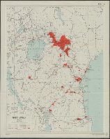
Creator:
Published / Created:
1954
Call Number:
63 1954 Sheet 3
Container / Volume:
BRBL_00335
Image Count:
1
Resource Type:
Maps, Atlases & Globes
Alternative Title:
D.C.S. (Misc.) ; 203c and D.C.S. (Series) ; 203c.
Description:
"8,500/10/54 S.P.C., R.E.", "Map 3"., and "Photolithographed and printed by G.S.G.S., 1954."
Publisher:
The Directorate,
Subject (Geographic):
Africa, East--Maps
Subject (Name):
Great Britain. War Office. General Staff. Geographical Section
Subject (Topic):
Population--Africa, East--Maps, Rain and rainfall--Africa, East--Maps, and Tsetse-flies--Africa, East--Maps
Found in:
Beinecke Rare Book and Manuscript Library > East Africa. Population, tsetse fly and rainfall [cartographic material] / drawn by Directorate of Colonial Surveys from information supplied by the Royal Commision to East Africa.
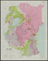
Creator:
Published / Created:
1954
Call Number:
63 1954 Sheet 2
Container / Volume:
BRBL_00335
Image Count:
1
Resource Type:
Maps, Atlases & Globes
Alternative Title:
D.C.S. (Misc.) ; 203b and D.C.S. (Series) ; 203b.
Description:
"8,500/10/54 S.P.C., R.E.", "Map 2"., and "Photolithographed and printed by G.S.G.S., 1954."
Publisher:
The Directorate,
Subject (Geographic):
Africa, East--Maps
Subject (Name):
Great Britain. War Office. General Staff. Geographical Section
Subject (Topic):
Population--Africa, East--Maps, Rain and rainfall--Africa, East--Maps, and Tsetse-flies--Africa, East--Maps
Found in:
Beinecke Rare Book and Manuscript Library > East Africa. Population, tsetse fly and rainfall [cartographic material] / drawn by Directorate of Colonial Surveys from information supplied by the Royal Commision to East Africa.
Published / Created:
19--?]
Call Number:
11hcf 1919B-17
Container / Volume:
BRBL_00010O
Image Count:
2
Resource Type:
Maps, Atlases & Globes
Description:
2 copies. Copy 2 has Ms. notes of later political boundaries., Copy 1 in two pieces., and Relief shown by hachures.
Publisher:
s.n.,
Subject (Geographic):
Europe--Maps
Subject (Topic):
World War, 1914-1918--Europe--Maps
Found in:
Beinecke Rare Book and Manuscript Library > Europe.
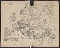
Published / Created:
19--?]
Call Number:
11hcf 1919B-17
Container / Volume:
BRBL_00010O
Image Count:
1
Resource Type:
Maps, Atlases & Globes
Description:
2 copies. Copy 2 has Ms. notes of later political boundaries. and Relief shown by hachures.
Publisher:
s.n.,
Subject (Geographic):
Europe--Maps
Subject (Topic):
World War, 1914-1918--Europe--Maps
Found in:
Beinecke Rare Book and Manuscript Library > Europe.
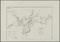
Creator:
Published / Created:
19--.
Call Number:
583 F862 1947
Container / Volume:
BRBL_00314
Image Count:
1
Resource Type:
Maps, Atlases & Globes
Description:
"No. 109-1947.", "S. 40.", Insets: Road to Fraser's Hill farm. Scale [1:6 336]. 8 chains to an in. -- Sketch of road from the Gap to Fraser's Hill. Scale [1:12 672]. 16 chains to an in., and Map of Bukit Fraser showing transportation, water features, recreation
Publisher:
Survey Dept.,
Subject (Geographic):
Bukit Fraser (Pahang)--Maps
Found in:
Beinecke Rare Book and Manuscript Library > Fraser's Hill.
Branch:v1.61.6 ,Deployed:2024-06-12T09:55:19-04:00