Search
You Searched For
Search Results
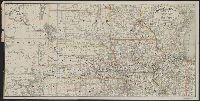
- Creator:
- Rand McNally and Company
- Published / Created:
- 1899
- Call Number:
- 80gme 1899
- Container / Volume:
- BRBL_00539
- Image Count:
- 1
- Resource Type:
- Maps, Atlases & Globes
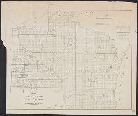
- Description:
- , Wisconsin, Nebraska, Iowa, Illinois, and
- Found in:
- Beinecke Rare Book and Manuscript Library > Chicago, Burlington & Quincy railroad system.
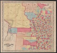
- Creator:
- Wells, John G. (John Gaylord), 1821-1880
- Published / Created:
- 1857
- Call Number:
- 825 1857B
- Container / Volume:
- BRBL_00573
- Image Count:
- 1
- Resource Type:
- Maps, Atlases & Globes
- Description:
- Minnesota, Wisconsin, Iowa, Illinois, Missouri
- Found in:
- Beinecke Rare Book and Manuscript Library > Kansas & Nebraska.
- Published / Created:
- 1897
- Call Number:
- 812gmb M648 1897
- Container / Volume:
- BRBL_00556
- Image Count:
- 1
- Resource Type:
- Maps, Atlases & Globes
- Subject (Geographic):
- Milwaukee (Wisconsin)--Maps
- Found in:
- Beinecke Rare Book and Manuscript Library > Wright's map of Milwaukee.
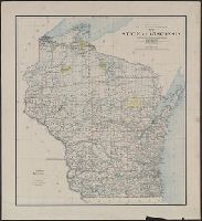
- Creator:
- United States. General Land Office
- Published / Created:
- 1896
- Call Number:
- 812 1896
- Container / Volume:
- BRBL_00555A
- Image Count:
- 1
- Resource Type:
- Maps, Atlases & Globes
- Subject (Geographic):
- Wisconsin--Administrative and political
- Found in:
- Beinecke Rare Book and Manuscript Library > Map of the state of Wisconsin / Department of the Interior, General Land Office ; compiled from the official records of the General Land Office and other sources under the direction of Harry King, C.E., chief of Drafting Division G.L.O. ; compiled, drawn
- Creator:
- Colton, G. Woolworth (George Woolworth), 1827-1901
- Published / Created:
- 1862
- Call Number:
- 754gme 1860A
- Container / Volume:
- BRBL_00420
- Image Count:
- 1
- Resource Type:
- Maps, Atlases & Globes
- Alternative Title:
- map of Wisconsin, Illinois, Missouri
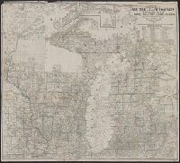
- Description:
- Wisconsin; Appleton is the northernmost town on
- Subject (Geographic):
- Wisconsin--Maps
- Subject (Topic):
- Railroads--Wisconsin--Maps
- Found in:
- Beinecke Rare Book and Manuscript Library > Colton's county and township rail road map of Wisconsin, Illinois, Missouri, & Iowa / Drawn, engraved & published by G. Woolworth Colton
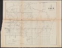
- Creator:
- Surveyor General of Iowa, Wisconsin, and Minnesota
- Published / Created:
- 1855
- Call Number:
- 812 1855C
- Container / Volume:
- BRBL_00555
- Image Count:
- 1
- Resource Type:
- Maps, Atlases & Globes
- Alternative Title:
- Wisconsin and territory of Minnesota.
- Subject (Geographic):
- Wisconsin--Maps
- Found in:
- Beinecke Rare Book and Manuscript Library > Sketch of the public surveys in Wisconsin and territory of Minnesota.
- Creator:
- Burr, David H., 1803-1875
- Published / Created:
- [1839?]
- Call Number:
- 811 1839A
- Container / Volume:
- BRBL_00552
- Image Count:
- 4
- Resource Type:
- Maps, Atlases & Globes
- Alternative Title:
- Map of Michigan and part of Wisconsin
- Subject (Geographic):
- Wisconsin--Maps
- Found in:
- Beinecke Rare Book and Manuscript Library > Map of Michigan & part of Wisconsin Territory : exhibiting the post offices, post roads, canals, rail roads, &c. / by David H. Burr.
- Published / Created:
- 1915
- Call Number:
- 812ag 1915
- Container / Volume:
- BRBL_00556
- Image Count:
- 2
- Resource Type:
- Maps, Atlases & Globes
- Alternative Title:
- northwestern Wisconsin
- Description:
- northern Wisconsin and Michigan, reached by the
- Subject (Geographic):
- Wisconsin--Maps
- Found in:
- Beinecke Rare Book and Manuscript Library > Hunting and fishing resorts of northern Wisconsin and Michigan : reached by the Chicago and North Western Railway.
- Creator:
- United States. Surveyor General
- Published / Created:
- 1860
- Call Number:
- 812fcm 1860
- Container / Volume:
- BRBL_00556
- Image Count:
- 1
- Resource Type:
- Maps, Atlases & Globes
- Alternative Title:
- Wisconsin and territory of Minnesota.
- Subject (Geographic):
- Wisconsin--Maps
- Found in:
- Beinecke Rare Book and Manuscript Library > Sketch of the public surveys in the state of Wisconsin and territory of Minnesota.
- Creator:
- Farmer, John, 1798-1859
- Published / Created:
- 1857
- Call Number:
- 754 1857
- Container / Volume:
- BRBL_00416
- Image Count:
- 1
- Resource Type:
- Maps, Atlases & Globes
- Alternative Title:
- Township map of Michigan and Wisconsin.
- Subject (Geographic):
- Wisconsin--Maps
- Found in:
- Beinecke Rare Book and Manuscript Library > Farmer's township map of Michigan and Wisconsin : embracing part of Iowa Illinois and Minnesota, with a chart of the lakes / prepared engraved and published by the author at Detroit.