Search
You Searched For
Search Results
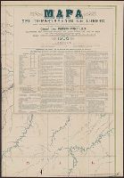
- Creator:
- United States. Department of Agriculture. Production and Marketing Administration
- Published / Created:
- [1951?]
- Call Number:
- 824bc K772 1951
- Container / Volume:
- BRBL_00571
- Image Count:
- 6
- Resource Type:
- Maps, Atlases & Globes
- Found in:
- Beinecke Rare Book and Manuscript Library > Knox County, Nebraska / U.S. Department of Agriculture, Production and Marketing Administration.
- Creator:
- Hoempler, Carlos E. C
- Published / Created:
- 1906
- Call Number:
- 9739 1906
- Container / Volume:
- BRBL_00678
- Image Count:
- 6
- Resource Type:
- Maps, Atlases & Globes
- Found in:
- Beinecke Rare Book and Manuscript Library > Mapa del departamento de Loreto [cartographic material] / correjido y aumentado con los estudios los Srs. Espinar, Buenaño, Mavila, Zavala, Donayre, Von Hassel y otros ; trazado y dibujo de los cartografos Hoempler, Baluarte y Vallejos.
- Creator:
- United States. Army Map Service
- Published / Created:
- 1943
- Call Number:
- 5844 1943
- Container / Volume:
- BRBL_00315
- Image Count:
- 6
- Resource Type:
- Maps, Atlases & Globes
- Found in:
- Beinecke Rare Book and Manuscript Library > Malaya 1:253 440 : Pahang.
- Creator:
- United States. General Land Office
- Published / Created:
- 1876
- Call Number:
- 75 1876
- Container / Volume:
- BRBL_00405
- Image Count:
- 6
- Resource Type:
- Maps, Atlases & Globes
- Found in:
- Beinecke Rare Book and Manuscript Library > Map of the United States and territories, showing the extent of public surveys, Indian and military reservations, land grant R.R., rail roads, canals, and other details / compiled from the official surveys of the General Land Office, and other authentic s
- Published / Created:
- [ca. 1870]
- Call Number:
- 428 1870
- Container / Volume:
- BRBL_00248
- Image Count:
- 6
- Resource Type:
- Maps, Atlases & Globes
- Found in:
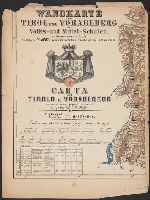
- Beinecke Rare Book and Manuscript Library > Wandkarte von Tirol und Vorarlberg für Volks-und Mittel-Schulen = Carta del Tirolo e Vorarlberg ad uso di scuole popolari e medie / Gezeichnet von G.v. Kaler.
- Creator:
- Mexico. Dirección de Estudios Geográficos y Climatológicos
- Published / Created:
- 1927?]
- Call Number:
- 8819 1927
- Container / Volume:
- BRBL_00652
- Image Count:
- 6
- Resource Type:
- Maps, Atlases & Globes
- Found in:
- Beinecke Rare Book and Manuscript Library > Estado de Chihuahua / Secretaria de Agricultura y Fomento, Direccion de Estudios Geográficos y Clim. ; Dep. Geográfico de Gabinete, Dep. Geogr. de Campo.
- Published / Created:
- 1909
- Call Number:
- 61 1909A
- Container / Volume:
- BRBL_00331
- Image Count:
- 6
- Resource Type:
- Maps, Atlases & Globes
- Found in:
- Beinecke Rare Book and Manuscript Library > Map of Egypt.
- Published / Created:
- 1799
- Call Number:
- 90 1799A
- Container / Volume:
- BRBL_00662
- Image Count:
- 6
- Resource Type:
- Maps, Atlases & Globes
- Found in:
- Beinecke Rare Book and Manuscript Library > Mapa Geográfico de America Meridionale, Dispuesto y Gravado por de Juan de la Cruz Cano y Olmedilla, Geogfo. Pensdo. de S.M. Individluo de la Rl. Academia de Sn. Fernando, y de la Sociedad Bascongada de los Amigos de Pais, teniendo presentes Varios Mapas
- Published / Created:
- 1811
- Call Number:
- 90 1819
- Container / Volume:
- BRBL_00662
- Image Count:
- 6
- Resource Type:
- Maps, Atlases & Globes
- Found in:
- Beinecke Rare Book and Manuscript Library > Outlines of the Physical and Political Divisions of South America: delineated by A. Arrowsmith partly from scarse and Original Documents, published before the year 1806 corrected from accurate Astronomical observations to 1810.
- Creator:
- Lüddecke, Richard
- Published / Created:
- [1891]
- Call Number:
- 60 1891
- Container / Volume:
- BRBL_00328
- Image Count:
- 6
- Resource Type:
- Maps, Atlases & Globes
- Found in:
- Beinecke Rare Book and Manuscript Library > Afrika in 6 Blättern, im Massstab von 1:10,000,000 / bearbeitet von R. Lüddecke (Blatt 2 von B. Domann).
- Creator:
- Survey of India
- Published / Created:
- 1904
- Call Number:
- 59gm 1903
- Container / Volume:
- BRBL_00318
- Image Count:
- 6
- Resource Type:
- Maps, Atlases & Globes
- Found in:
- Beinecke Rare Book and Manuscript Library > Military map of India : Corrected to 1903.
- Creator:
- Walling, Henry Francis, 1825-1888
- Published / Created:
- 1858
- Call Number:
- 764 N76 1858
- Container / Volume:
- BRBL_00458
- Image Count:
- 6
- Resource Type:
- Maps, Atlases & Globes
- Found in:
- Beinecke Rare Book and Manuscript Library > Map of the county of Norfolk, Massachusetts / based upon the details of the trigonometrical survey of the state; the details from actual surveys under the direction of Henry F. Walling. Supt. of the state map.
- Creator:
- Clason Map Co
- Published / Created:
- 1909
- Call Number:
- 831 H36 1909
- Container / Volume:
- BRBL_00580
- Image Count:
- 6
- Resource Type:
- Maps, Atlases & Globes
- Found in:
- Beinecke Rare Book and Manuscript Library > Map of city of Helena, Montana / Copyrighted 1909 by Geo. S. Clason.
- Creator:
- McGee, W. J., 1853-1912
- Published / Created:
- [1893?]
- Call Number:
- 75CA 1893
- Container / Volume:
- BRBL_00408
- Image Count:
- 10
- Resource Type:
- Maps, Atlases & Globes
- Found in:
- Beinecke Rare Book and Manuscript Library > Reconnoissance map of the United States showing the distribution of the geologic system so far as known / compiled from data in possession of the U.S. Geological Survey by W.J. McGee, 1893.
- Published / Created:
- [1918]
- Call Number:
- 38hc R283 1918
- Container / Volume:
- BRBL_00173
- Image Count:
- 10
- Resource Type:
- Maps, Atlases & Globes
- Found in:
- Beinecke Rare Book and Manuscript Library > [Collection of maps related to raid of the Second Battalion Infantry Regiment 134 near Remenauville during the night of April 27/28 1918].
- Creator:
- United States. Army. Engineer Aviation Topographic Battalion, 942nd
- Published / Created:
- 1945
- Call Number:
- 57gfb 1945
- Container / Volume:
- BRBL_00306
- Image Count:
- 10
- Resource Type:
- Maps, Atlases & Globes
- Found in:
- Beinecke Rare Book and Manuscript Library > Japan electric power / drawn and reproduced by Co B, 942nd Engr. Avn. Topo. Bn, 325th Ric., US Army.
- Creator:
- Mitchell, John, 1711-1768
- Published / Created:
- 1776]
- Call Number:
- 71 1776D
- Container / Volume:
- BRBL_00365
- Image Count:
- 8
- Resource Type:
- Maps, Atlases & Globes
- Found in:
- Beinecke Rare Book and Manuscript Library > Amérique septentrionale avec les routes : distances en miles, villages, et etablissements françois et anglois / par le docteur Mitchel ; traduit de l'Anglois à Paris par Le Rouge, ingr. géographe du roy, Rue des Grands Augustins 1756.
- Creator:
- Mozambique. Direcção dos Serviços de Agrimensura
- Published / Created:
- 1929
- Call Number:
- 636 1929
- Container / Volume:
- BRBL_00337
- Image Count:
- 8
- Resource Type:
- Maps, Atlases & Globes
- Found in:
- Beinecke Rare Book and Manuscript Library > Colónia de Moçambiqve : esboço geografico da colonía na escala de 1/1.000.000 / Direcção dos Serviços de Agrimensura ; comp., B.A. Lourinho ; des., R.J. Ximénes.
- Creator:
- Ukraïnsʹke aeroheodezychne pidpryi︠e︡mstvo
- Published / Created:
- 1992
- Call Number:
- 3531 1992
- Container / Volume:
- BRBL_00111
- Image Count:
- 8
- Resource Type:
- Maps, Atlases & Globes
- Found in:
- Beinecke Rare Book and Manuscript Library > Kievskai︠a︡ oblastʹ, obshchegeograficheskai︠a︡ karta : masshtab 1:200 000 / Ukrainskoe AGP ; karta sostavlena i podgotovlena k pechati Ukrainskim aėrogeodezicheskim predprii︠a︡tiem v 1992 g.
- Published / Created:
- 1879
- Call Number:
- 40 R66 1879
- Container / Volume:
- BRBL_00218
- Image Count:
- 8
- Resource Type:
- Maps, Atlases & Globes
- Found in:
- Beinecke Rare Book and Manuscript Library > Carta Topografica dell'agro Romano Territori Limitrofi.