Search
You Searched For
Search Results
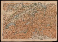
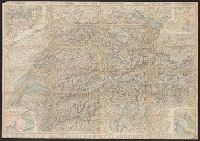
- Creator:
- Wagner & Debes
- Published / Created:
- [between 1900 and 1920?]
- Call Number:
- BrSides 2019 101
- Image Count:
- 1
- Resource Type:
- Maps, Atlases & Globes
- Subject (Geographic):
- Switzerland--Maps.
- Found in:
- Beinecke Rare Book and Manuscript Library > Switzerland.
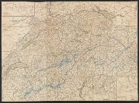
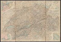
- Published / Created:
- 1820?]
- Call Number:
- 37 1820A
- Image Count:
- 2
- Resource Type:
- Maps, Atlases & Globes
- Subject (Geographic):
- Switzerland--Maps
- Found in:
- Beinecke Rare Book and Manuscript Library > [Switzerland]
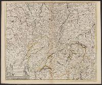
- Published / Created:
- [1660?]
- Call Number:
- 3615 1660
- Container / Volume:
- BRBL_00135
- Image Count:
- 1
- Resource Type:
- Maps, Atlases & Globes
- Description:
- , Switzerland, Southwestern Germany.
- Found in:
- Beinecke Rare Book and Manuscript Library > Accuratissima Rheni Superioris Mosae et Mosellae ...
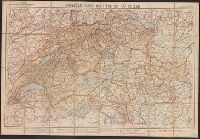
- Creator:
- Taride, A
- Published / Created:
- [1908]
- Call Number:
- 37 1908
- Container / Volume:
- BRBL_00149
- Image Count:
- 1
- Resource Type:
- Maps, Atlases & Globes
- Subject (Geographic):
- Switzerland--Maps
- Subject (Topic):
- Bicycle trails--Switzerland--Maps
- Found in:
- Beinecke Rare Book and Manuscript Library > Nouvelle carte routière de la Suisse : à l'usage des cyclistes, automobiles, touristes, etc.
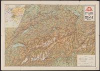
- Creator:
- Switzerland. Generaldirektion der Post-, Telegraphen- und Telephonverwaltung
- Published / Created:
- 1951
- Call Number:
- 37 Sa5 1951
- Container / Volume:
- BRBL_00150
- Image Count:
- 2
- Resource Type:
- Maps, Atlases & Globes
- Subject (Geographic):
- Alps, Swiss (Switzerland)--Maps
- Subject (Topic):
- Mountain passes--Switzerland--Maps
- Found in:
- Beinecke Rare Book and Manuscript Library > Schweizerische Alpenposten San Bernardino, Splügen - Mesocco / [cartographic material] / Kümmerly & Frey, Bern.
- Creator:
- Kümmerly + Frey
- Published / Created:
- 1907
- Call Number:
- 37 1907A
- Container / Volume:
- BRBL_00149
- Image Count:
- 1
- Resource Type:
- Maps, Atlases & Globes
- Alternative Title:
- Tourist map of Switzerland
- Subject (Geographic):
- Switzerland--Maps
- Subject (Topic):
- Railroads--Switzerland--Maps
- Found in:
- Beinecke Rare Book and Manuscript Library > Swiss Federal Railways tourist map of Switzerland / Geogr. Establishment Kümmerly & Frey.
- Creator:
- Kümmerly + Frey
- Published / Created:
- 1909
- Call Number:
- 37 1909A
- Container / Volume:
- BRBL_00149
- Image Count:
- 2
- Resource Type:
- Maps, Atlases & Globes
- Alternative Title:
- Tourist map of Switzerland
- Subject (Geographic):
- Switzerland--Maps
- Subject (Topic):
- Railroads--Switzerland--Maps
- Found in:
- Beinecke Rare Book and Manuscript Library > Swiss Federal Railways tourist map of Switzerland / Geogr. Establishment Kümmerly & Frey.
- Creator:
- Leuthold, H. F
- Published / Created:
- 1860
- Call Number:
- 37 1860A
- Image Count:
- 2
- Resource Type:
- Maps, Atlases & Globes
- Alternative Title:
- Road map of Switzerland
- Subject (Geographic):
- Switzerland--Maps
- Subject (Topic):
- Roads--Switzerland--Maps
- Found in:
- Beinecke Rare Book and Manuscript Library > Roadmap of Switzerland = Reisekarte der Schweiz = Carta stradale della Svizzera = Carte routière de la Suisse : en partie tirée de l'atlas topographique de la confederation / dresée et gravée par Mullhaupt ; publiée par H.F. Leuthold editeur ; ecrit
- Creator:
- Leuthold, H. F
- Published / Created:
- 1861
- Call Number:
- 37 1861A
- Image Count:
- 2
- Resource Type:
- Maps, Atlases & Globes
- Alternative Title:
- Road map of Switzerland
- Subject (Geographic):
- Switzerland--Maps
- Subject (Topic):
- Roads--Switzerland--Maps
- Found in:
- Beinecke Rare Book and Manuscript Library > Roadmap of Switzerland = Reisekarte der Schweiz = Carta stradale della Svizzera = Carte routière de la Suisse : en partie tirée de l'atlas topographique de la confederation / dresée et gravée par Mullhaupt ; publiée par H.F. Leuthold editeur ; ecrit
- Creator:
- Leuthold, H. F
- Published / Created:
- 1858
- Call Number:
- 37 1858
- Image Count:
- 2
- Resource Type:
- Maps, Atlases & Globes
- Alternative Title:
- Road map of Switzerland
- Subject (Geographic):
- Switzerland--Maps
- Subject (Topic):
- Roads--Switzerland--Maps
- Found in:
- Beinecke Rare Book and Manuscript Library > Roadmap of Switzerland = Reisekarte der Schweiz = Carta stradale della Svizzera = Carte routière de la Suisse : en partie tirée de l'atlas topographique de la confederation / dresée et gravée par Mullhaupt ; publiée par H.F. Leuthold editeur ; ecrit
- Creator:
- Leuthold, H. F
- Published / Created:
- 1867
- Call Number:
- 37 1867
- Image Count:
- 2
- Resource Type:
- Maps, Atlases & Globes
- Alternative Title:
- Road map of Switzerland
- Subject (Geographic):
- Switzerland--Maps
- Subject (Topic):
- Roads--Switzerland--Maps
- Found in:
- Beinecke Rare Book and Manuscript Library > Roadmap of Switzerland = Reisekarte der Schweiz = Carta stradale della Svizzera = Carte routière de la Suisse : en partie tirée de l'atlas topographique de la confederation / dresée et gravée par Mullhaupt ; publiée par H.F. Leuthold editeur ; ecrit
- Creator:
- Leuthold, H. F
- Published / Created:
- 1856
- Call Number:
- 37 1856
- Image Count:
- 2
- Resource Type:
- Maps, Atlases & Globes
- Alternative Title:
- Road map of Switzerland
- Subject (Geographic):
- Switzerland--Maps
- Subject (Topic):
- Roads--Switzerland--Maps
- Found in:
- Beinecke Rare Book and Manuscript Library > Roadmap of Switzerland = Reisekarte der Schweiz = Carta stradale della Svizzera = Carte routière de la Suisse : en partie tirée de l'atlas topographique de la confederation / dresée et gravée par Mullhaupt ; publiée par H.F. Leuthold editeur ; ecrit
- Published / Created:
- 1910
- Call Number:
- 37 1910A
- Container / Volume:
- BRBL_00149
- Image Count:
- 2
- Resource Type:
- Maps, Atlases & Globes
- Subject (Geographic):
- Switzerland--Maps
- Subject (Topic):
- Railroads--Switzerland--Maps
- Found in:
- Beinecke Rare Book and Manuscript Library > Swiss Ferderal Railways Tourist map of Switzerland, 1910 / Kümmerly & Frey's Geographl. Establ. Berne.
- Published / Created:
- 1921
- Call Number:
- 37 1921
- Container / Volume:
- BRBL_00149
- Image Count:
- 2
- Resource Type:
- Maps, Atlases & Globes
- Subject (Geographic):
- Switzerland--Maps
- Subject (Topic):
- Railroads--Switzerland--Maps
- Found in:
- Beinecke Rare Book and Manuscript Library > Office Suisse du tourisme Carte de la Suisse.
- Published / Created:
- 1879
- Call Number:
- 37 1879
- Image Count:
- 1
- Resource Type:
- Maps, Atlases & Globes
- Subject (Geographic):
- Switzerland--Maps
- Subject (Topic):
- Railroads--Switzerland--Maps
- Found in:
- Beinecke Rare Book and Manuscript Library > Tableau des chemins de fer & des Routes de la Suisse.
- Creator:
- Washburn, Bradford, 1910-2007
- Published / Created:
- c1960.
- Call Number:
- 848 M215 1960
- Container / Volume:
- BRBL_00634
- Image Count:
- 1
- Resource Type:
- Maps, Atlases & Globes
- Subject (Name):
- Switzerland. Eidg. Landestopographie
- Found in:
- Beinecke Rare Book and Manuscript Library > Mount McKinley, Alaska.
- Published / Created:
- [1923]
- Call Number:
- 37 1923
- Container / Volume:
- BRBL_00149
- Image Count:
- 2
- Resource Type:
- Maps, Atlases & Globes
- Subject (Geographic):
- Bernese Alps (Switzerland)--Maps
- Subject (Topic):
- Panoramas--Switzerland--Bernese Alps
- Found in:
- Beinecke Rare Book and Manuscript Library > Panorama of the Bernese Oberland and the Bernese Alps Railway Berne-Lœtschberg-Simplon.
- Published / Created:
- 1896?
- Call Number:
- 37 1900A
- Image Count:
- 2
- Resource Type:
- Maps, Atlases & Globes
- Subject (Geographic):
- Switzerland--Maps
- Subject (Topic):
- Bicycle trails--Switzerland--Maps
- Found in:
- Beinecke Rare Book and Manuscript Library > Deuxième carte routière de la Suisse pour Velocipedistes et touristes.
- Creator:
- Rand McNally and Company
- Published / Created:
- [1923?]
- Call Number:
- 30 1940J
- Container / Volume:
- BRBL_00032B
- Image Count:
- 1
- Resource Type:
- Maps, Atlases & Globes
- Description:
- Switzerland, France and Belgium.
- Found in:
- Beinecke Rare Book and Manuscript Library > Rand McNally war map of Western Front.
- Creator:
- Taride, A
- Published / Created:
- 1909
- Call Number:
- 38gmb 1909
- Container / Volume:
- BRBL_00170
- Image Count:
- 1
- Resource Type:
- Maps, Atlases & Globes
- Description:
- Switzerland from Montbeliard, France in the north
- Subject (Geographic):
- Jura Mountains (France and Switzerland
- Subject (Topic):
- and Switzerland)--Maps
- Found in:
- Beinecke Rare Book and Manuscript Library > Carte routière pour cyclistes & automobiles de l'est de la France : Franche-Comté - Jura - Suisse Française / A. Taride, Éditeur ; P. Bineteau del't.
- Creator:
- Schweizerischer Juraverein
- Published / Created:
- [1940]-
- Call Number:
- 37 J974 1940
- Image Count:
- 2
- Resource Type:
- Maps, Atlases & Globes
- Subject (Geographic):
- Jura Mountains (France and Switzerland
- Subject (Topic):
- Switzerland)--Maps
- Found in:
- Beinecke Rare Book and Manuscript Library > Carte du Jura = Spezialkarte des Jura / editée par le Schweizerischen Juraverein.
- Creator:
- Geographia Ltd
Gross, Alexander, 1879-1958
- Published / Created:
- [1916?]
- Call Number:
- 11hcf 1919C-6
- Container / Volume:
- BRBL_00010V
- Image Count:
- 1
- Resource Type:
- Maps, Atlases & Globes
- Description:
- , France, Germany and Switzerland.
- Found in:
- Beinecke Rare Book and Manuscript Library > The Daily telegraph war map no. 15 [cartographic material] : of the western front, Verdun to Belfort / By Alexander Gross ; Geographia Ltd.
- Published / Created:
- 191-.
- Call Number:
- 11hcf 1919E-28
- Container / Volume:
- BRBL_00010ZA
- Image Count:
- 1
- Resource Type:
- Maps, Atlases & Globes
- Description:
- Shows geographic area from Switzerland
- Found in:
- Beinecke Rare Book and Manuscript Library > [Map of southern Europe and the Adriatic Sea .]
- Published / Created:
- 1864
- Call Number:
- 37 1907B
- Container / Volume:
- BRBL_00149
- Image Count:
- 1
- Resource Type:
- Maps, Atlases & Globes
- Subject (Geographic):
- Switzerland--Maps
- Found in:
- Beinecke Rare Book and Manuscript Library > [Switzerland] / G.H. Dufour direxit; H. Müllhaupt sculpsit.
- Creator:
- George Philip & Son
London Geographical Institute
- Published / Created:
- 1940
- Call Number:
- 36 1940A
- Container / Volume:
- BRBL_00121
- Image Count:
- 1
- Resource Type:
- Maps, Atlases & Globes
- Subject (Geographic):
- Switzerland--Maps
- Found in:
- Beinecke Rare Book and Manuscript Library > Western Germany, with Holland, Belgium and Switzerland.
- Creator:
- Kartographia Winterthur A.G
- Published / Created:
- [1914?]
- Call Number:
- 30 1914A
- Container / Volume:
- BRBL_00032
- Image Count:
- 1
- Resource Type:
- Maps, Atlases & Globes
- Found in:
- Beinecke Rare Book and Manuscript Library > Uebersichtskarte der europ. Kriegsschauplätze.
- Creator:
- George Philip & Son
London Geographical Institute
- Published / Created:
- 1940
- Call Number:
- 36 1940D
- Container / Volume:
- BRBL_00121
- Image Count:
- 1
- Resource Type:
- Maps, Atlases & Globes
- Alternative Title:
- and Switzerland.
- Description:
- Holland, Belgium and Switzerland.
- Found in:
- Beinecke Rare Book and Manuscript Library > Eastern Germany, with Hungary.
- Creator:
- Boston and Maine Railroad. General Passenger Dept
- Published / Created:
- [1900?]
- Call Number:
- 76gme 1900
- Container / Volume:
- BRBL_00446A
- Image Count:
- 2
- Resource Type:
- Maps, Atlases & Globes
- Description:
- Inset: The "American Switzerland" as
- Found in:
- Beinecke Rare Book and Manuscript Library > Summer resorts of the coast, lake, and mountain regions along the Boston & Maine Railroad and connections.
- Creator:
- Ettling, Theodor, b. 1823
- Published / Created:
- 1860
- Call Number:
- 40 1860
- Container / Volume:
- BRBL_00201
- Image Count:
- 1
- Resource Type:
- Maps, Atlases & Globes
- Subject (Geographic):
- Switzerland--Maps
- Found in:
- Beinecke Rare Book and Manuscript Library > Map of Italy and Switzerland [cartographic material] / by T. Ettling.
- Creator:
- Fisk & Co
Thomas Cook Ltd
- Published / Created:
- c1881.
- Call Number:
- 304ag 1881
- Container / Volume:
- BRBL_00034A
- Image Count:
- 2
- Resource Type:
- Maps, Atlases & Globes
- Description:
- , Switzerland, southern Germany, Austria, and Italy.
- Found in:
- Beinecke Rare Book and Manuscript Library > Map of Cook's tours in central Europe / Fisk & Co., engs.
- Creator:
- Ringier, A
- Published / Created:
- 1907
- Call Number:
- 37 1907C
- Container / Volume:
- BRBL_00149
- Image Count:
- 2
- Resource Type:
- Maps, Atlases & Globes
- Alternative Title:
- Distance map of Switzerland
- Subject (Geographic):
- Switzerland--Maps
- Found in:
- Beinecke Rare Book and Manuscript Library > Distanzenkarte der Schweiz in Marschstunden = Carte des distances de la Suisse en heures de marche / Calculation des distances de A. Ringier, topographe au bureau topogr. federal.
- Published / Created:
- [1852]
- Call Number:
- 37 1852
- Image Count:
- 1
- Resource Type:
- Maps, Atlases & Globes
- Subject (Geographic):
- Switzerland--Maps
- Found in:
- Beinecke Rare Book and Manuscript Library > Map of the Republic of Switzerland describing the Twenty-Two Cantons including those of Le Valois, Geneva and Neuchatel, exhibiting the various objects interesting to the traveller / compiled from the surveys of Weiss, Kellar &c.
- Published / Created:
- 1811
- Call Number:
- 37 1811
- Image Count:
- 1
- Resource Type:
- Maps, Atlases & Globes
- Subject (Geographic):
- Switzerland--Maps
- Found in:
- Beinecke Rare Book and Manuscript Library > A new map of Swisserland ... By John Cary, Engraver.
- Published / Created:
- 1824
- Call Number:
- 37 1824
- Image Count:
- 1
- Resource Type:
- Maps, Atlases & Globes
- Subject (Geographic):
- Switzerland--Maps
- Found in:
- Beinecke Rare Book and Manuscript Library > Carte Genérale de la Suisse ...
- Published / Created:
- 1803
- Call Number:
- 37 1803
- Image Count:
- 1
- Resource Type:
- Maps, Atlases & Globes
- Subject (Geographic):
- Switzerland--Maps
- Found in:
- Beinecke Rare Book and Manuscript Library > Carte Générale de la Suisse ... 1803. Graveur a Basle.
- Published / Created:
- [1851]
- Call Number:
- 37 1851
- Image Count:
- 2
- Resource Type:
- Maps, Atlases & Globes
- Subject (Geographic):
- Switzerland--Maps
- Found in:
- Beinecke Rare Book and Manuscript Library > Carte Routière de la Suisse augmentée et corrigée après la derniére de Keller.
- Published / Created:
- [1870]
- Call Number:
- 37 1870A
- Image Count:
- 1
- Resource Type:
- Maps, Atlases & Globes
- Subject (Geographic):
- Switzerland--Maps
- Found in:
- Beinecke Rare Book and Manuscript Library > Carte Routière de la Suisse augmentée et corrigée d'après la derniére de Keller.
- Published / Created:
- 1852
- Call Number:
- 37 1852A
- Image Count:
- 2
- Resource Type:
- Maps, Atlases & Globes
- Subject (Geographic):
- Switzerland--Maps
- Found in:
- Beinecke Rare Book and Manuscript Library > Carte Routière de la Suisse d'après Keller, 1852.
- Published / Created:
- 1851
- Call Number:
- 37j 1250
- Container / Volume:
- BRBL_00150A
- Image Count:
- 1
- Resource Type:
- Maps, Atlases & Globes
- Subject (Geographic):
- Switzerland--Maps
- Found in:
- Beinecke Rare Book and Manuscript Library > Carte de L'évêché de Lausanne au XIII Siécle ... Lith. Spengler & Cie.
- Published / Created:
- [1905?]
- Call Number:
- 37 1905
- Container / Volume:
- BRBL_00149
- Image Count:
- 1
- Resource Type:
- Maps, Atlases & Globes
- Subject (Geographic):
- Switzerland--Maps
- Found in:
- Beinecke Rare Book and Manuscript Library > Carte de la Suisse / par W. Rodier, professeur.
- Published / Created:
- 1834
- Call Number:
- 37 1834
- Image Count:
- 1
- Resource Type:
- Maps, Atlases & Globes
- Subject (Geographic):
- Switzerland--Maps
- Found in:
- Beinecke Rare Book and Manuscript Library > Carte de la Suisse. Dressée par Pierre Tardieu d'aprés Keller.
- Published / Created:
- [1900]
- Call Number:
- 37 1900
- Image Count:
- 2
- Resource Type:
- Maps, Atlases & Globes
- Subject (Geographic):
- Switzerland--Maps
- Found in:
- Beinecke Rare Book and Manuscript Library > Carte générale de la Suisse.
- Creator:
- Jaillot, Alexis Hubert, 1632?-1712
- Published / Created:
- 1692
- Call Number:
- 1984 Folio 3
- Collection Title:
- Atlas nouveau : contenant toutes les parties du monde ou sont exactement remarques les empires
- Image Count:
- 1
- Resource Type:
- Maps, Atlases & Globes
- Subject (Geographic):
- Switzerland
- Found in:
- Beinecke Rare Book and Manuscript Library > Comte de Namur dresse sur les memoirs les plus nouveaux presente a sa Majeste pour le service de ses troupes par le service de ses troupes par le service de ses troupes ...
- Creator:
- Woerl, Joseph Edmund, creator
- Call Number:
- 37 1835
- Container / Volume:
- BRBL_00148
- Image Count:
- 19
- Resource Type:
- Maps, Atlases & Globes
- Subject (Geographic):
- Switzerland--Maps
- Found in:
- Beinecke Rare Book and Manuscript Library > Karte der Schweiz / von Dr. I. Woerl.
- Creator:
- Woerl, Joseph Edmund, creator
- Call Number:
- 37 1835
- Container / Volume:
- BRBL_00148
- Image Count:
- 2
- Resource Type:
- Maps, Atlases & Globes
- Subject (Geographic):
- Switzerland--Maps
- Found in:
- Beinecke Rare Book and Manuscript Library > Karte der Schweiz / von Dr. I. Woerl.
- Published / Created:
- [1874]
- Call Number:
- 37 1874A
- Image Count:
- 1
- Resource Type:
- Maps, Atlases & Globes
- Subject (Geographic):
- Switzerland--Maps
- Found in:
- Beinecke Rare Book and Manuscript Library > Karte der Schweiz von R. Leuzinger = Carte de la Suisse par R. Leuzinger.
- Published / Created:
- 1868
- Call Number:
- 37 1868
- Image Count:
- 1
- Resource Type:
- Maps, Atlases & Globes
- Subject (Geographic):
- Switzerland--Maps
- Found in:
- Beinecke Rare Book and Manuscript Library > La Svizzera di Keller divisa in 22 cantoni colla relativa popolazione secondo le più recenti statistiche dell' anno 1868.
- Creator:
- Nolin, Jean Baptiste, 1648-1708
- Published / Created:
- 1691
- Call Number:
- 1984 Folio 3
- Collection Title:
- Atlas nouveau : contenant toutes les parties du monde ou sont exactement remarques les empires
- Image Count:
- 1
- Resource Type:
- Maps, Atlases & Globes
- Subject (Geographic):
- Switzerland
- Found in:
- Beinecke Rare Book and Manuscript Library > Les Etats de Savoye et de Piemont