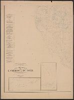
At head of title: Congrès géologique international Xe session, 1906., Imperfect: Two sheets showing eastern half of map wanting., and Includes 2 insets.
Publisher:
s.n.],
Subject (Name):
Bailey, Willis, 1858-1949 and Gannett, Henry, 1846-1914
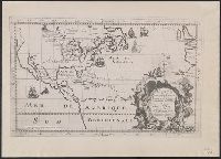
Photocopy of map from Hennepin's Description de la Louisiane. Paris, 1683. and Relief shown pictorially.
Publisher:
s.n.,
Subject (Geographic):
NorthAmerica--Maps
Subject (Name):
Guérard, Nicholas and Hennepin, Louis, 17th cent. Description de la Louisiane, nouvellement decouverte au sud' oüest de la Nouvelle France, par ordre du roy
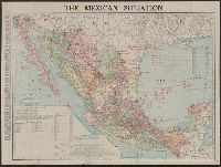
In bottom margin: Andrew B. Graham, photo-litho, Washington, D.C., In English and Spanish., and Prime meridians: Greenwich and Paris.
Publisher:
Andrew B. Graham?],
Subject (Name):
Andrew B. Graham Co, International American Conference (2nd : 1901-1902 : Mexico), Pan-American Railway--Maps, and Permanent Pan-American Railway Committee
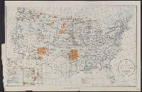
Insets: Mission Ind. res. in California. [Scale ca. 1:1,600,000] -- Indian pueblo grants in New Mexico. [Scale ca 1:2,300,000] -- Northeastern Oklahoma [Scale ca. 1:1,600,000]. and Map originally bound in: Annual report of the Department of the Interior.
Publisher:
Office of Indian Affairs],
Subject (Name):
Valentine, Robert G. (Robert Grosvenor), 1872-1916
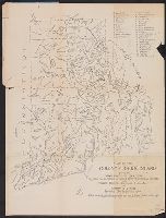
Indian map of the lands of Rhode Island. and Lands of Rhode Island as they were known to Canonicus and Miantinomi.
Description:
"Edition limited to 220 copies.", Also published as part of: Rider, S. S. The lands of Rhode Island as they were known to Canonicus and Miantinomi..., Covers attached to verso. Not digitized., and Title on folder: An Indian map of the lands of Rhode Island as they were known to Canonicus and Miantinomi when Roger Williams came here in 1636.
Publisher:
[s.n.]
Subject (Geographic):
Rhode Island--History--Colonial period, ca. 1600-1775--Maps