Skip to search
Skip to main content
Skip to first result
Search
You Searched For
Date
1858 - 1859
Resource Type
Maps, Atlases & Globes
Date Created
1858 to 1859
New Search
Search Results
Creator:
Published / Created:
[1862], c1852
Call Number:
21cea 1862
Image Count:
1
Resource Type:
Maps, Atlases & Globes
Alternative Title:
Chesapeake and Delaware Bays.
Description:
"Drawn by F. Lucas, Jr.", "Engraved by John and William W. Warr, Philadelphia.", "Sold by Lucas Brothers.", Depths shown by soundings and shading., and Includes views: View of the coast from Indian River to Cape Henlopen [Del.] -- Windmill Point [Va.] -- Smiths P
Publisher:
Fielding Lucas,
Subject (Geographic):
Chesapeake Bay Region (Md. and Va.)--Maps and Delaware Bay Region (Del. and N.J.)--Maps
Subject (Topic):
Coasts--Delaware--Maps, Coasts--Maryland--Maps, Coasts--New Jersey--Maps, and Coasts--Virginia--Maps
Found in:
Beinecke Rare Book and Manuscript Library > A chart of the Chesapeake and Delaware Bays / compiled and published by Fielding Lucas.
Published / Created:
[185-]
Call Number:
754gme 1850C
Container / Volume:
BRBL_00419
Image Count:
1
Resource Type:
Maps, Atlases & Globes
Description:
Shows railroads and coal lands between Lakes Erie and Ontario and Long Island.
Publisher:
Bisbee, lith.,
Subject (Geographic):
United States--Maps
Found in:
Beinecke Rare Book and Manuscript Library > A map of the North Western Rail Way : passing thr'o [sic] the Lackawanna Coal Lands in Pennsylvania / by James Seymour.
Creator:
Published / Created:
[1859?]
Call Number:
825 1859A
Container / Volume:
BRBL_00573
Image Count:
1
Resource Type:
Maps, Atlases & Globes
Description:
"Entered according to act of Congress in the year 1859 by C. Desilver in the clerk's office of the district court of the Eastern District of Pennsylvania." and Relief shown by hachures.
Publisher:
C. Desilver,
Subject (Geographic):
Kansas--Maps
Found in:
Beinecke Rare Book and Manuscript Library > A new map of Kansas / by W.H. Holmes.
Published / Created:
1728 [1874]
Call Number:
771 N49 1728F
Container / Volume:
BRBL_00484
Image Count:
1
Resource Type:
Maps, Atlases & Globes
Description:
"Facsimile from an original Map of New York in 1728, Published by F.B. Patterson, ... 1874."
Publisher:
Wm. Bradford,
Subject (Geographic):
New York (N.Y.)--Maps--Early works to 1800
Found in:
Beinecke Rare Book and Manuscript Library > A plan of the City of New York from an actual Survey made by James Lyne.
Published / Created:
[18--]
Call Number:
26 1860
Container / Volume:
BRBL_00022
Image Count:
1
Resource Type:
Maps, Atlases & Globes
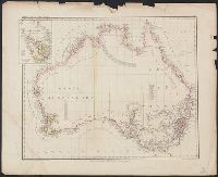
Alternative Title:
Karte v. Festland Australia and Karte v[on] Festland Australia
Description:
Inset: Van Diemens Land.
Publisher:
Verlag der Rubach'schen Buchhandlung (E Fabricius),
Subject (Geographic):
Australia--Maps and Tasmania--Maps
Found in:
Beinecke Rare Book and Manuscript Library > Abtheilung V. Karte v[on] Festland Australia / lith. u. gedr. im geog. lith. Institut v. Albr. Platt.
Creator:
Published / Created:
1858
Call Number:
60 1858
Container / Volume:
BRBL_00326
Image Count:
1
Resource Type:
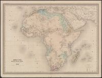
Maps, Atlases & Globes
Alternative Title:
Grand atlas universel, physique, historique et politique de géographie ancienne et moderene, 1860.
Description:
Impé. par Louis Antoine., Relief shown by hachures., and Upper left: Atlas Universel pl. 35 ; upper right: Géographie moderne Pl. 26.
Publisher:
Armamd Le Chevalier,
Subject (Geographic):
Africa--Maps
Subject (Name):
Dyonnet, Charles and Paulin et Le Chevalier (Firm)
Found in:
Beinecke Rare Book and Manuscript Library > Afrique / dressée par A.H. Dufour, gravée par Ch. Dyonnet ; Paulin & Le Chevalier.
Published / Created:
[18--]
Call Number:
50J 1650
Container / Volume:
BRBL_00274
Image Count:
1
Resource Type:
Maps, Atlases & Globes
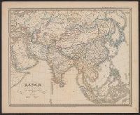
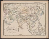
Description:
Spruner's Historical Atlas.
Publisher:
Justus Perthes,
Subject (Geographic):
Asia--Maps--Early works to 1800
Found in:
Beinecke Rare Book and Manuscript Library > Asien am Angange des XVIIten Jahrhunderts ...
Published / Created:
[18--]
Call Number:
50J 1775
Container / Volume:
BRBL_00274
Image Count:
1
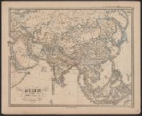
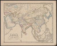
Resource Type:
Maps, Atlases & Globes
Description:
Spruner's Historical Atlas.
Publisher:
Justus Perthes,
Subject (Geographic):
Asia--Maps--Early works to 1800
Found in:
Beinecke Rare Book and Manuscript Library > Asien gegen Ende des XVIIIten Jahrhunderts ... C. Stier sc.
Published / Created:
[18--]
Call Number:
50J 450
Container / Volume:
BRBL_00274
Image Count:
1
Resource Type:
Maps, Atlases & Globes
Description:
Spruner's Historical Atlas.
Publisher:
Justus Perthes,
Subject (Geographic):
Asia--Maps--Early works to 1800
Found in:
Beinecke Rare Book and Manuscript Library > Asien gegen die Mitte des Fünften Jahrhunderts ...
Published / Created:
[18--]
Call Number:
50J 1150
Container / Volume:
BRBL_00274
Image Count:
1
Resource Type:
Maps, Atlases & Globes
Description:
Spruner's Historical Atlas.
Publisher:
Justus Perthes,
Subject (Geographic):
Asia--Maps--Early works to 1800
Found in:
Beinecke Rare Book and Manuscript Library > Asien im XIten und XIIten Jahrhunderts ... Mädel II sc.
Branch:v1.61.6 ,Deployed:2024-06-12T09:55:36-04:00