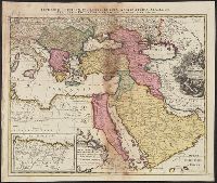
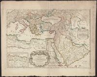
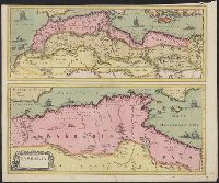
Imperium Turcicum, complectens Europae, Asiae et Africae, Arabiae que regiones ac provincias plurimas, industria et labore Sr. Sanson
Description:
Includes four bar scales., Inset map [partially obscuring title in cartouche] is continuation of the North African coastline., Prime meridian: Ferro., Reinforced on back with paper. Sheet measures 51.5 x 61.0 cm., and Relief shown pictorially.
Publisher:
s.n.,
Subject (Geographic):
Africa, North--Maps--Early works to 1800, Europe, Southern--Maps--Early works to 1800, Middle East--Maps--Early works to 1800, and Turkey--Maps--Early works to 1800
Mariette, Pierre, 1603-1657, publisher Sanson, Nicolas, 1600-1667, cartographer Sanson, Nicolas, 1600-1667. Cartes générales de toutes les parties du monde Tavernier, Melchior, -1641
Published / Created:
1637
Call Number:
314 1637
Container / Volume:
BRBL_00038
Image Count:
1
Resource Type:
Maps, Atlases & Globes
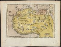
Description:
Appeared in Sanson's Cartes générales de toutes les parties du monde (1658)., No 3: Imperfect: chewed in upper right corner, with no loss of text. Sheet measures 45.2 x 62.3 cm., Prime meridian: Ferro., Relief shown pictorially., and Watermark.
Publisher:
par M. Tauernier graueur & imprimeur du roy et a present chez Pierre Mariette rue S. Iacques a l'esperance,
Subject (Geographic):
Africa, North--Maps--Early works to 1800, Europe, Southern--Maps--Early works to 1800, and Middle East--Maps--Early works to 1800
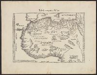
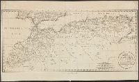
"Avec privilege du Roy, pour vingt ans.", "La coste des Negres, et Guinee, &c. est apres les observations de Samuel Blomart.", Has watermark., Relief shown pictorially., and Verso: numbered "24" in ink in upper right corner.
Publisher:
Chez Pierre Mariette, rue St. Iacques a l'Esperance,
Subject (Geographic):
Africa, North--Maps--Early works to 1800 and Africa, West--Maps--Early works to 1800
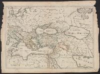
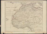
Appears in Jaillot's Atlas françois., Includes six bar scales., Prime meridian: Ferro., Relief shown pictorially., Sheet measures 57.3 x 72.2 cm., and Watermark.
Subject (Geographic):
Africa, North--Maps--Early works to 1800, Europe, Southern--Maps--Early works to 1800, Middle East--Maps--Early works to 1800, and Turkey--Maps--Early works to 1800
Subject (Name):
Albany Institute Stamp, Cordier, Louis, -1711, engraver, and Jaillot, Alexis Hubert, 1632?-1712. Atlas françois
"Avec privil, "The words 'premier geographe du Roi' added in the title ... [indicate] that [a map] could not have been issued before 1718 when [De l'Isle] was appointed to that office"--Tooley, R.V. Guide to maps of Africa, p. 68., and Relief shown pictorially.
Publisher:
chez l'auteur fur le Quai de l'Horloge a l'Aigle d'Or,
Subject (Geographic):
Africa, North--Maps--Early works to 1800 and Africa, West--Maps--Early works to 1800
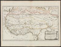
Ferro meridian., From Bleau's Atlas major (German ed.). Zu Amsterdam : Bey Johannem Blaeu, [ca. 1670]., Relief shown pictorially., and Sheet measures 52 x 62.2 cm.
Publisher:
Joan Blaeu,
Subject (Geographic):
Africa, North--Maps--Early works to 1800
Subject (Name):
Blaeu, Joan, 1596-1673. Atlas maior. German and Rodriguez, José M.--Bookplate