Skip to search
Skip to main content
Skip to first result
Search
You Searched For
Subject (Geographic)
Atlantic Ocean--Maps--Early works to 1800
New Search
Search Results
Published / Created:
1619?]
Call Number:
21cea 1619
Container / Volume:
BRBL_00700
Image Count:
1
Resource Type:
Maps, Atlases & Globes
Description:
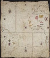
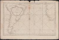
Following is the description of the chart from Auktion XXXVIII, p. 72, published by Haus der Bücher AG and L'Art Ancien S.A.: "Portolankarte. Anonyme portugiesische Seekarte von Teilen des atlantischen Ozeans. Portugal, 17. J and Title supplied by cataloger.
Subject (Geographic):
Atlantic Ocean--Maps--Early works to 1800
Found in:
Beinecke Rare Book and Manuscript Library > [Anonymous ms. Portugese portolano of the Atlantic Ocean.]
Creator:
Call Number:
C6 033c
Collection Title:
The natural and civil history of the French dominions in North and South America : with an
Image Count:
1
Resource Type:
Maps, Atlases & Globes
Description:
Plate between p. 2-3.
Subject (Geographic):
Atlantic Ocean--Charts, maps, etc., Atlantic Ocean--Maps--Early works to 1800, and Santo Domingo (Dominican Republic)
Collection Created:
London, Printed for T. Jeffreys, 1761
Found in:
Beinecke Rare Book and Manuscript Library > The island of Hispaniola called by the French St. Domingo. Subject to France and Spain. from the best authorities by Thomas Jeffreys, geographer to his Royal Highness the Prince of Wales
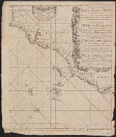
Published / Created:
[1670?]
Call Number:
21 1670
Image Count:
1
Resource Type:
Maps, Atlases & Globes
Description:
1 sheet missing.
Publisher:
Joannes Van Keulen ... ,
Subject (Geographic):
Atlantic Ocean--Maps--Early works to 1800
Found in:
Beinecke Rare Book and Manuscript Library > The New Sea map of the Spannish-Zea between Ireland et C. Blanco ... and Canary Islands.
Published / Created:
1787
Call Number:
21 1787
Container / Volume:
BRBL_00724
Image Count:
1
Resource Type:
Maps, Atlases & Globes
Description:
From his Hydraulic and nautical observations on the currents in the Atlantic ... , London, 1787.
Publisher:
R. Sayer,
Subject (Geographic):
Atlantic Ocean--Maps--Early works to 1800
Found in:
Beinecke Rare Book and Manuscript Library > The Atlantic Ocean / by Governor Pownall F.R.S.
Creator:
Published / Created:
[1683?]
Call Number:
21 1683
Container / Volume:
BRBL_00682
Image Count:
1
Resource Type:
Maps, Atlases & Globes
Description:
A sea chart with a variety of measuring scales and rumb lines., Appeared in Robijn's Zeeatlas (1683); see Koeman, C. Atlantes Neerlandici, IV, p. 438 (Rob 1, map 18)., and Imperfect: mutilated, with some loss of cartouche. Backed with linen. Cross Collection 62.
Publisher:
By Jacobus Robyn,
Subject (Geographic):
Atlantic Ocean--Maps--Early works to 1800, Brazil--Maps--Early works to 1800, Cape Verde--Maps--Early works to 1800, and New Guinea--Maps--Early works to 1800
Subject (Name):
Robijn, Jacobus, -approximately 1710. Zeeatlas
Subject (Topic):
Nautical charts--Atlantic Ocean--Early works to 1800
Found in:
Beinecke Rare Book and Manuscript Library > Pascaarte vande zee custen van Guinea en Brasilias van Cabo de Verde, tot C. de bona Esperanca en van R. de Amazones tot Rio de la Plata, alles op wassende graaden gestelt [cartographic material].
Creator:
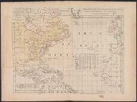
Published / Created:
1762]
Call Number:
71 1762
Container / Volume:
BRBL_00364
Image Count:
3
Resource Type:
Maps, Atlases & Globes
Description:
"Longitude w. from London.", "Plate III. The dominions ceded by France & Spain to Great Britain are colored with a feint red.", Accompanied by 2 leaves intended to be hinged to the margin as overlays to North America: Plate I. Clai, and Relief shown pictorially.
Subject (Geographic):
Atlantic Ocean--Maps--Early works to 1800 and North America--Maps--Early works to 1800
Subject (Topic):
World maps--Early works to 1800
Found in:
Beinecke Rare Book and Manuscript Library > Chart of the Atlantic Ocean, with the British, French, & Spanish settlements in North America, and the West Indies, as also on the coast of Africa / by Thos. Jefferys, geographer to His Majesty.
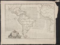
Published / Created:
[1780?]
Call Number:
21 1780A
Container / Volume:
BRBL_00014
Image Count:
1
Resource Type:
Maps, Atlases & Globes
Description:
South Atlantic; Gibralter to Cape Horn, all of South America and Western part of Africa.
Subject (Geographic):
Atlantic Ocean--Maps--Early works to 1800
Found in:
Beinecke Rare Book and Manuscript Library > Carte pour servir A L'Histoire Philosophique et Politique des Etablissemens et du Commerce des Européens dans les Deux indes ... Par M. Bonne ... Gravée par André.
Published / Created:
1753
Call Number:
21 1753
Image Count:
1
Resource Type:
Maps, Atlases & Globes
Description:
South Atlantic, all of South America below the mouth of the Amazon River and the African Coast.
Subject (Geographic):
Atlantic Ocean--Maps--Early works to 1800
Found in:
Beinecke Rare Book and Manuscript Library > Carte Réduite de L'Ocean Meridional ...
Published / Created:
1775
Call Number:
21 1775
Container / Volume:
BRBL_00014
Image Count:
1
Resource Type:
Maps, Atlases & Globes
Description:
English Channel to Cape Verde, Cuba to Newfoundland. New York City.
Publisher:
Par Mrs. de Verdum de la Crenne, le Cher. de Borda, et Pingré,
Subject (Geographic):
Atlantic Ocean--Maps--Early works to 1800
Found in:
Beinecke Rare Book and Manuscript Library > Carte Réduite D'une de L'Océan Atlantique ou Occidental. Divisée et Gravée au Burin par Petit.
Creator:
Call Number:
C6 033c
Collection Title:
The natural and civil history of the French dominions in North and South America : with an
Image Count:
1
Resource Type:
Maps, Atlases & Globes
Description:
Plate between p. 68-9.
Subject (Geographic):
Atlantic Ocean--Charts, maps, etc., Atlantic Ocean--Maps--Early works to 1800, and Santo Domingo (Dominican Republic)
Collection Created:
London, Printed for T. Jeffreys, 1761
Found in:
Beinecke Rare Book and Manuscript Library > An authentic plan of the town and harbour of Cap Francois in the isle of St. Domingo. By Thomas Jefferys geographer to his Royal Highness the Prince of Wales
Branch:v1.62.5 ,Deployed:2024-07-17T14:10:18-04:00