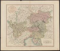
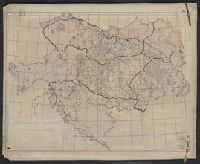
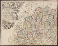
"Cum gratia et privil. S.R.I. Vicariat[us], in partib[us] Rheni, Suevice, et juris Franconici.", Manuscript number in upper right corner: 11. From the Karpinski-von Wieser Map Collection., Relief shown pictorially., and With reference grid.
United States. Office of Strategic Services. Research and Analysis Branch
Published / Created:
1944
Call Number:
42gmb 1944
Container / Volume:
BRBL_00245
Image Count:
1
Resource Type:
Maps, Atlases & Globes
Description:
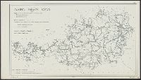
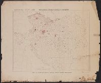
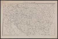
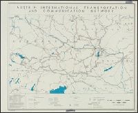
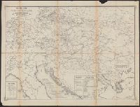
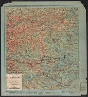
Indicates left- and right- hand driving zones and snow clearing., Map in German; legend and overlays in English., and Relief indicated by spot heights.
Publisher:
Lithographed in the Reproduction Branch, OSS,
Subject (Geographic):
Austria--Maps
Subject (Name):
United States. Office of Strategic Services. Reproduction Branch
Subject (Topic):
Roads--Austria--Maps and Snow removal--Austria--Maps
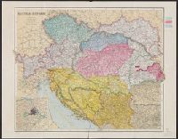
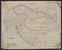
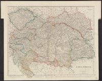
"Dr. Seymour" in upper left corner of sheet., Includes inset of Vienna and environs., Shows "Czecho-Slovak" and "Ruthenian" areas and Austria-Hungary border from 1914., and Title at head of sheet.
Publisher:
s.n.,
Subject (Geographic):
Austria--Maps, Europe, Eastern--Maps, and Hungary--Maps
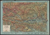
Includes col. overlay labeled "Cities" showing populations. "No. 6" outside upper right margin of overlay., Includes inset of Vienna and environs, scale 1:1,000,000., and Relief shown by hachures and spot heights.
Publisher:
Longmans, Green & Co.,
Subject (Geographic):
Austria--Maps, Europe, Eastern--Maps, and Hungary--Maps
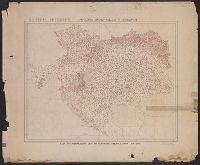
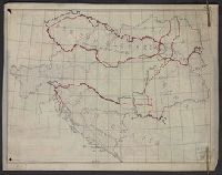
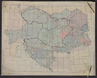
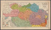
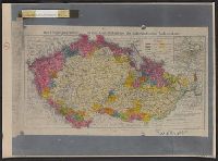
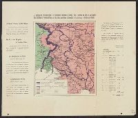
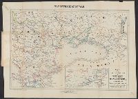
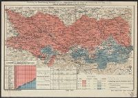
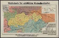
[Claims by races within empire of Austria-Hungary]
Description:
Includes inset of Vienna and environs, scale 1:1,000,000., Paper with inferred title affixed to map above printed title. Includes col. overlay with outlines and labels of countries corresponding wi, and Relief shown by hachures and spot heights.
Publisher:
Longmans & Co.,
Subject (Geographic):
Austria--Maps, Europe, Eastern--Maps, and Hungary--Maps
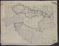
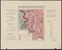
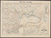
Include, Paper with inferred title affixed to map around printed title. Includes col. overlay with outlines and labels of countries shown on base map; "No. 2" outside upper right margin of overlay., and Relief shown by hachures and spot heights.
Publisher:
Longmans & Co.,
Subject (Geographic):
Austria--Maps, Europe, Eastern--Maps, and Hungary--Maps
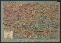
Includes inset of Vienna and environs, scale 1:1,000,000. and Paper with inferred title affixed to map around printed title. Includes col. overlay showing population density with corresponding legend affixed to base map; "No. 4" outside upper
Publisher:
Longmans & Co.,
Subject (Geographic):
Austria--Maps, Europe, Eastern--Maps, and Hungary--Maps
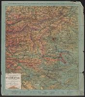
Includes inset of Vienna and environs, scale 1:1,000,000. and Paper with inferred title affixed to map around printed title. Includes col. overlay showing religious denominations with corresponding legend affixed to base map; "No. 14" outside
Publisher:
Longmans & Co.,
Subject (Geographic):
Austria--Maps, Europe, Eastern--Maps, and Hungary--Maps
Map of the seat of war and Seat of war in the East.
Description:
At head of map: Map of the seat of war., Cover title: The seat of war in the east : a new map of the frontier provinces of Turkey, Russia & Austria, the Black Sea, &c., and Inset: Map showing in detail the Mouths & part of the River Danube, with the fortified t
Publisher:
Published by Willmer & Rogers, Importers of Foreign Books & Newspapers, 42 & 44 Nassau Street,
Subject (Geographic):
Austria--Maps, Black Sea--Charts, maps, etc, Danube River--Charts, diagrams, etc, Russia (Federation)--Maps, and Turkey--Maps
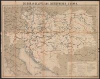
Area: from Baltic Sea to Innsbruck ; from Luxemburg to Warsaw., Imperfect. Cover wanting, some text lost., Includes index., and Shows: camps and hospitals for British prisoners, towns, rivers and roads.
Publisher:
Nisbet & Co.,
Subject (Geographic):
Austria--Maps and Germany--Maps
Subject (Topic):
World War, 1914-1918--Maps and World War, 1914-1918--Prisoners and prisons, German--Maps
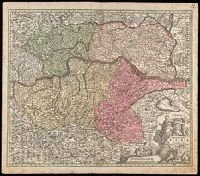
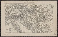
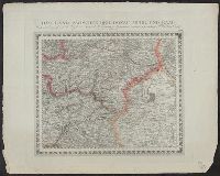
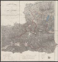
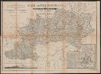
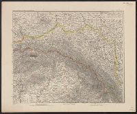
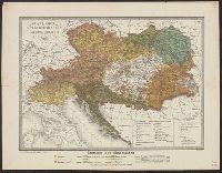
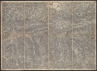
In bottom margin: Schrift von W. Kratz ; Terrain v. V. Geyer. and Insets: [1.] Wien und Umgegend, 1:72,000 -- [2.] Profil: Lundenburg-Wien-Semmering-Gratz.