Search
You Searched For
Search Results
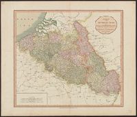
- Creator:
- Cary, John
- Published / Created:
- 1804
- Call Number:
- 335 1804
- Container / Volume:
- BRBL_00086
- Image Count:
- 1
- Resource Type:
- Maps, Atlases & Globes
- Found in:
- Beinecke Rare Book and Manuscript Library > A new map of the Netherlands also of that part of Germany westward of the Rhine as ceded to the French and divided into their several Departments from the latest authorities / by John Cary, Engraver, 1804.
- Creator:
- Cary, John
- Published / Created:
- 1811
- Call Number:
- 335 1811
- Container / Volume:
- BRBL_00086
- Image Count:
- 1
- Resource Type:
- Maps, Atlases & Globes
- Found in:
- Beinecke Rare Book and Manuscript Library > A new map of the Netherlands also of that part of Germany westward of the Rhine as ceded to the French and divided into their several Departments from the latest authorities / by John Cary, Engraver, 1811.
- Published / Created:
- 191-.
- Call Number:
- 11hcf 1919D-29
- Container / Volume:
- BRBL_00010X
- Image Count:
- 1
- Resource Type:
- Maps, Atlases & Globes
- Found in:
- Beinecke Rare Book and Manuscript Library > Belgique : Carte Administrative et Commerciale; chemins de fer, canaux, routes / publiée par "The Scarborough Co.", Éditeurs de Cartes Géographiques.
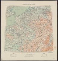
- Creator:
- United States. Office of Strategic Services
- Published / Created:
- 1942
- Call Number:
- 335gfb 1942A
- Container / Volume:
- BRBL_00087
- Image Count:
- 1
- Resource Type:
- Maps, Atlases & Globes
- Found in:
- Beinecke Rare Book and Manuscript Library > Belgium Generation and Transmission of Electrical Energy / compiled and drawn in Geography Division, O.S.S.
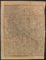
- Creator:
- Great Britain. War Office. General Staff. Geographical Section
- Published / Created:
- 1910
- Call Number:
- 335 1910
- Container / Volume:
- BRBL_00086
- Image Count:
- 1
- Resource Type:
- Maps, Atlases & Globes
- Found in:
- Beinecke Rare Book and Manuscript Library > Belgium and the north east of France G.S.G.S. 2517 [cartographic material].
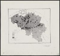
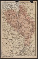
- Creator:
- United States. Office of Strategic Services
- Published / Created:
- 1942
- Call Number:
- 335eb 1942
- Container / Volume:
- BRBL_00087
- Image Count:
- 1
- Resource Type:
- Maps, Atlases & Globes
- Found in:
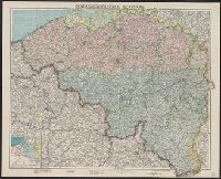
- Beinecke Rare Book and Manuscript Library > Belgium population density / compiled and drawn in Geography Division, O.S.S.
- Published / Created:
- [1904?]
- Call Number:
- 335 1904
- Container / Volume:
- BRBL_00086
- Image Count:
- 1
- Resource Type:
- Maps, Atlases & Globes
- Found in:
- Beinecke Rare Book and Manuscript Library > Carte Pour Cyclistes & Automobiles de la Belgique Section est.
- Creator:
- Établissement Géographique (Bruxelles)
Mols, L
Ongers, J
- Published / Created:
- [ca. 1855]
- Call Number:
- 335 1855
- Container / Volume:
- BRBL_00086
- Image Count:
- 1
- Resource Type:
- Maps, Atlases & Globes
- Found in:
- Beinecke Rare Book and Manuscript Library > Carte pittoresque des chemins de fer de la Belgique / Dessiné par L. Mols et gravé par J. Ongers.
- Published / Created:
- 1913
- Call Number:
- 335 1913
- Container / Volume:
- BRBL_00086
- Image Count:
- 1
- Resource Type:
- Maps, Atlases & Globes
- Found in:
- Beinecke Rare Book and Manuscript Library > Carte routière de la Belgique à l'usage des touristes, cyclistes et automobilistes / publiée sous la direction de Aug. Fourmanois Chef des Routes, des Cartes et des Itinéraires topographique du T.C.B.
- Published / Created:
- [1917?]
- Call Number:
- 335 Y93 1917
- Container / Volume:
- BRBL_00087
- Image Count:
- 1
- Resource Type:
- Maps, Atlases & Globes
- Found in:
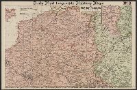
- Beinecke Rare Book and Manuscript Library > Champ de bataille de l'Yser = The Yser battlefield.
- Creator:
- Philip, George, 1870-1937
- Published / Created:
- [1914.]
- Call Number:
- 11hc 1915B
- Image Count:
- 2
- Resource Type:
- Maps, Atlases & Globes
- Found in:
- Beinecke Rare Book and Manuscript Library > Daily Mail large-scale Military maps No. 3. : The Franco-Belgian Theatre of War / edited by George Philip, F.R.G.S., in conjunction with Military experts.
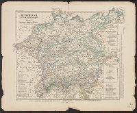
- Published / Created:
- 1852
- Call Number:
- 36ef 1852
- Container / Volume:
- BRBL_00127
- Image Count:
- 1
- Resource Type:
- Maps, Atlases & Globes
- Found in:
- Beinecke Rare Book and Manuscript Library > Deutschland, Niederlande, Belgien und Sweiz : National-, Sprach-, Dialect Verschiedenheit.
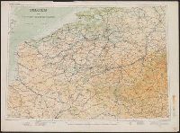
- Published / Created:
- 1931
- Call Number:
- 11hc 1918E
- Container / Volume:
- BRBL_00010E
- Image Count:
- 2
- Resource Type:
- Maps, Atlases & Globes
- Found in:
- Beinecke Rare Book and Manuscript Library > Earl Haig's war map refutes General Pershing.
- Creator:
- Carl Flemming (Firm)
Flemming, C. (Carl), 1806-1878
Kettler, J. I
- Published / Created:
- [1918?]
- Call Number:
- 11hc 1918P
- Container / Volume:
- BRBL_00010F
- Image Count:
- 1
- Resource Type:
- Maps, Atlases & Globes
- Found in:
- Beinecke Rare Book and Manuscript Library > Flemmings grosse Karte der Westfront [cartographic material].
- Published / Created:
- [1914].
- Call Number:
- 335 1914
- Container / Volume:
- BRBL_00086
- Image Count:
- 1
- Resource Type:
- Maps, Atlases & Globes
- Found in:
- Beinecke Rare Book and Manuscript Library > Generalgouvernement Belgien.
- Published / Created:
- 1915
- Call Number:
- 335 1915
- Container / Volume:
- BRBL_00086
- Image Count:
- 1
- Resource Type:
- Maps, Atlases & Globes
- Found in:
- Beinecke Rare Book and Manuscript Library > Map of Canals and Navigable Rivers in Belgium and The North of France.
- Published / Created:
- 1896
- Call Number:
- 335hc 1896
- Container / Volume:
- BRBL_00087
- Image Count:
- 1
- Resource Type:
- Maps, Atlases & Globes
- Found in:
- Beinecke Rare Book and Manuscript Library > Map of the Theatre of Operations, Belgian Maneuvers, 1896.
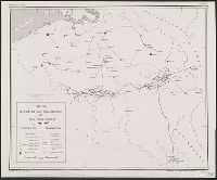
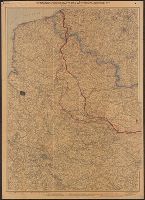
- Published / Created:
- [191-?]
- Call Number:
- 38 191X
- Container / Volume:
- BRBL_00155
- Image Count:
- 1
- Resource Type:
- Maps, Atlases & Globes
- Found in:
- Beinecke Rare Book and Manuscript Library > Map to illustrate retreat from Mons and battles of the Marne & Aisne.
- Creator:
- Freytag, G
- Published / Created:
- 1914
- Call Number:
- 38 1914C
- Container / Volume:
- BRBL_00155
- Image Count:
- 1
- Resource Type:
- Maps, Atlases & Globes
- Found in:
- Beinecke Rare Book and Manuscript Library > Nordost-Frankreich, Belgien und Luxemburg, Deutsche Rheinländer / entworfen und gezeichnet von G. Freytag ; II. Auflage bearbeitet von Dr. K. Peucker.
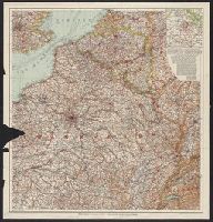
- Creator:
- Rand McNally and Company
- Published / Created:
- [c1917]
- Call Number:
- 11hc 1917B
- Container / Volume:
- BRBL_00010D
- Image Count:
- 2
- Resource Type:
- Maps, Atlases & Globes
- Found in:
- Beinecke Rare Book and Manuscript Library > Rand McNally war map of the British front : a strategic map of of the battleground in Belgium and northern France, from Ostend to St. Quentin / compiled from the latest military maps of the army staffs in Washington, London and Paris, and from other offic
- Published / Created:
- 1919
- Call Number:
- 335 Sc26 1919
- Container / Volume:
- BRBL_00087
- Image Count:
- 1
- Resource Type:
- Maps, Atlases & Globes
- Found in:
- Beinecke Rare Book and Manuscript Library > Schelde Area.
- Creator:
- Edward Stanford Ltd
- Published / Created:
- 1917
- Call Number:
- 11hc 1917P
- Container / Volume:
- BRBL_00010E
- Image Count:
- 1
- Resource Type:
- Maps, Atlases & Globes
- Found in:
- Beinecke Rare Book and Manuscript Library > Stanford's half-inch map of the British front in France & Flanders.
- Published / Created:
- 1918
- Call Number:
- 11hc 1918F
- Container / Volume:
- BRBL_00010E
- Image Count:
- 2
- Resource Type:
- Maps, Atlases & Globes
- Found in:
- Beinecke Rare Book and Manuscript Library > The Fifth of five sections making up the New York Times war map.
- Published / Created:
- 1918
- Call Number:
- 11hc 1918G
- Container / Volume:
- BRBL_00010E
- Image Count:
- 2
- Resource Type:
- Maps, Atlases & Globes
- Found in:
- Beinecke Rare Book and Manuscript Library > The Fourth of five sections making up the New York Times war map.
- Published / Created:
- 1918
- Call Number:
- 11hc 1918D-2
- Container / Volume:
- BRBL_00010E
- Image Count:
- 2
- Resource Type:
- Maps, Atlases & Globes
- Found in:
- Beinecke Rare Book and Manuscript Library > The Position of the Western Front.
- Creator:
- Curtiss Aeroplane and Motor Corporation
- Published / Created:
- [1917]
- Call Number:
- 11hc 1917E
- Container / Volume:
- BRBL_00010D
- Image Count:
- 2
- Resource Type:
- Maps, Atlases & Globes
- Found in:
- Beinecke Rare Book and Manuscript Library > The battle front in France and Belgium.
- Published / Created:
- 1918
- Call Number:
- 11hc 1918D
- Container / Volume:
- BRBL_00010E
- Image Count:
- 2
- Resource Type:
- Maps, Atlases & Globes
- Found in:
- Beinecke Rare Book and Manuscript Library > Three Months of Victory on the Western Front.
- Creator:
- Great Britain. War Office. General Staff. Geographical Section
- Published / Created:
- 1915
- Call Number:
- 11hc 1915E
- Image Count:
- 1
- Resource Type:
- Maps, Atlases & Globes
- Found in:
- Beinecke Rare Book and Manuscript Library > Western theatre of war.
- Creator:
- Army Service Schools (U.S.)
- Published / Created:
- [1915?]
- Call Number:
- 11hc 1916C
- Container / Volume:
- BRBL_00010C
- Image Count:
- 1
- Resource Type:
- Maps, Atlases & Globes
- Found in:
- Beinecke Rare Book and Manuscript Library > Western theatre-European War.
- Published / Created:
- 191-]
- Call Number:
- 11hcf 1919-2
- Container / Volume:
- BRBL_00010J
- Image Count:
- 1
- Resource Type:
- Maps, Atlases & Globes
- Found in:
- Beinecke Rare Book and Manuscript Library > [Map of area in dispute between Belgium and Germany.]
- Published / Created:
- [1918?]
- Call Number:
- 11hc 1918Y
- Container / Volume:
- BRBL_00010F
- Image Count:
- 2
- Resource Type:
- Maps, Atlases & Globes
- Found in:
- Beinecke Rare Book and Manuscript Library > [Map of the Western Front].
- Creator:
- Velhagen & Klasing (Firm)
- Published / Created:
- [1916?]
- Call Number:
- 38 1916
- Container / Volume:
- BRBL_00155
- Image Count:
- 1
- Resource Type:
- Maps, Atlases & Globes
- Found in:
- Beinecke Rare Book and Manuscript Library > [Northeast France and Belgium].
- Published / Created:
- [1940?]
- Call Number:
- 38gmp B833 1940
- Container / Volume:
- BRBL_00171
- Image Count:
- 1
- Resource Type:
- Maps, Atlases & Globes
- Found in:
- Beinecke Rare Book and Manuscript Library > [View taken above Bruges].