Search
You Searched For
Search Results
- Published / Created:
- 1919
- Call Number:
- 335 Sc26 1919
- Container / Volume:
- BRBL_00087
- Image Count:
- 1
- Resource Type:
- Maps, Atlases & Globes
- Found in:
- Beinecke Rare Book and Manuscript Library > Schelde Area.
- Creator:
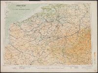
- Great Britain. War Office. General Staff. Geographical Section
- Published / Created:
- 1910
- Call Number:
- 335 1910
- Container / Volume:
- BRBL_00086
- Image Count:
- 1
- Resource Type:
- Maps, Atlases & Globes
- Found in:
- Beinecke Rare Book and Manuscript Library > Belgium and the north east of France G.S.G.S. 2517 [cartographic material].
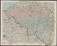
- Published / Created:
- [1904?]
- Call Number:
- 335 1904
- Container / Volume:
- BRBL_00086
- Image Count:
- 1
- Resource Type:
- Maps, Atlases & Globes
- Found in:
- Beinecke Rare Book and Manuscript Library > Carte Pour Cyclistes & Automobiles de la Belgique Section est.
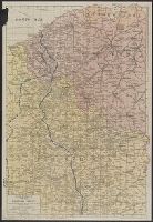
- Published / Created:
- 1915
- Call Number:
- 335 1915
- Container / Volume:
- BRBL_00086
- Image Count:
- 1
- Resource Type:
- Maps, Atlases & Globes
- Found in:
- Beinecke Rare Book and Manuscript Library > Map of Canals and Navigable Rivers in Belgium and The North of France.
- Published / Created:
- [1914].
- Call Number:
- 335 1914
- Container / Volume:
- BRBL_00086
- Image Count:
- 1
- Resource Type:
- Maps, Atlases & Globes
- Found in:
- Beinecke Rare Book and Manuscript Library > Generalgouvernement Belgien.
- Published / Created:
- 1913
- Call Number:
- 335 1913
- Container / Volume:
- BRBL_00086
- Image Count:
- 1
- Resource Type:
- Maps, Atlases & Globes
- Found in:
- Beinecke Rare Book and Manuscript Library > Carte routière de la Belgique à l'usage des touristes, cyclistes et automobilistes / publiée sous la direction de Aug. Fourmanois Chef des Routes, des Cartes et des Itinéraires topographique du T.C.B.
- Creator:
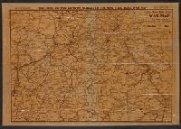
- Rand McNally and Company
- Published / Created:
- [c1917]
- Call Number:
- 11hc 1917B
- Container / Volume:
- BRBL_00010D
- Image Count:
- 2
- Resource Type:
- Maps, Atlases & Globes
- Found in:
- Beinecke Rare Book and Manuscript Library > Rand McNally war map of the British front : a strategic map of of the battleground in Belgium and northern France, from Ostend to St. Quentin / compiled from the latest military maps of the army staffs in Washington, London and Paris, and from other offic
- Published / Created:
- 1931
- Call Number:
- 11hc 1918E
- Container / Volume:
- BRBL_00010E
- Image Count:
- 2
- Resource Type:
- Maps, Atlases & Globes
- Found in:
- Beinecke Rare Book and Manuscript Library > Earl Haig's war map refutes General Pershing.
- Published / Created:
- 1918
- Call Number:
- 11hc 1918F
- Container / Volume:
- BRBL_00010E
- Image Count:
- 2
- Resource Type:
- Maps, Atlases & Globes
- Found in:
- Beinecke Rare Book and Manuscript Library > The Fifth of five sections making up the New York Times war map.
- Published / Created:
- 1918
- Call Number:
- 11hc 1918D
- Container / Volume:
- BRBL_00010E
- Image Count:
- 2
- Resource Type:
- Maps, Atlases & Globes
- Found in:
- Beinecke Rare Book and Manuscript Library > Three Months of Victory on the Western Front.