Search
You Searched For
Search Results
- Creator:
- U.S. Lake Survey
United States. Aeronautical Chart Service
United States. Army Map Service
- Published / Created:
- 1944
- Call Number:
- 275 1944A
- Container / Volume:
- BRBL_00023B
- Image Count:
- 1
- Resource Type:
- Maps, Atlases & Globes
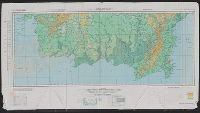
- Alternative Title:
- No. C-47. and South Borneo
- Description:
- Map on verso: No. C-48 West Java.
- Publisher:
- Army Map Service,
- Subject (Geographic):
- Borneo--Maps
- Found in:
- Beinecke Rare Book and Manuscript Library > AAF cloth chart. No. C-47. South Borneo.
- Creator:
- United States. Office of Strategic Services. Research and Analysis Branch
- Published / Created:
- 1945
- Call Number:
- 273gma 1945
- Container / Volume:
- BRBL_00023B
- Image Count:
- 1
- Resource Type:
- Maps, Atlases & Globes
- Description:
- "No. 6279."
- Publisher:
- Reproduction Branch, OSS,
- Subject (Geographic):
- Borneo--Maps
- Subject (Topic):
- Waterways--Borneo--Maps
- Found in:
- Beinecke Rare Book and Manuscript Library > Borneo: navigable waterways / R & A, OSS.
- Creator:
- Petermann, A. (August), 1822-1878
- Published / Created:
- 1851
- Call Number:
- 273 1851
- Container / Volume:
- BRBL_00023A
- Image Count:
- 1
- Resource Type:
- Maps, Atlases & Globes
- Alternative Title:
- Borneo and Map of Borneo
- Description:
- 4 insets.
- Publisher:
- [s.n.],
- Subject (Geographic):
- Borneo--Maps
- Found in:
- Beinecke Rare Book and Manuscript Library > To the subscribers to the Borneo Church Mission Institution, this map of Borneo : constructed principally from that of Baron Melvill de Carnbee and the unpublished Admiralty surveys / Augustus Petermann.