Search
You Searched For
Search Results
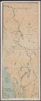
- Creator:
- U.S. Coast and Geodetic Survey
- Published / Created:
- 1898
- Call Number:
- 848 J953 1897
- Container / Volume:
- BRBL_00633
- Image Count:
- 1
- Resource Type:
- Maps, Atlases & Globes
- Found in:
- Beinecke Rare Book and Manuscript Library > Route map, Juneau to Porcupine River, Alaska.
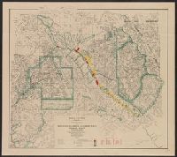
- Creator:
- Canada. Dept. of the Interior
- Published / Created:
- 1913
- Call Number:
- 739gme 1913
- Container / Volume:
- BRBL_00393
- Image Count:
- 4
- Resource Type:
- Maps, Atlases & Globes
- Found in:
- Beinecke Rare Book and Manuscript Library > British Columbia railway belt : map showing disposition of Lands / prepared under the direction of F.C.C. Lynch, Superintendent of Railway Lands.
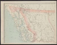
- Creator:
- British Columbia. Dept. of Lands
- Published / Created:
- 1912
- Call Number:
- 739 1912R
- Container / Volume:
- BRBL_00388
- Image Count:
- 4
- Resource Type:
- Maps, Atlases & Globes
- Found in:
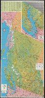
- Beinecke Rare Book and Manuscript Library > British Columbia / G.G. Aitken, chief geographer.
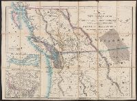
- Creator:
- Wyld, James, 1812-1887
- Published / Created:
- July 16th, 1858.
- Call Number:
- 739 1858
- Container / Volume:
- BRBL_00388
- Image Count:
- 2
- Resource Type:
- Maps, Atlases & Globes
- Found in:
- Beinecke Rare Book and Manuscript Library > Map of the colony of New Caledonia and the British & American territory west of the Rocky mountains including Vancouvers Island and the gold fields [cartographic material] / by James Wyld, geographer to the Queen & the Prince Consort, Charing Cross East,
- Creator:
- British Columbia Government Travel Bureau
- Published / Created:
- 1954
- Call Number:
- 739 1954
- Container / Volume:
- BRBL_00389
- Image Count:
- 2
- Resource Type:
- Maps, Atlases & Globes
- Found in:
- Beinecke Rare Book and Manuscript Library > Highway and travel map of British Columbia / Basic map data by Geological Survey of Canada ; tourist information by Geographic Division, Surveys and Mapping Branch, Department of Lands and Forests.
- Creator:
- National Geographic Society (U.S.). Cartographic Division
- Published / Created:
- 1978
- Call Number:
- 739 1978
- Container / Volume:
- BRBL_00389
- Image Count:
- 2
- Resource Type:
- Maps, Atlases & Globes
- Found in:
- Beinecke Rare Book and Manuscript Library > Close-up: Canada, British Columbia, Alberta, and the Yukon Territory / produced by the Cartographic Division, National Geographic Society ; William T. Peele, chief cartographer ; Richard K. Rogers, assistant chief cartographer.
- Creator:
- Brenner, G. E
- Published / Created:
- 1971
- Call Number:
- 739 1971
- Container / Volume:
- BRBL_00389
- Image Count:
- 2
- Resource Type:
- Maps, Atlases & Globes
- Found in:
- Beinecke Rare Book and Manuscript Library > Beautiful British Columbia [cartographic material] : 1971-1972 road map, campground & fishing guide / G.E. Brenner, cartographer.
- Creator:
- National Geographic Society (U.S.). Cartographic Section
- Published / Created:
- 1950
- Call Number:
- 80 1950
- Container / Volume:
- BRBL_00536
- Image Count:
- 1
- Resource Type:
- Maps, Atlases & Globes
- Found in:
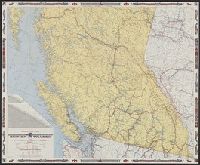
- Beinecke Rare Book and Manuscript Library > Northwestern United States and neighboring Canadian provinces / compiled and drawn in the Cartographic Section of the National Geographic Society for the National geographic magazine ; James M. Darley, chief cartographer.
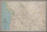
- Creator:
- National Geographic Society (U.S.). Cartographic Section
- Published / Created:
- 1950
- Call Number:
- 80 1950
- Container / Volume:
- BRBL_00536
- Image Count:
- 1
- Resource Type:
- Maps, Atlases & Globes
- Found in:
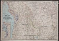
- Beinecke Rare Book and Manuscript Library > Northwestern United States and neighboring Canadian provinces / compiled and drawn in the Cartographic Section of the National Geographic Society for the National geographic magazine ; James M. Darley, chief cartographer.
- Creator:
- National Geographic Society (U.S.). Cartographic Section
- Published / Created:
- 1941
- Call Number:
- 80 1941
- Container / Volume:
- BRBL_00536
- Image Count:
- 1
- Resource Type:
- Maps, Atlases & Globes
- Found in:
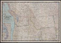
- Beinecke Rare Book and Manuscript Library > A map of Northwestern United States and neighboring Canadian Provinces / prepared in the Cartographic Section of the National Geographic Society for the National geographic magazine ; James M. Darley, chief cartographer.